<< Text Pages >> Briaglia menhir - Standing Stone (Menhir) in Italy in Piemonte
Submitted by AlexHunger on Wednesday, 06 August 2008 Page Views: 4087
Neolithic and Bronze AgeSite Name: Briaglia menhirCountry: Italy
NOTE: This site is 21.536 km away from the location you searched for.
Region: Piemonte Type: Standing Stone (Menhir)
Nearest Town: Cuneo Nearest Village: Poggio
Latitude: 44.375499N Longitude: 7.873187E
Condition:
| 5 | Perfect |
| 4 | Almost Perfect |
| 3 | Reasonable but with some damage |
| 2 | Ruined but still recognisable as an ancient site |
| 1 | Pretty much destroyed, possibly visible as crop marks |
| 0 | No data. |
| -1 | Completely destroyed |
| 5 | Superb |
| 4 | Good |
| 3 | Ordinary |
| 2 | Not Good |
| 1 | Awful |
| 0 | No data. |
| 5 | Can be driven to, probably with disabled access |
| 4 | Short walk on a footpath |
| 3 | Requiring a bit more of a walk |
| 2 | A long walk |
| 1 | In the middle of nowhere, a nightmare to find |
| 0 | No data. |
| 5 | co-ordinates taken by GPS or official recorded co-ordinates |
| 4 | co-ordinates scaled from a detailed map |
| 3 | co-ordinates scaled from a bad map |
| 2 | co-ordinates of the nearest village |
| 1 | co-ordinates of the nearest town |
| 0 | no data |
Internal Links:
External Links:
Standing Stone (Menhir) in Piemonte
Ancient 4.3 metre tall menhir re-utilized by Romans as tombstone with "SEX MAIORI M:f:CAM" written on it. Found by Professor Janigro D'Acquino. It now resides in a private garden, but is visible through the fence.
You may be viewing yesterday's version of this page. To see the most up to date information please register for a free account.
Do not use the above information on other web sites or publications without permission of the contributor.
Nearby Images from Flickr
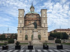
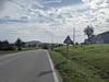
The above images may not be of the site on this page, but were taken nearby. They are loaded from Flickr so please click on them for image credits.
Click here to see more info for this site
Nearby sites
Click here to view sites on an interactive map of the areaKey: Red: member's photo, Blue: 3rd party photo, Yellow: other image, Green: no photo - please go there and take one, Grey: site destroyed
Download sites to:
KML (Google Earth)
GPX (GPS waypoints)
CSV (Garmin/Navman)
CSV (Excel)
To unlock full downloads you need to sign up as a Contributory Member. Otherwise downloads are limited to 50 sites.
Turn off the page maps and other distractions
Nearby sites listing. In the following links * = Image available
8.0km SSW 212° St. Martino Cromlech Stone Circle
8.8km SSW 207° Bassi dolmen Burial Chamber or Dolmen
9.0km SSW 208° Bassi Menhirs Standing Stones
9.2km SSE 164° Savin Menhir Standing Stone (Menhir)
9.7km SW 217° Maudagna Valley engraved stone Rock Art
9.9km SW 217° Frabosa Sottana Menhirs Standing Stones
9.9km SW 217° Frabosa Sottana Barrows Round Barrow(s)
17.7km SSE 153° Deversi Pietra delle Masche Cup Mark Stone Rock Art
18.1km SSE 151° Deversi Engraved stone Rock Art
21.4km E 83° Belbo Spring Menhir Standing Stone (Menhir)
24.4km WSW 240° Bisalta Menhir Standing Stone (Menhir)
25.6km SSW 211° Lago della Ratoira Menhir Standing Stone (Menhir)
32.9km ESE 120° Bric Gettina* Ancient Mine, Quarry or other Industry
33.3km ESE 121° The Megaliths of Sparossino* Natural Stone / Erratic / Other Natural Feature
38.8km SW 215° Musée des Merveilles* Museum
39.0km SSW 207° Notre-Dame-des-Fontaines* Holy Well or Sacred Spring
39.0km ESE 114° Riparo di Rocca Due Teste* Ancient Village or Settlement
40.4km ESE 120° Site near Finale Ligure* Rock Art
40.6km ESE 118° Menhir close stone table near Bric Le Pile* Standing Stone (Menhir)
40.6km ESE 118° Altar Stone near Bric Le Pile* Rock Art
40.6km ESE 118° Anthropomorphic stele near Bric Le Pile* Standing Stone (Menhir)
40.7km ESE 118° Bric Le Pile* Rock Art
41.0km S 183° Sotto di St. Lorenzo Altar Rock Rock Art
41.4km ESE 123° Castelliere of Verezzi Hillfort
41.5km S 186° Passo di Mezzaluna Menhir* Standing Stone (Menhir)
View more nearby sites and additional images


 We would like to know more about this location. Please feel free to add a brief description and any relevant information in your own language.
 Wir möchten mehr über diese Stätte erfahren. Bitte zögern Sie nicht, eine kurze Beschreibung und relevante Informationen in Deutsch hinzuzufügen.
 Nous aimerions en savoir encore un peu sur les lieux. S'il vous plaît n'hesitez pas à ajouter une courte description et tous les renseignements pertinents dans votre propre langue.
 Quisieramos informarnos un poco más de las lugares. No dude en añadir una breve descripción y otros datos relevantes en su propio idioma.