


<< Our Photo Pages >> Laufen Dolmen - Chambered Tomb in Switzerland in Baselland
Submitted by AlexHunger on Saturday, 18 February 2006 Page Views: 4870
Neolithic and Bronze AgeSite Name: Laufen DolmenCountry: Switzerland
NOTE: This site is 1.447 km away from the location you searched for.
Canton: Baselland Type: Chambered Tomb
Nearest Town: Basel Nearest Village: Laufen
Latitude: 47.423340N Longitude: 7.499840E
Condition:
| 5 | Perfect |
| 4 | Almost Perfect |
| 3 | Reasonable but with some damage |
| 2 | Ruined but still recognisable as an ancient site |
| 1 | Pretty much destroyed, possibly visible as crop marks |
| 0 | No data. |
| -1 | Completely destroyed |
| 5 | Superb |
| 4 | Good |
| 3 | Ordinary |
| 2 | Not Good |
| 1 | Awful |
| 0 | No data. |
| 5 | Can be driven to, probably with disabled access |
| 4 | Short walk on a footpath |
| 3 | Requiring a bit more of a walk |
| 2 | A long walk |
| 1 | In the middle of nowhere, a nightmare to find |
| 0 | No data. |
| 5 | co-ordinates taken by GPS or official recorded co-ordinates |
| 4 | co-ordinates scaled from a detailed map |
| 3 | co-ordinates scaled from a bad map |
| 2 | co-ordinates of the nearest village |
| 1 | co-ordinates of the nearest town |
| 0 | no data |
Internal Links:
External Links:
I have visited· I would like to visit
Megalithic89 visited on 25th Jun 2021 - their rating: Cond: 3 Amb: 4 Access: 5
aolson visited on 20th Apr 2019 - their rating: Cond: 3 Amb: 2 Access: 5
Average ratings for this site from all visit loggers: Condition: 3 Ambience: 3 Access: 5
")
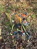
Partially reconstructed Dolmen in glass pavilion at town gate but found on Wahlenstrasse. Originally about 4 metres by 3 metres
Address: Rennimattstrasse 40,
You may be viewing yesterday's version of this page. To see the most up to date information please register for a free account.
")
")
")
")
Do not use the above information on other web sites or publications without permission of the contributor.
Nearby Images from Flickr


The above images may not be of the site on this page, but were taken nearby. They are loaded from Flickr so please click on them for image credits.
Click here to see more info for this site
Nearby sites
Click here to view sites on an interactive map of the areaKey: Red: member's photo, Blue: 3rd party photo, Yellow: other image, Green: no photo - please go there and take one, Grey: site destroyed
Download sites to:
KML (Google Earth)
GPX (GPS waypoints)
CSV (Garmin/Navman)
CSV (Excel)
To unlock full downloads you need to sign up as a Contributory Member. Otherwise downloads are limited to 50 sites.
Turn off the page maps and other distractions
Nearby sites listing. In the following links * = Image available
7.2km NE 46° Aesch Dolmen* Chambered Tomb
7.6km NNE 30° Summstein Ettingen Modern Stone Circle etc
7.8km ESE 120° Meltingen Schalenstein* Rock Art
10.7km WNW 291° Saint-Joseph Abri* Cave or Rock Shelter
12.6km SW 228° Pierre de Saint Germain* Rock Art
18.7km WNW 297° Kastelberg Oppidium* Promontory Fort / Cliff Castle
19.2km NE 41° Hornfels* Hillfort
20.0km W 281° Grotte du Mannlefelsen (Oberlarg)* Cave or Rock Shelter
20.7km NE 54° Augusta Raurica* Ancient Village or Settlement
21.5km SE 146° Oberbipp Dolmen* Burial Chamber or Dolmen
21.7km SE 131° Oensingen Schalenstein* Rock Art
21.7km SSE 156° Attiswil Freistein* Standing Stone (Menhir)
21.7km S 173° Rüttenen Schalenstein Rock Art
21.9km S 170° Schildchrott - Solothurner Megalithweg* Natural Stone / Erratic / Other Natural Feature
21.9km S 170° Namenloser Findling - Solothurner Megalithweg* Natural Stone / Erratic / Other Natural Feature
21.9km S 170° Chli Matterhorn - Solothurner Megalithweg* Natural Stone / Erratic / Other Natural Feature
22.0km SSE 150° Menhir Wiedlisbach* Modern Stone Circle etc
22.1km S 170° Steinsetzungen - Solothurner Megalithweg* Natural Stone / Erratic / Other Natural Feature
22.1km WSW 244° Bassecourt Menhir Standing Stone (Menhir)
22.2km S 170° Rütschelistein - Solothurner Megalithweg* Natural Stone / Erratic / Other Natural Feature
23.1km S 191° Selzach Schalenstein* Rock Art
24.0km NNE 30° Burghof Museum Museum
26.0km NNE 32° Homburger Wald Grabhügelgruppe Barrow Cemetery
26.4km S 183° Nennigkofen Schalenstein* Rock Art
28.1km SSW 198° Eichholz Schalenstein* Rock Art
View more nearby sites and additional images


 We would like to know more about this location. Please feel free to add a brief description and any relevant information in your own language.
 Wir möchten mehr über diese Stätte erfahren. Bitte zögern Sie nicht, eine kurze Beschreibung und relevante Informationen in Deutsch hinzuzufügen.
 Nous aimerions en savoir encore un peu sur les lieux. S'il vous plaît n'hesitez pas à ajouter une courte description et tous les renseignements pertinents dans votre propre langue.
 Quisieramos informarnos un poco más de las lugares. No dude en añadir una breve descripción y otros datos relevantes en su propio idioma.