<< Our Photo Pages >> Longue Pierre De Soultzmatt - Standing Stone (Menhir) in France in Alsace-Lorraine:Haut-Rhin (68)
Submitted by AlexHunger on Saturday, 16 April 2005 Page Views: 4388
Neolithic and Bronze AgeSite Name: Longue Pierre De Soultzmatt Alternative Name: Langenstein MenhirCountry: France Département: Alsace-Lorraine:Haut-Rhin (68) Type: Standing Stone (Menhir)
Nearest Town: Colmar Nearest Village: Soultzmatt
Latitude: 47.957330N Longitude: 7.220910E
Condition:
| 5 | Perfect |
| 4 | Almost Perfect |
| 3 | Reasonable but with some damage |
| 2 | Ruined but still recognisable as an ancient site |
| 1 | Pretty much destroyed, possibly visible as crop marks |
| 0 | No data. |
| -1 | Completely destroyed |
| 5 | Superb |
| 4 | Good |
| 3 | Ordinary |
| 2 | Not Good |
| 1 | Awful |
| 0 | No data. |
| 5 | Can be driven to, probably with disabled access |
| 4 | Short walk on a footpath |
| 3 | Requiring a bit more of a walk |
| 2 | A long walk |
| 1 | In the middle of nowhere, a nightmare to find |
| 0 | No data. |
| 5 | co-ordinates taken by GPS or official recorded co-ordinates |
| 4 | co-ordinates scaled from a detailed map |
| 3 | co-ordinates scaled from a bad map |
| 2 | co-ordinates of the nearest village |
| 1 | co-ordinates of the nearest town |
| 0 | no data |
Internal Links:
External Links:
I have visited· I would like to visit
Strykljocht visited on 1st Jan 2019 - their rating: Cond: 4 Amb: 4 Access: 4
")
3.5 metre tall menhir, limestone with embedded pebbles, 850 metres west of town, west of D40, along path in Soultzmatt Communal Forest
Address: close to Schaeferthal, 68570
You may be viewing yesterday's version of this page. To see the most up to date information please register for a free account.
")
")
")
Do not use the above information on other web sites or publications without permission of the contributor.
Nearby Images from Flickr
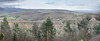
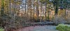

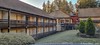
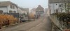
The above images may not be of the site on this page, but were taken nearby. They are loaded from Flickr so please click on them for image credits.
Click here to see more info for this site
Nearby sites
Click here to view sites on an interactive map of the areaKey: Red: member's photo, Blue: 3rd party photo, Yellow: other image, Green: no photo - please go there and take one, Grey: site destroyed
Download sites to:
KML (Google Earth)
GPX (GPS waypoints)
CSV (Garmin/Navman)
CSV (Excel)
To unlock full downloads you need to sign up as a Contributory Member. Otherwise downloads are limited to 50 sites.
Turn off the page maps and other distractions
Nearby sites listing. In the following links * = Image available
4.0km SSW 197° Appenthal Menhirs* Stone Row / Alignment
5.1km NE 45° Pierre du Diable du Teufelstein Rock Outcrop
5.2km NE 41° Table des Druides Schauenberg* Rock Outcrop
6.7km S 191° Dietrichstein* Rock Outcrop
6.8km SSW 211° Puppelestein de Rimbach* Rock Outcrop
7.3km S 189° Heidenbuckel Menhir Standing Stone (Menhir)
10.8km NNE 16° Rocher Turenne* Natural Stone / Erratic / Other Natural Feature
11.2km NNE 16° La Fontaine de la Dame* Holy Well or Sacred Spring
12.7km NE 37° Ricoh Tumuli* Artificial Mound
28.6km SSE 157° Rixheim Tumulus* Artificial Mound
29.6km N 10° Rocher de la Paix d'Udine* Rock Outcrop
29.9km N 10° Roche de la Garde* Rock Outcrop
30.2km N 9° Mur Païen* Promontory Fort / Cliff Castle
30.3km N 9° La Roche Pointue* Rock Outcrop
30.4km N 9° Taenchel Menhirs Couche Standing Stone (Menhir)
31.1km N 6° Rocher de l'Anneau* Rock Outcrop
31.2km N 6° Roches des Trois Tables* Rock Outcrop
31.4km N 7° Rocher des Reptiles* Rock Outcrop
31.4km N 8° Rocher des Cordonniers* Rock Outcrop
31.4km N 7° Rocher de la Petite Fée* Rock Outcrop
31.4km N 8° Cupules du Rocher du Géant* Rock Art
31.9km NE 39° Hoelmatt Tumulus* Artificial Mound
32.1km ENE 74° Löhbücke Grabhügelgruppe Barrow Cemetery
32.4km E 80° Heid Grabhügelgruppe Barrow Cemetery
33.7km ENE 58° Gräberfeld der Rössener Kultur Jechtingen* Barrow Cemetery
View more nearby sites and additional images


 We would like to know more about this location. Please feel free to add a brief description and any relevant information in your own language.
 Wir möchten mehr über diese Stätte erfahren. Bitte zögern Sie nicht, eine kurze Beschreibung und relevante Informationen in Deutsch hinzuzufügen.
 Nous aimerions en savoir encore un peu sur les lieux. S'il vous plaît n'hesitez pas à ajouter une courte description et tous les renseignements pertinents dans votre propre langue.
 Quisieramos informarnos un poco más de las lugares. No dude en añadir una breve descripción y otros datos relevantes en su propio idioma.