<< Our Photo Pages >> Kjerland - Round Barrow(s) in Norway in Hordaland
Submitted by kenntha88 on Saturday, 15 October 2022 Page Views: 301
Neolithic and Bronze AgeSite Name: KjerlandCountry: Norway
NOTE: This site is 9.419 km away from the location you searched for.
Fylke: Hordaland Type: Round Barrow(s)
Nearest Town: Bergen Nearest Village: Granvin
Latitude: 60.530574N Longitude: 6.731682E
Condition:
| 5 | Perfect |
| 4 | Almost Perfect |
| 3 | Reasonable but with some damage |
| 2 | Ruined but still recognisable as an ancient site |
| 1 | Pretty much destroyed, possibly visible as crop marks |
| 0 | No data. |
| -1 | Completely destroyed |
| 5 | Superb |
| 4 | Good |
| 3 | Ordinary |
| 2 | Not Good |
| 1 | Awful |
| 0 | No data. |
| 5 | Can be driven to, probably with disabled access |
| 4 | Short walk on a footpath |
| 3 | Requiring a bit more of a walk |
| 2 | A long walk |
| 1 | In the middle of nowhere, a nightmare to find |
| 0 | No data. |
| 5 | co-ordinates taken by GPS or official recorded co-ordinates |
| 4 | co-ordinates scaled from a detailed map |
| 3 | co-ordinates scaled from a bad map |
| 2 | co-ordinates of the nearest village |
| 1 | co-ordinates of the nearest town |
| 0 | no data |
Internal Links:
External Links:
")
Only one barrow remains today of a larger barrow cemetery once located here. The barrow is located on the flat top of a large triangle shaped forest covered hill overlooking the valley and farms around.
The barrow is covered with high pine trees and can be difficult to see from below the hill. It is around 18 metres in diameter and around 2 metres in height.
You may be viewing yesterday's version of this page. To see the most up to date information please register for a free account.
")
")
Do not use the above information on other web sites or publications without permission of the contributor.
Nearby Images from Flickr
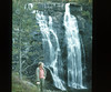
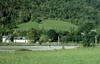
The above images may not be of the site on this page, but were taken nearby. They are loaded from Flickr so please click on them for image credits.
Click here to see more info for this site
Nearby sites
Click here to view sites on an interactive map of the areaKey: Red: member's photo, Blue: 3rd party photo, Yellow: other image, Green: no photo - please go there and take one, Grey: site destroyed
Download sites to:
KML (Google Earth)
GPX (GPS waypoints)
CSV (Garmin/Navman)
CSV (Excel)
To unlock full downloads you need to sign up as a Contributory Member. Otherwise downloads are limited to 50 sites.
Turn off the page maps and other distractions
Nearby sites listing. In the following links * = Image available
3.2km N 356° Bårstesteinen* Standing Stone (Menhir)
3.3km N 358° Endrehaugen* Round Barrow(s)
15.7km SW 221° Lothe (Utne)* Round Barrow(s)
16.7km NW 322° Sledasteinen* Rock Art
18.2km NW 314° Vetlehaugen* Round Barrow(s)
18.8km SSW 197° Håhaugsteinen Helleristninger* Rock Art
20.1km NW 321° Reppavegen* Round Barrow(s)
20.1km ESE 112° Lægreid Liksteinen* Carving
20.3km NW 305° Rogne* Round Barrow(s)
21.0km ESE 111° Hæreidsmoen* Barrow Cemetery
21.9km WNW 297° Ormshaugen* Round Barrow(s)
22.1km WNW 297° Kvåle* Cist
23.7km NW 326° Grjotland* Barrow Cemetery
24.6km WNW 295° Byrkjehaugen* Round Barrow(s)
28.2km SW 223° Bakke-Kalhagen Helleristning * Rock Art
28.8km SW 223° Vik-Gamlenaustet* Ancient Village or Settlement
28.9km WSW 238° Leirhaug* Round Barrow(s)
29.3km WSW 240° Krakahaugen* Round Barrow(s)
29.8km WSW 237° Rykkje* Rock Art
29.9km WSW 237° Bjelkanes* Cairn
31.1km NNW 334° Runakollane* Cairn
31.1km N 353° Lundahovden* Round Barrow(s)
31.2km N 351° Tinghaugane* Round Barrow(s)
31.2km NNW 338° Draugsvoll* Round Barrow(s)
36.7km WSW 242° Grova* Round Barrow(s)
View more nearby sites and additional images


 We would like to know more about this location. Please feel free to add a brief description and any relevant information in your own language.
 Wir möchten mehr über diese Stätte erfahren. Bitte zögern Sie nicht, eine kurze Beschreibung und relevante Informationen in Deutsch hinzuzufügen.
 Nous aimerions en savoir encore un peu sur les lieux. S'il vous plaît n'hesitez pas à ajouter une courte description et tous les renseignements pertinents dans votre propre langue.
 Quisieramos informarnos un poco más de las lugares. No dude en añadir una breve descripción y otros datos relevantes en su propio idioma.