<< Text Pages >> Nécropole tumulaire de Téterchen - Barrow Cemetery in France in Alsace-Lorraine:Moselle (57)
Submitted by KaiHofmann on Wednesday, 16 January 2013 Page Views: 1889
Neolithic and Bronze AgeSite Name: Nécropole tumulaire de TéterchenCountry: France
NOTE: This site is 15.451 km away from the location you searched for.
Département: Alsace-Lorraine:Moselle (57) Type: Barrow Cemetery
Nearest Village: Téterchen
Latitude: 49.228754N Longitude: 6.552293E
Condition:
| 5 | Perfect |
| 4 | Almost Perfect |
| 3 | Reasonable but with some damage |
| 2 | Ruined but still recognisable as an ancient site |
| 1 | Pretty much destroyed, possibly visible as crop marks |
| 0 | No data. |
| -1 | Completely destroyed |
| 5 | Superb |
| 4 | Good |
| 3 | Ordinary |
| 2 | Not Good |
| 1 | Awful |
| 0 | No data. |
| 5 | Can be driven to, probably with disabled access |
| 4 | Short walk on a footpath |
| 3 | Requiring a bit more of a walk |
| 2 | A long walk |
| 1 | In the middle of nowhere, a nightmare to find |
| 0 | No data. |
| 5 | co-ordinates taken by GPS or official recorded co-ordinates |
| 4 | co-ordinates scaled from a detailed map |
| 3 | co-ordinates scaled from a bad map |
| 2 | co-ordinates of the nearest village |
| 1 | co-ordinates of the nearest town |
| 0 | no data |
Be the first person to rate this site - see the 'Contribute!' box in the right hand menu.
Internal Links:
External Links:
Iron age barrow cemetery on a field close to the village of Téterchen.
You may be viewing yesterday's version of this page. To see the most up to date information please register for a free account.
Do not use the above information on other web sites or publications without permission of the contributor.
Nearby Images from Flickr
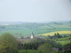
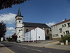
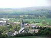
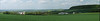
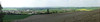
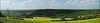
The above images may not be of the site on this page, but were taken nearby. They are loaded from Flickr so please click on them for image credits.
Click here to see more info for this site
Nearby sites
Click here to view sites on an interactive map of the areaKey: Red: member's photo, Blue: 3rd party photo, Yellow: other image, Green: no photo - please go there and take one, Grey: site destroyed
Download sites to:
KML (Google Earth)
GPX (GPS waypoints)
CSV (Garmin/Navman)
CSV (Excel)
To unlock full downloads you need to sign up as a Contributory Member. Otherwise downloads are limited to 50 sites.
Turn off the page maps and other distractions
Nearby sites listing. In the following links * = Image available
12.5km NNE 18° Sudelfels* Holy Well or Sacred Spring
13.5km NE 41° Drei Kapuziner* Rock Art
14.0km N 4° Grabhuegelfeld Niedaltdorf Barrow Cemetery
14.6km NE 40° Emilianusstollen* Ancient Mine, Quarry or other Industry
15.5km NW 307° Nonnenfels* Rock Art
16.0km NNE 31° Königsberg Wallburg Hillfort
16.3km NE 42° Limberg Wallanlage Hillfort
18.0km NE 39° Museum Pachten & Römerpark Museum
18.6km ESE 110° Kohlschlag* Round Barrow(s)
20.1km ESE 110° Weiherdamm Naepfchenstein* Rock Art
20.1km ESE 111° Gugertsloch* Ancient Mine, Quarry or other Industry
20.3km ESE 113° Wiselstein* Natural Stone / Erratic / Other Natural Feature
20.4km ESE 109° Gallbrunnen* Holy Well or Sacred Spring
20.4km NE 34° Heidenloch Beckingen Cave or Rock Shelter
21.5km NNE 18° Bietzener Heilquelle Holy Well or Sacred Spring
22.4km SSE 146° Dicke Udel Natural Stone / Erratic / Other Natural Feature
22.5km NNW 334° Stèle de Paffenacker* Standing Stone (Menhir)
22.7km ESE 108° Bettlade & Sieben Stufen* Rock Art
22.9km N 354° Site des Menhirs de l´Europe Modern Stone Circle etc
23.2km N 356° Steine an der Grenze Modern Stone Circle etc
24.1km ESE 110° Hérapel* Ancient Village or Settlement
25.4km NE 41° Summstein Nalbach Modern Stone Circle etc
25.7km NE 40° Grauer Stein Dueppenweiler* Natural Stone / Erratic / Other Natural Feature
25.8km ENE 67° Fürstengrab Elm* Round Barrow(s)
26.2km ENE 72° Wetzrillenstein Koellerbach* Polissoir
View more nearby sites and additional images


 We would like to know more about this location. Please feel free to add a brief description and any relevant information in your own language.
 Wir möchten mehr über diese Stätte erfahren. Bitte zögern Sie nicht, eine kurze Beschreibung und relevante Informationen in Deutsch hinzuzufügen.
 Nous aimerions en savoir encore un peu sur les lieux. S'il vous plaît n'hesitez pas à ajouter une courte description et tous les renseignements pertinents dans votre propre langue.
 Quisieramos informarnos un poco más de las lugares. No dude en añadir una breve descripción y otros datos relevantes en su propio idioma.