<< Our Photo Pages >> Le cercle de pierres du Fossard - Stone Circle in France in Alsace-Lorraine:Vosges (88)
Submitted by KaiHofmann on Thursday, 07 June 2012 Page Views: 2965
Neolithic and Bronze AgeSite Name: Le cercle de pierres du Fossard Alternative Name: Rond point des Roches du ThinCountry: France Département: Alsace-Lorraine:Vosges (88) Type: Stone Circle
Nearest Town: Éloyes
Latitude: 48.057370N Longitude: 6.637850E
Condition:
| 5 | Perfect |
| 4 | Almost Perfect |
| 3 | Reasonable but with some damage |
| 2 | Ruined but still recognisable as an ancient site |
| 1 | Pretty much destroyed, possibly visible as crop marks |
| 0 | No data. |
| -1 | Completely destroyed |
| 5 | Superb |
| 4 | Good |
| 3 | Ordinary |
| 2 | Not Good |
| 1 | Awful |
| 0 | No data. |
| 5 | Can be driven to, probably with disabled access |
| 4 | Short walk on a footpath |
| 3 | Requiring a bit more of a walk |
| 2 | A long walk |
| 1 | In the middle of nowhere, a nightmare to find |
| 0 | No data. |
| 5 | co-ordinates taken by GPS or official recorded co-ordinates |
| 4 | co-ordinates scaled from a detailed map |
| 3 | co-ordinates scaled from a bad map |
| 2 | co-ordinates of the nearest village |
| 1 | co-ordinates of the nearest town |
| 0 | no data |
Internal Links:
External Links:
I have visited· I would like to visit
Team-Omega-25 has visited here
")
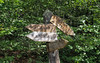
A probable iron-age ring built out of lying stones, like a wall. It has a diameter of 20m.
You may be viewing yesterday's version of this page. To see the most up to date information please register for a free account.
")
Do not use the above information on other web sites or publications without permission of the contributor.
Nearby Images from Flickr
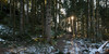
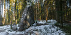
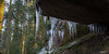

The above images may not be of the site on this page, but were taken nearby. They are loaded from Flickr so please click on them for image credits.
Click here to see more info for this site
Nearby sites
Click here to view sites on an interactive map of the areaKey: Red: member's photo, Blue: 3rd party photo, Yellow: other image, Green: no photo - please go there and take one, Grey: site destroyed
Download sites to:
KML (Google Earth)
GPX (GPS waypoints)
CSV (Garmin/Navman)
CSV (Excel)
To unlock full downloads you need to sign up as a Contributory Member. Otherwise downloads are limited to 50 sites.
Turn off the page maps and other distractions
Nearby sites listing. In the following links * = Image available
1.9km SSE 166° Pierres-Fittes Deux menhirs Standing Stone (Menhir)
2.2km S 174° La Pierre de Kerlinkin* Natural Stone / Erratic / Other Natural Feature
3.1km NE 38° Dolmen de Purifaing* Burial Chamber or Dolmen
3.2km E 84° Fontaine Saint Augustin* Holy Well or Sacred Spring
4.0km N 360° Bassins de la tête des Cuveaux* Natural Stone / Erratic / Other Natural Feature
8.4km ENE 69° Pierre du Chaud Costet* Natural Stone / Erratic / Other Natural Feature
28.4km NNE 15° Site de hauteur de la Corre Ancient Village or Settlement
30.3km SSW 200° Pierre Mourey Natural Stone / Erratic / Other Natural Feature
33.2km W 279° Grotte Saint-Martin* Cave or Rock Shelter
33.9km W 280° Fontaine Le Bœuf Holy Well or Sacred Spring
37.4km NE 37° Camp Celtique de la Bure* Ancient Village or Settlement
38.4km NNE 23° Dolmen dit le Chaudron des Fées Burial Chamber or Dolmen
39.1km NNE 22° Menhir des Lèches* Standing Stone (Menhir)
39.2km NNE 25° Enceinte dite la Pierre d'Appel* Ancient Village or Settlement
41.7km NNE 29° Menhir dit la Haute Pierre (Moyenmoutier) Standing Stone (Menhir)
42.5km NNE 19° Pierre Borne (Bertrichamps)* Standing Stone (Menhir)
42.7km NNE 18° Pierre-Borne à la Maladrerie Menhirs Standing Stone (Menhir)
43.3km ESE 113° Puppelestein de Rimbach* Rock Outcrop
44.8km ESE 104° Longue Pierre De Soultzmatt* Standing Stone (Menhir)
44.8km ESE 109° Appenthal Menhirs* Stone Row / Alignment
45.7km ESE 113° Dietrichstein* Rock Outcrop
46.0km ESE 113° Heidenbuckel Menhir Standing Stone (Menhir)
46.4km E 91° Rocher Turenne* Natural Stone / Erratic / Other Natural Feature
46.5km WSW 245° Polaincourt burial chamber Burial Chamber or Dolmen
46.5km E 90° La Fontaine de la Dame* Holy Well or Sacred Spring
View more nearby sites and additional images


 We would like to know more about this location. Please feel free to add a brief description and any relevant information in your own language.
 Wir möchten mehr über diese Stätte erfahren. Bitte zögern Sie nicht, eine kurze Beschreibung und relevante Informationen in Deutsch hinzuzufügen.
 Nous aimerions en savoir encore un peu sur les lieux. S'il vous plaît n'hesitez pas à ajouter une courte description et tous les renseignements pertinents dans votre propre langue.
 Quisieramos informarnos un poco más de las lugares. No dude en añadir una breve descripción y otros datos relevantes en su propio idioma.