 with our Megalithic Portal iPhone app")


<< Our Photo Pages >> Rogne - Round Barrow(s) in Norway in Hordaland
Submitted by kenntha88 on Thursday, 27 October 2022 Page Views: 278
Neolithic and Bronze AgeSite Name: RogneCountry: Norway
NOTE: This site is 5.531 km away from the location you searched for.
Fylke: Hordaland Type: Round Barrow(s)
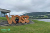
Nearest Town: Voss
Latitude: 60.634510N Longitude: 6.426476E
Condition:
| 5 | Perfect |
| 4 | Almost Perfect |
| 3 | Reasonable but with some damage |
| 2 | Ruined but still recognisable as an ancient site |
| 1 | Pretty much destroyed, possibly visible as crop marks |
| 0 | No data. |
| -1 | Completely destroyed |
| 5 | Superb |
| 4 | Good |
| 3 | Ordinary |
| 2 | Not Good |
| 1 | Awful |
| 0 | No data. |
| 5 | Can be driven to, probably with disabled access |
| 4 | Short walk on a footpath |
| 3 | Requiring a bit more of a walk |
| 2 | A long walk |
| 1 | In the middle of nowhere, a nightmare to find |
| 0 | No data. |
| 5 | co-ordinates taken by GPS or official recorded co-ordinates |
| 4 | co-ordinates scaled from a detailed map |
| 3 | co-ordinates scaled from a bad map |
| 2 | co-ordinates of the nearest village |
| 1 | co-ordinates of the nearest town |
| 0 | no data |
Internal Links:
External Links:
")
Close to a local road and between some private houses in the west side of the town Voss is a very pretty round barrow. The barrow is today a part of a private garden and covered only in short lawn grass. From the barrow it is a beautiful view to the south east over Voss.
The barrow is 25 metres in diameter and 2,5 metres in height. Some of the north west part of the barrow have been damaged of the local road and here is also a short stone fence.
You may be viewing yesterday's version of this page. To see the most up to date information please register for a free account.
")
")
")
Do not use the above information on other web sites or publications without permission of the contributor.
Nearby Images from Flickr
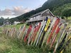
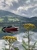
The above images may not be of the site on this page, but were taken nearby. They are loaded from Flickr so please click on them for image credits.
Click here to see more info for this site
Nearby sites
Click here to view sites on an interactive map of the areaKey: Red: member's photo, Blue: 3rd party photo, Yellow: other image, Green: no photo - please go there and take one, Grey: site destroyed
Download sites to:
KML (Google Earth)
GPX (GPS waypoints)
CSV (Garmin/Navman)
CSV (Excel)
To unlock full downloads you need to sign up as a Contributory Member. Otherwise downloads are limited to 50 sites.
Turn off the page maps and other distractions
Nearby sites listing. In the following links * = Image available
3.4km WSW 238° Ormshaugen* Round Barrow(s)
3.5km WSW 241° Kvåle* Cist
3.7km ENE 74° Vetlehaugen* Round Barrow(s)
5.7km NE 45° Reppavegen* Round Barrow(s)
5.8km WSW 259° Byrkjehaugen* Round Barrow(s)
6.5km ENE 76° Sledasteinen* Rock Art
8.6km NNE 22° Grjotland* Barrow Cemetery
16.5km N 10° Runakollane* Cairn
17.9km NNE 15° Draugsvoll* Round Barrow(s)
18.4km ESE 117° Bårstesteinen* Standing Stone (Menhir)
18.5km ESE 116° Endrehaugen* Round Barrow(s)
20.3km SE 125° Kjerland* Round Barrow(s)
22.7km NNE 32° Tinghaugane* Round Barrow(s)
23.3km NNE 34° Lundahovden* Round Barrow(s)
24.2km SSE 165° Lothe (Utne)* Round Barrow(s)
27.5km SSW 198° Krakahaugen* Round Barrow(s)
28.0km SSW 196° Leirhaug* Round Barrow(s)
29.1km SSW 196° Rykkje* Rock Art
29.2km SSW 196° Bjelkanes* Cairn
31.6km SSE 159° Håhaugsteinen Helleristninger* Rock Art
32.3km S 184° Bakke-Kalhagen Helleristning * Rock Art
32.8km S 185° Vik-Gamlenaustet* Ancient Village or Settlement
33.0km SSW 208° Grova* Round Barrow(s)
36.6km SSW 200° Salthammeren Stone Age Carvings* Rock Art
36.7km SSW 200° Salthammeren Bronze Age Carvings* Rock Art
View more nearby sites and additional images


 We would like to know more about this location. Please feel free to add a brief description and any relevant information in your own language.
 Wir möchten mehr über diese Stätte erfahren. Bitte zögern Sie nicht, eine kurze Beschreibung und relevante Informationen in Deutsch hinzuzufügen.
 Nous aimerions en savoir encore un peu sur les lieux. S'il vous plaît n'hesitez pas à ajouter une courte description et tous les renseignements pertinents dans votre propre langue.
 Quisieramos informarnos un poco más de las lugares. No dude en añadir una breve descripción y otros datos relevantes en su propio idioma.