

<< Our Photo Pages >> Menhir d'Ondenval - Modern Stone Circle etc in Belgium in Liège
Submitted by Alta-Falisa on Tuesday, 07 April 2015 Page Views: 1783
Modern SitesSite Name: Menhir d'OndenvalCountry: Belgium
NOTE: This site is 7.518 km away from the location you searched for.
Province: Liège Type: Modern Stone Circle etc
Nearest Town: Malmedy
Latitude: 50.388790N Longitude: 6.118280E
Condition:
| 5 | Perfect |
| 4 | Almost Perfect |
| 3 | Reasonable but with some damage |
| 2 | Ruined but still recognisable as an ancient site |
| 1 | Pretty much destroyed, possibly visible as crop marks |
| 0 | No data. |
| -1 | Completely destroyed |
| 5 | Superb |
| 4 | Good |
| 3 | Ordinary |
| 2 | Not Good |
| 1 | Awful |
| 0 | No data. |
| 5 | Can be driven to, probably with disabled access |
| 4 | Short walk on a footpath |
| 3 | Requiring a bit more of a walk |
| 2 | A long walk |
| 1 | In the middle of nowhere, a nightmare to find |
| 0 | No data. |
| 5 | co-ordinates taken by GPS or official recorded co-ordinates |
| 4 | co-ordinates scaled from a detailed map |
| 3 | co-ordinates scaled from a bad map |
| 2 | co-ordinates of the nearest village |
| 1 | co-ordinates of the nearest town |
| 0 | no data |
Internal Links:
External Links:
")
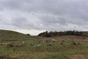
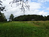
The stone was found in one of the largest forest of the region, the Wolfsbusch (about 50.359, 6.091), rich in rock outcrops – a particular spot called "Am Stein" is rather impressive and popular.
It is now used as a monument dedicated to the victims of WWI and WWII. Nevertheless, we shall stick to the local traditional name.
Photo : mid-March 2015.
You may be viewing yesterday's version of this page. To see the most up to date information please register for a free account.
")
")
Do not use the above information on other web sites or publications without permission of the contributor.
Nearby Images from Flickr
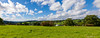
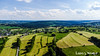
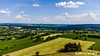
The above images may not be of the site on this page, but were taken nearby. They are loaded from Flickr so please click on them for image credits.
Click here to see more info for this site
Nearby sites
Click here to view sites on an interactive map of the areaKey: Red: member's photo, Blue: 3rd party photo, Yellow: other image, Green: no photo - please go there and take one, Grey: site destroyed
Download sites to:
KML (Google Earth)
GPX (GPS waypoints)
CSV (Garmin/Navman)
CSV (Excel)
To unlock full downloads you need to sign up as a Contributory Member. Otherwise downloads are limited to 50 sites.
Turn off the page maps and other distractions
Nearby sites listing. In the following links * = Image available
8.4km SE 143° Meyerode Kreuzstein Early Christian Sculptured Stone
17.3km E 80° Weißer Stein* Natural Stone / Erratic / Other Natural Feature
17.5km NW 325° Solwaster-Sart* Burial Chamber or Dolmen
21.4km NNE 17° Kaiser Karls Bettstatt Natural Stone / Erratic / Other Natural Feature
22.3km SE 130° Forstmeister-Jansen-Stein* Standing Stone (Menhir)
28.5km NE 41° Heilsteinquelle* Holy Well or Sacred Spring
28.6km SE 143° Watzerath* Modern Stone Circle etc
29.8km WNW 296° Menhir de Deigné* Standing Stone (Menhir)
29.8km SE 133° Weissenstein* Standing Stone (Menhir)
31.3km S 169° Menhir von Eschfeld* Standing Stone (Menhir)
31.7km W 259° Chêne-al-Pierre Rock Outcrop
31.9km SSE 163° Menhir Binscheid* Standing Stone (Menhir)
34.3km SE 125° Fleringen Menhir* Standing Stone (Menhir)
35.2km SE 125° Langstein bei Wallersheim* Standing Stone (Menhir)
35.3km E 87° Düwelsteen Ripsdorfer Wald* Rock Outcrop
35.5km E 87° Düwelskall* Cave or Rock Shelter
35.8km SE 133° Altburg Niederhersdorf* Hillfort
35.9km E 83° Grabhügel Hängebuche* Round Barrow(s)
36.9km ENE 73° Matronenheiligtum Nettersheim* Ancient Temple
37.0km N 358° Zyklopensteine* Natural Stone / Erratic / Other Natural Feature
37.0km ENE 74° Steinrütsch bei Nettersheim* Ancient Mine, Quarry or other Industry
37.9km ESE 119° Buedesheim Rotley Natural Stone / Erratic / Other Natural Feature
38.0km N 353° Klausberg Hügelgrab* Round Barrow(s)
38.3km N 8° Varnenum* Ancient Temple
38.4km ENE 66° Weyerer Wald Huegelgraeberfeld* Barrow Cemetery
View more nearby sites and additional images


 We would like to know more about this location. Please feel free to add a brief description and any relevant information in your own language.
 Wir möchten mehr über diese Stätte erfahren. Bitte zögern Sie nicht, eine kurze Beschreibung und relevante Informationen in Deutsch hinzuzufügen.
 Nous aimerions en savoir encore un peu sur les lieux. S'il vous plaît n'hesitez pas à ajouter une courte description et tous les renseignements pertinents dans votre propre langue.
 Quisieramos informarnos un poco más de las lugares. No dude en añadir una breve descripción y otros datos relevantes en su propio idioma.