

<< Other Photo Pages >> Man-Pupu-Nyor - Natural Stone / Erratic / Other Natural Feature in Russia
Submitted by KaiHofmann on Monday, 14 November 2011 Page Views: 7088
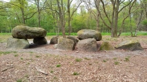
Natural PlacesSite Name: Man-Pupu-NyorCountry: Russia
NOTE: This site is 225.549 km away from the location you searched for.
Type: Natural Stone / Erratic / Other Natural Feature
Nearest Town: Syktyvkar
Latitude: 62.256684N Longitude: 59.299211E
Condition:
| 5 | Perfect |
| 4 | Almost Perfect |
| 3 | Reasonable but with some damage |
| 2 | Ruined but still recognisable as an ancient site |
| 1 | Pretty much destroyed, possibly visible as crop marks |
| 0 | No data. |
| -1 | Completely destroyed |
| 5 | Superb |
| 4 | Good |
| 3 | Ordinary |
| 2 | Not Good |
| 1 | Awful |
| 0 | No data. |
| 5 | Can be driven to, probably with disabled access |
| 4 | Short walk on a footpath |
| 3 | Requiring a bit more of a walk |
| 2 | A long walk |
| 1 | In the middle of nowhere, a nightmare to find |
| 0 | No data. |
| 5 | co-ordinates taken by GPS or official recorded co-ordinates |
| 4 | co-ordinates scaled from a detailed map |
| 3 | co-ordinates scaled from a bad map |
| 2 | co-ordinates of the nearest village |
| 1 | co-ordinates of the nearest town |
| 0 | no data |
Internal Links:
External Links:
")
You may be viewing yesterday's version of this page. To see the most up to date information please register for a free account.
")
Do not use the above information on other web sites or publications without permission of the contributor.
Nearby Images from Flickr
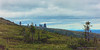
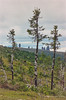

The above images may not be of the site on this page, but were taken nearby. They are loaded from Flickr so please click on them for image credits.
Click here to see more info for this site
Nearby sites
Click here to view sites on an interactive map of the areaKey: Red: member's photo, Blue: 3rd party photo, Yellow: other image, Green: no photo - please go there and take one, Grey: site destroyed
Download sites to:
KML (Google Earth)
GPX (GPS waypoints)
CSV (Garmin/Navman)
CSV (Excel)
To unlock full downloads you need to sign up as a Contributory Member. Otherwise downloads are limited to 50 sites.
Turn off the page maps and other distractions
Nearby sites listing. In the following links * = Image available
255.1km SW 217° Cherdyn Hillfort* Hillfort
316.9km E 90° Emder* Ancient Village or Settlement
387.0km S 179° Balancing stone Kachkanar* Natural Stone / Erratic / Other Natural Feature
507.9km NNE 16° Settlement Mammoth Kuria* Ancient Village or Settlement
582.9km SW 221° Idnakar* Ancient Village or Settlement
668.2km SE 128° Ancient Tobolsk* Ancient Village or Settlement
712.5km NNE 29° Sacred Stone Grandfather* Standing Stone (Menhir)
743.9km NNE 24° Sanctuary Khe-he Pe — Sacred stone* Natural Stone / Erratic / Other Natural Feature
790.1km S 177° Isle of Vera* Standing Stones
813.3km S 180° Zyuratkul Elk* Hill Figure or Geoglyph
833.1km SSE 153° Tzarevo hillfort* Hillfort
833.9km SSW 213° Yelabuga settlement* Ancient Village or Settlement
854.9km W 263° Tiunovskoe sanctuary* Carving
881.4km SW 227° Karman-Kuryk* Ancient Village or Settlement
938.0km SSW 193° Baishevskie Barrows Ring Cairn
961.1km S 182° The oldest settlement Mysovaya - Urta-Tube* Ancient Village or Settlement
1047.2km WSW 245° Seraphim Big Stone 4* Natural Stone / Erratic / Other Natural Feature
1060.5km S 181° Barrow Cemetary near Kizil'skoye Barrow Cemetery
1068.5km S 179° Arkaim Ancient Village or Settlement
1085.4km WSW 241° Georgiev stone* Carving
1086.4km WSW 242° Gorodets Museum of Regional Studies* Museum
1087.7km S 177° Sintashta* Ancient Village or Settlement
1101.8km SE 132° Pokrovskaya Fortress* Hillfort
1107.6km SSW 212° Volga historical wall* Ancient Village or Settlement
1146.7km SE 145° Krasnyi Yar Barrow Cemetery
View more nearby sites and additional images


 We would like to know more about this location. Please feel free to add a brief description and any relevant information in your own language.
 Wir möchten mehr über diese Stätte erfahren. Bitte zögern Sie nicht, eine kurze Beschreibung und relevante Informationen in Deutsch hinzuzufügen.
 Nous aimerions en savoir encore un peu sur les lieux. S'il vous plaît n'hesitez pas à ajouter une courte description et tous les renseignements pertinents dans votre propre langue.
 Quisieramos informarnos un poco más de las lugares. No dude en añadir una breve descripción y otros datos relevantes en su propio idioma.