<< Text Pages >> Nécropole Mérovingienne Audun-le-Tiche - Barrow Cemetery in France in Alsace-Lorraine:Moselle (57)
Submitted by KaiHofmann on Tuesday, 03 September 2013 Page Views: 2749
Neolithic and Bronze AgeSite Name: Nécropole Mérovingienne Audun-le-TicheCountry: France
NOTE: This site is 2.879 km away from the location you searched for.
Département: Alsace-Lorraine:Moselle (57) Type: Barrow Cemetery
Nearest Town: Esch-Sur-Alzette Nearest Village: Audun-le-Tiche
Latitude: 49.467596N Longitude: 5.949989E
Condition:
| 5 | Perfect |
| 4 | Almost Perfect |
| 3 | Reasonable but with some damage |
| 2 | Ruined but still recognisable as an ancient site |
| 1 | Pretty much destroyed, possibly visible as crop marks |
| 0 | No data. |
| -1 | Completely destroyed |
| 5 | Superb |
| 4 | Good |
| 3 | Ordinary |
| 2 | Not Good |
| 1 | Awful |
| 0 | No data. |
| 5 | Can be driven to, probably with disabled access |
| 4 | Short walk on a footpath |
| 3 | Requiring a bit more of a walk |
| 2 | A long walk |
| 1 | In the middle of nowhere, a nightmare to find |
| 0 | No data. |
| 5 | co-ordinates taken by GPS or official recorded co-ordinates |
| 4 | co-ordinates scaled from a detailed map |
| 3 | co-ordinates scaled from a bad map |
| 2 | co-ordinates of the nearest village |
| 1 | co-ordinates of the nearest town |
| 0 | no data |
Internal Links:
External Links:
Barrow Cemetery in Alsace:Moselle (57)
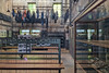
Merovingian necropolis of the 7th century CE. On the site are many stone-cist like burials to find, some with large capstones.
You may be viewing yesterday's version of this page. To see the most up to date information please register for a free account.
Do not use the above information on other web sites or publications without permission of the contributor.
Nearby Images from Flickr
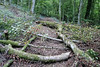
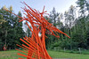
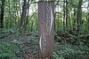
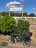
The above images may not be of the site on this page, but were taken nearby. They are loaded from Flickr so please click on them for image credits.
Click here to see more info for this site
Nearby sites
Click here to view sites on an interactive map of the areaKey: Red: member's photo, Blue: 3rd party photo, Yellow: other image, Green: no photo - please go there and take one, Grey: site destroyed
Download sites to:
KML (Google Earth)
GPX (GPS waypoints)
CSV (Garmin/Navman)
CSV (Excel)
To unlock full downloads you need to sign up as a Contributory Member. Otherwise downloads are limited to 50 sites.
Turn off the page maps and other distractions
Nearby sites listing. In the following links * = Image available
16.0km ENE 76° Aalburg Befort* Hillfort
17.0km SSE 156° Eperon barré du bois des Chênes Hillfort
23.5km ENE 70° Vicus Ricciaco* Ancient Village or Settlement
27.8km SSE 148° Archéosite Celte Museum
28.0km SSE 158° La pierre qui tourne Pierrevillers Standing Stone (Menhir)
28.3km WNW 294° Dolmen de Gomery* Burial Chamber or Dolmen
28.7km SSE 160° La Côte de Drince Oppidum Ancient Village or Settlement
30.0km WNW 287° Polissoirs de Saint-Mard* Polissoir
30.1km NNE 30° Blaschette Modern Stone Circle* Modern Stone Circle etc
30.2km NNE 18° Wichtelslee* Hillfort
30.4km NNE 20° Mamerlayen Ancient Mine, Quarry or other Industry
31.4km NNE 19° Mamerlach Cave or Rock Shelter
31.6km ENE 78° Molknopp* Round Barrow(s)
32.1km ENE 78° Villa Nennig* Ancient Palace
33.7km NNE 16° Beisenerbierg Menhir* Standing Stone (Menhir)
34.3km S 181° Fontaine des Bons Malades Holy Well or Sacred Spring
34.5km E 100° Stèle de Paffenacker* Standing Stone (Menhir)
34.7km NNE 33° Freylay* Natural Stone / Erratic / Other Natural Feature
34.8km NNE 34° La Roche des Payens* Rock Art
34.8km NNE 34° Schleifrillen Häerdcheslee* Polissoir
35.6km E 85° Hunnenschanze Borg Misc. Earthwork
35.6km ESE 119° Nonnenfels* Rock Art
36.8km E 85° Villa Borg Ancient Palace
36.8km E 85° Roman Villa (Borg)* Ancient Village or Settlement
38.3km SSE 161° Lorry-les-Metz burial chamber Burial Chamber or Dolmen
View more nearby sites and additional images


 We would like to know more about this location. Please feel free to add a brief description and any relevant information in your own language.
 Wir möchten mehr über diese Stätte erfahren. Bitte zögern Sie nicht, eine kurze Beschreibung und relevante Informationen in Deutsch hinzuzufügen.
 Nous aimerions en savoir encore un peu sur les lieux. S'il vous plaît n'hesitez pas à ajouter une courte description et tous les renseignements pertinents dans votre propre langue.
 Quisieramos informarnos un poco más de las lugares. No dude en añadir una breve descripción y otros datos relevantes en su propio idioma.