<< Our Photo Pages >> Polissoir de Sart - Polissoir in Belgium in Luxembourg
Submitted by Alta-Falisa on Saturday, 05 September 2015 Page Views: 1744
Neolithic and Bronze AgeSite Name: Polissoir de SartCountry: Belgium
NOTE: This site is 17.096 km away from the location you searched for.
Province: Luxembourg Type: Polissoir
Nearest Town: Arlon Nearest Village: Neufchâteau
Latitude: 49.818300N Longitude: 5.451200E
Condition:
| 5 | Perfect |
| 4 | Almost Perfect |
| 3 | Reasonable but with some damage |
| 2 | Ruined but still recognisable as an ancient site |
| 1 | Pretty much destroyed, possibly visible as crop marks |
| 0 | No data. |
| -1 | Completely destroyed |
| 5 | Superb |
| 4 | Good |
| 3 | Ordinary |
| 2 | Not Good |
| 1 | Awful |
| 0 | No data. |
| 5 | Can be driven to, probably with disabled access |
| 4 | Short walk on a footpath |
| 3 | Requiring a bit more of a walk |
| 2 | A long walk |
| 1 | In the middle of nowhere, a nightmare to find |
| 0 | No data. |
| 5 | co-ordinates taken by GPS or official recorded co-ordinates |
| 4 | co-ordinates scaled from a detailed map |
| 3 | co-ordinates scaled from a bad map |
| 2 | co-ordinates of the nearest village |
| 1 | co-ordinates of the nearest town |
| 0 | no data |
Internal Links:
External Links:
")
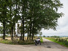
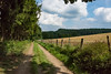
A highly resilient block of quartzite showing deep grooves from polishing activities.
Information is scarce. The block is now in front of a small chapel.
Photo : August 2015.
You may be viewing yesterday's version of this page. To see the most up to date information please register for a free account.
")
")
")
")
Do not use the above information on other web sites or publications without permission of the contributor.
Nearby Images from Flickr
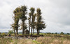
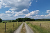
The above images may not be of the site on this page, but were taken nearby. They are loaded from Flickr so please click on them for image credits.
Click here to see more info for this site
Nearby sites
Click here to view sites on an interactive map of the areaKey: Red: member's photo, Blue: 3rd party photo, Yellow: other image, Green: no photo - please go there and take one, Grey: site destroyed
Download sites to:
KML (Google Earth)
GPX (GPS waypoints)
CSV (Garmin/Navman)
CSV (Excel)
To unlock full downloads you need to sign up as a Contributory Member. Otherwise downloads are limited to 50 sites.
Turn off the page maps and other distractions
Nearby sites listing. In the following links * = Image available
2.6km NNW 343° Menhir de Lahérie* Standing Stone (Menhir)
12.1km N 359° Menhir de Renaumont* Standing Stone (Menhir)
29.4km SSE 160° Dolmen de Gomery* Burial Chamber or Dolmen
31.1km SSE 166° Polissoirs de Saint-Mard* Polissoir
31.8km NW 323° Pierre Misautée* Natural Stone / Erratic / Other Natural Feature
33.4km NNE 25° La Pierre Druidique* Polissoir
37.1km NNW 339° Forrières* Stone Circle
40.8km NNE 25° Monument Europalia Portugal* Modern Stone Circle etc
40.9km W 277° Pierre à marier* Natural Stone / Erratic / Other Natural Feature
41.7km NW 322° Lavaux-Sainte-Anne* Modern Stone Circle etc
43.0km NNW 347° Bois des Lus* Modern Stone Circle etc
43.9km N 6° Source Miraculeuse de Saint Thibaut Holy Well or Sacred Spring
45.0km N 350° Pierre Saint-Hubert* Marker Stone
45.3km E 98° Beisenerbierg Menhir* Standing Stone (Menhir)
45.8km N 350° Pierre de Pîrîre* Modern Stone Circle etc
46.2km ESE 103° Wichtelslee* Hillfort
47.2km E 101° Mamerlach Cave or Rock Shelter
47.4km ESE 102° Mamerlayen Ancient Mine, Quarry or other Industry
48.5km W 280° Roc la Tour Natural Stone / Erratic / Other Natural Feature
49.4km S 189° Oppidum Le Châtelet Ancient Village or Settlement
50.2km SSW 200° Menhir dit la Hotte du Diable* Standing Stone (Menhir)
50.5km E 85° Deiwelselter* Burial Chamber or Dolmen
52.6km ESE 104° Blaschette Modern Stone Circle* Modern Stone Circle etc
52.9km E 91° Rocher Champignon* Polissoir
53.0km SE 137° Nécropole Mérovingienne Audun-le-Tiche Barrow Cemetery
View more nearby sites and additional images


 We would like to know more about this location. Please feel free to add a brief description and any relevant information in your own language.
 Wir möchten mehr über diese Stätte erfahren. Bitte zögern Sie nicht, eine kurze Beschreibung und relevante Informationen in Deutsch hinzuzufügen.
 Nous aimerions en savoir encore un peu sur les lieux. S'il vous plaît n'hesitez pas à ajouter une courte description et tous les renseignements pertinents dans votre propre langue.
 Quisieramos informarnos un poco más de las lugares. No dude en añadir una breve descripción y otros datos relevantes en su propio idioma.