<< Text Pages >> Abri de St-Mitre - Cave or Rock Shelter in France in Provence:Alpes-de Haute-Provence 04
Submitted by TheCaptain on Wednesday, 08 September 2010 Page Views: 1770
Natural PlacesSite Name: Abri de St-MitreCountry: France
NOTE: This site is 13.988 km away from the location you searched for.
Département: Provence:Alpes-de Haute-Provence 04 Type: Cave or Rock Shelter
Nearest Village: Reillanne
Latitude: 43.880000N Longitude: 5.659000E
Condition:
| 5 | Perfect |
| 4 | Almost Perfect |
| 3 | Reasonable but with some damage |
| 2 | Ruined but still recognisable as an ancient site |
| 1 | Pretty much destroyed, possibly visible as crop marks |
| 0 | No data. |
| -1 | Completely destroyed |
| 5 | Superb |
| 4 | Good |
| 3 | Ordinary |
| 2 | Not Good |
| 1 | Awful |
| 0 | No data. |
| 5 | Can be driven to, probably with disabled access |
| 4 | Short walk on a footpath |
| 3 | Requiring a bit more of a walk |
| 2 | A long walk |
| 1 | In the middle of nowhere, a nightmare to find |
| 0 | No data. |
| 5 | co-ordinates taken by GPS or official recorded co-ordinates |
| 4 | co-ordinates scaled from a detailed map |
| 3 | co-ordinates scaled from a bad map |
| 2 | co-ordinates of the nearest village |
| 1 | co-ordinates of the nearest town |
| 0 | no data |
Be the first person to rate this site - see the 'Contribute!' box in the right hand menu.
Internal Links:
External Links:
Collective Tombe in Provence:Alpes-de Haute-Provence 04
Abri de St-Mitre is a Collective Tombe in the community of Reillanne, Departement of Alpes-de Haute-Provence, Region of Provence - Alpes - Cote d'Azur
You may be viewing yesterday's version of this page. To see the most up to date information please register for a free account.
Do not use the above information on other web sites or publications without permission of the contributor.
Nearby Images from Flickr
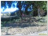
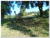
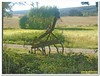
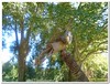
The above images may not be of the site on this page, but were taken nearby. They are loaded from Flickr so please click on them for image credits.
Click here to see more info for this site
Nearby sites
Click here to view sites on an interactive map of the areaKey: Red: member's photo, Blue: 3rd party photo, Yellow: other image, Green: no photo - please go there and take one, Grey: site destroyed
Download sites to:
KML (Google Earth)
GPX (GPS waypoints)
CSV (Garmin/Navman)
CSV (Excel)
To unlock full downloads you need to sign up as a Contributory Member. Otherwise downloads are limited to 50 sites.
Turn off the page maps and other distractions
Nearby sites listing. In the following links * = Image available
2.8km WNW 292° Grotte de Carluc Cave or Rock Shelter
9.1km N 1° La Grange Neuve Cave or Rock Shelter
15.5km NNW 346° Grotte Calvet Cave or Rock Shelter
21.0km ESE 106° Val de Fer Hypogee Long Barrow
23.2km WNW 288° Sanguinouse Cave or Rock Shelter
23.2km WSW 257° Grotte Julian Cave or Rock Shelter
27.5km S 175° Dolmen des Cudieres 2 Burial Chamber or Dolmen
27.5km S 175° Dolmen des Cudieres 1 Burial Chamber or Dolmen
28.5km SE 136° Grotte Sepulcrale du Pignolet Cave or Rock Shelter
28.9km WSW 257° Saint Gervais Cave or Rock Shelter
29.2km SSW 201° Dolmen de La Plaine 1 Burial Chamber or Dolmen
30.2km SW 224° St-Valentin Cave or Rock Shelter
30.2km SW 225° Le Moulestre Cave or Rock Shelter
30.9km NW 320° Les Boileau Cave or Rock Shelter
31.1km SSE 164° Baudrimont Grotte Cave or Rock Shelter
31.5km WSW 242° Les Vachons (Lauris) Cave or Rock Shelter
33.2km W 267° L'Ubac Burial Chamber or Dolmen
33.3km W 267° Trabari Cave or Rock Shelter
35.0km W 260° Dolmen de la Pitchoune* Burial Chamber or Dolmen
35.8km SSE 151° Grotte Sepulcrale de la Glacierre Cave or Rock Shelter
36.4km ESE 123° Charavine Village Prehistorique Ancient Village or Settlement
36.4km ESE 123° Gorges du Verdon Musée de la Préhistoire* Museum
36.4km S 187° Grotte de la Citadelle 2 Cave or Rock Shelter
36.4km ESE 123° Malassoque 1 & 2 Barrow Cemetery
36.4km S 187° Grotte de la Citadelle 1 Cave or Rock Shelter
View more nearby sites and additional images


 We would like to know more about this location. Please feel free to add a brief description and any relevant information in your own language.
 Wir möchten mehr über diese Stätte erfahren. Bitte zögern Sie nicht, eine kurze Beschreibung und relevante Informationen in Deutsch hinzuzufügen.
 Nous aimerions en savoir encore un peu sur les lieux. S'il vous plaît n'hesitez pas à ajouter une courte description et tous les renseignements pertinents dans votre propre langue.
 Quisieramos informarnos un poco más de las lugares. No dude en añadir una breve descripción y otros datos relevantes en su propio idioma.