

<< Text Pages >> Pas de la Fosse - Artificial Mound in France in Provence:Bouches-du-Rhône (13)
Submitted by TheCaptain on Wednesday, 08 September 2010 Page Views: 1647
Multi-periodSite Name: Pas de la FosseCountry: France
NOTE: This site is 0.225 km away from the location you searched for.
Département: Provence:Bouches-du-Rhône (13) Type: Artificial Mound
Nearest Town: Marseille Nearest Village: Ensues
Latitude: 43.354000N Longitude: 5.203000E
Condition:
| 5 | Perfect |
| 4 | Almost Perfect |
| 3 | Reasonable but with some damage |
| 2 | Ruined but still recognisable as an ancient site |
| 1 | Pretty much destroyed, possibly visible as crop marks |
| 0 | No data. |
| -1 | Completely destroyed |
| 5 | Superb |
| 4 | Good |
| 3 | Ordinary |
| 2 | Not Good |
| 1 | Awful |
| 0 | No data. |
| 5 | Can be driven to, probably with disabled access |
| 4 | Short walk on a footpath |
| 3 | Requiring a bit more of a walk |
| 2 | A long walk |
| 1 | In the middle of nowhere, a nightmare to find |
| 0 | No data. |
| 5 | co-ordinates taken by GPS or official recorded co-ordinates |
| 4 | co-ordinates scaled from a detailed map |
| 3 | co-ordinates scaled from a bad map |
| 2 | co-ordinates of the nearest village |
| 1 | co-ordinates of the nearest town |
| 0 | no data |
Be the first person to rate this site - see the 'Contribute!' box in the right hand menu.
Internal Links:
External Links:
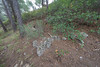
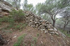
Tumulus in Provence:Bouches-du-Rhône (13)
Pas de la Fosse is a Tumulus in the community of Ensues, Departement of Bouches-du-Rhône, Region of Provence - Alpes - Cote d'Azur
You may be viewing yesterday's version of this page. To see the most up to date information please register for a free account.
Do not use the above information on other web sites or publications without permission of the contributor.
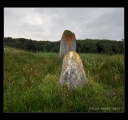
Nearby Images from Flickr
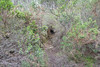
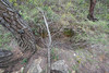
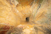
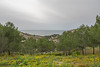
The above images may not be of the site on this page, but were taken nearby. They are loaded from Flickr so please click on them for image credits.
Click here to see more info for this site
Nearby sites
Click here to view sites on an interactive map of the areaKey: Red: member's photo, Blue: 3rd party photo, Yellow: other image, Green: no photo - please go there and take one, Grey: site destroyed
Download sites to:
KML (Google Earth)
GPX (GPS waypoints)
CSV (Garmin/Navman)
CSV (Excel)
To unlock full downloads you need to sign up as a Contributory Member. Otherwise downloads are limited to 50 sites.
Turn off the page maps and other distractions
Nearby sites listing. In the following links * = Image available
4.1km ENE 66° Les Heritages Cave or Rock Shelter
4.2km ENE 67° Abri de Laure Cave or Rock Shelter
6.8km NNE 22° Montretout Oppidium Hillfort
8.3km WSW 252° Hypogee de Sausset Passage Grave
15.1km NNE 14° Oppidum ligure du Castellas* Ancient Village or Settlement
15.8km ESE 113° Grotte des Escourtines Cave or Rock Shelter
15.9km ESE 113° Grotte du Roy d'Espagne Cave or Rock Shelter
15.9km ESE 113° Abri des Trois Ponts Cave or Rock Shelter
20.5km NNE 15° Roquepertuse* Ancient Temple
21.3km E 91° Baume Montée Cave or Rock Shelter
21.4km E 91° Aven de la Carriere Cave or Rock Shelter
21.5km NW 304° Oppidum Saint-Blaise* Ancient Village or Settlement
22.6km E 95° Pilon de Roi Cave or Rock Shelter
22.6km NNW 344° Oppidum de Constantine* Ancient Village or Settlement
22.6km E 95° Aven de Gage Cave or Rock Shelter
22.6km E 95° Enco de Bote Burial Chamber or Dolmen
22.7km E 95° Pitchoun Homme Cave or Rock Shelter
23.3km ENE 76° Grotte du Facteur Cave or Rock Shelter
23.7km ENE 78° Grotte de l'Ermite Cave or Rock Shelter
24.8km NW 315° Rassuen Cave or Rock Shelter
25.1km NW 317° Castellan Oppidium Hillfort
25.9km ENE 75° Oppidium de Mimet Ancient Village or Settlement
26.8km E 79° Grotte des Fées (Mimet) Cave or Rock Shelter
27.7km NE 46° Mousse Fountain Holy Well or Sacred Spring
27.7km NE 47° La Blaque Burial Chamber or Dolmen
View more nearby sites and additional images


 We would like to know more about this location. Please feel free to add a brief description and any relevant information in your own language.
 Wir möchten mehr über diese Stätte erfahren. Bitte zögern Sie nicht, eine kurze Beschreibung und relevante Informationen in Deutsch hinzuzufügen.
 Nous aimerions en savoir encore un peu sur les lieux. S'il vous plaît n'hesitez pas à ajouter une courte description et tous les renseignements pertinents dans votre propre langue.
 Quisieramos informarnos un poco más de las lugares. No dude en añadir una breve descripción y otros datos relevantes en su propio idioma.