<< Other Photo Pages >> Gadachrili Gora - Ancient Village or Settlement in Georgia
Submitted by davidmorgan on Tuesday, 14 November 2017 Page Views: 4175
DigsSite Name: Gadachrili GoraCountry: Georgia
NOTE: This site is 35.947 km away from the location you searched for.
Type: Ancient Village or Settlement
Nearest Town: Tbilisi
Latitude: 41.390550N Longitude: 44.820840E
Condition:
| 5 | Perfect |
| 4 | Almost Perfect |
| 3 | Reasonable but with some damage |
| 2 | Ruined but still recognisable as an ancient site |
| 1 | Pretty much destroyed, possibly visible as crop marks |
| 0 | No data. |
| -1 | Completely destroyed |
| 5 | Superb |
| 4 | Good |
| 3 | Ordinary |
| 2 | Not Good |
| 1 | Awful |
| 0 | No data. |
| 5 | Can be driven to, probably with disabled access |
| 4 | Short walk on a footpath |
| 3 | Requiring a bit more of a walk |
| 2 | A long walk |
| 1 | In the middle of nowhere, a nightmare to find |
| 0 | No data. |
| 5 | co-ordinates taken by GPS or official recorded co-ordinates |
| 4 | co-ordinates scaled from a detailed map |
| 3 | co-ordinates scaled from a bad map |
| 2 | co-ordinates of the nearest village |
| 1 | co-ordinates of the nearest town |
| 0 | no data |
Internal Links:
External Links:
")
More information at Gadachrili Gora Regional Archaeological Project Expedition.
Note: Evidence of world's earliest winemaking uncovered by archaeologists. More in the latest comment on our page.
You may be viewing yesterday's version of this page. To see the most up to date information please register for a free account.
Do not use the above information on other web sites or publications without permission of the contributor.
Nearby Images from Flickr
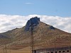
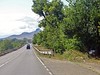
The above images may not be of the site on this page, but were taken nearby. They are loaded from Flickr so please click on them for image credits.
Click here to see more info for this site
Nearby sites
Click here to view sites on an interactive map of the areaKey: Red: member's photo, Blue: 3rd party photo, Yellow: other image, Green: no photo - please go there and take one, Grey: site destroyed
Download sites to:
KML (Google Earth)
GPX (GPS waypoints)
CSV (Garmin/Navman)
CSV (Excel)
To unlock full downloads you need to sign up as a Contributory Member. Otherwise downloads are limited to 50 sites.
Turn off the page maps and other distractions
Nearby sites listing. In the following links * = Image available
50.6km WNW 283° Mamulos Pantiani* Ancient Village or Settlement
57.2km SSE 162° Anapat Cave Rock Art
60.6km ESE 120° Yastytepe Ancient Village or Settlement
69.6km WNW 299° Tejisi Menhir* Standing Stone (Menhir)
77.0km SW 223° Gogaran Iron Age mausoleum Burial Chamber or Dolmen
78.7km W 280° Chikiani Menhir Standing Stone (Menhir)
91.2km SSW 213° Gegharot* Ancient Village or Settlement
94.8km W 269° Abuli Fortress* Ancient Village or Settlement
98.6km S 174° Lchashen Bronze-Age complex Ancient Village or Settlement
102.1km SE 128° Tatarly Stone Age settlement Ancient Village or Settlement
107.9km SSE 167° Berdunk Urartian Fortress Promontory Fort / Cliff Castle
108.1km ENE 64° Ananauri 3 Great Kurgan* Round Barrow(s)
111.8km SW 223° Vardakar settlement Ancient Village or Settlement
112.6km W 269° Kat Kar Menhir Standing Stone (Menhir)
127.5km S 186° Aramus Ancient Village or Settlement
128.4km SSE 165° K'anaker* Stone Circle
129.1km S 178° Geghard Petroglyphs 2 Rock Art
130.1km SSW 201° Agarak Rock Cut Tomb
131.3km S 191° Karmir Berd Rock Art
131.4km SSW 201° Agarak 2 Ancient Village or Settlement
132.0km SSW 209° Kakavadzor temple Ancient Temple
132.3km S 178° Geghard Petroglyphs Rock Art
132.7km SSW 201° Voskehat settlement Ancient Village or Settlement
133.8km SSW 200° Voskevaz Vishap Standing Stone (Menhir)
136.5km S 186° Voghjaberd Caves Cave or Rock Shelter
View more nearby sites and additional images


 We would like to know more about this location. Please feel free to add a brief description and any relevant information in your own language.
 Wir möchten mehr über diese Stätte erfahren. Bitte zögern Sie nicht, eine kurze Beschreibung und relevante Informationen in Deutsch hinzuzufügen.
 Nous aimerions en savoir encore un peu sur les lieux. S'il vous plaît n'hesitez pas à ajouter une courte description et tous les renseignements pertinents dans votre propre langue.
 Quisieramos informarnos un poco más de las lugares. No dude en añadir una breve descripción y otros datos relevantes en su propio idioma.