<< Text Pages >> Shengavit - Ancient Village or Settlement in Armenia
Submitted by davidmorgan on Monday, 05 June 2017 Page Views: 1345
Multi-periodSite Name: ShengavitCountry: Armenia
NOTE: This site is 1.458 km away from the location you searched for.
Type: Ancient Village or Settlement
Nearest Town: Yerevan
Latitude: 40.156903N Longitude: 44.476905E
Condition:
| 5 | Perfect |
| 4 | Almost Perfect |
| 3 | Reasonable but with some damage |
| 2 | Ruined but still recognisable as an ancient site |
| 1 | Pretty much destroyed, possibly visible as crop marks |
| 0 | No data. |
| -1 | Completely destroyed |
| 5 | Superb |
| 4 | Good |
| 3 | Ordinary |
| 2 | Not Good |
| 1 | Awful |
| 0 | No data. |
| 5 | Can be driven to, probably with disabled access |
| 4 | Short walk on a footpath |
| 3 | Requiring a bit more of a walk |
| 2 | A long walk |
| 1 | In the middle of nowhere, a nightmare to find |
| 0 | No data. |
| 5 | co-ordinates taken by GPS or official recorded co-ordinates |
| 4 | co-ordinates scaled from a detailed map |
| 3 | co-ordinates scaled from a bad map |
| 2 | co-ordinates of the nearest village |
| 1 | co-ordinates of the nearest town |
| 0 | no data |
Internal Links:
External Links:
Ancient Settlement in Armenia
A large Early Bronze Age (3200-2500 BCE) Kura-Araxes settlement next to Lake Yerevan.
You may be viewing yesterday's version of this page. To see the most up to date information please register for a free account.
Do not use the above information on other web sites or publications without permission of the contributor.
Nearby Images from Flickr
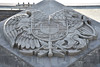
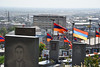
The above images may not be of the site on this page, but were taken nearby. They are loaded from Flickr so please click on them for image credits.
Click here to see more info for this site
Nearby sites
Click here to view sites on an interactive map of the areaKey: Red: member's photo, Blue: 3rd party photo, Yellow: other image, Green: no photo - please go there and take one, Grey: site destroyed
Download sites to:
KML (Google Earth)
GPX (GPS waypoints)
CSV (Garmin/Navman)
CSV (Excel)
To unlock full downloads you need to sign up as a Contributory Member. Otherwise downloads are limited to 50 sites.
Turn off the page maps and other distractions
Nearby sites listing. In the following links * = Image available
2.1km WSW 258° Karmir Blur Ancient Village or Settlement
5.5km ESE 109° Erebuni Ancient Village or Settlement
9.1km NNE 24° Karmir Berd Rock Art
15.0km E 85° Voghjaberd Caves Cave or Rock Shelter
18.7km ENE 56° Aramus Ancient Village or Settlement
19.5km NW 305° Voskevaz Vishap Standing Stone (Menhir)
22.1km ESE 103° Garni temple* Ancient Temple
22.5km NW 309° Agarak 2 Ancient Village or Settlement
22.8km NW 312° Agarak Rock Cut Tomb
23.3km NW 305° Voskehat settlement Ancient Village or Settlement
24.8km W 262° Metsamor Complex* Standing Stones
29.1km E 93° Geghard monastery* Ancient Cross
31.8km SSE 166° Artashat Ancient Village or Settlement
32.1km SSE 165° Khor Virap* Early Christian Sculptured Stone
34.7km E 82° Geghard Petroglyphs Rock Art
34.9km WNW 292° Shamiram settlement Ancient Village or Settlement
35.1km ENE 76° Geghard Petroglyphs 2 Rock Art
41.7km WNW 302° Kakavadzor temple Ancient Temple
55.8km NE 45° Lchashen Bronze-Age complex Ancient Village or Settlement
61.4km ESE 104° Bullhead Vishap Standing Stone (Menhir)
62.7km ENE 59° Berdunk Urartian Fortress Promontory Fort / Cliff Castle
64.6km NNW 341° Gegharot* Ancient Village or Settlement
64.6km ENE 78° K'anaker* Stone Circle
68.6km ESE 109° Selim Caravansarai* Ancient Trackway
73.6km NW 319° Vardakar settlement Ancient Village or Settlement
View more nearby sites and additional images


 We would like to know more about this location. Please feel free to add a brief description and any relevant information in your own language.
 Wir möchten mehr über diese Stätte erfahren. Bitte zögern Sie nicht, eine kurze Beschreibung und relevante Informationen in Deutsch hinzuzufügen.
 Nous aimerions en savoir encore un peu sur les lieux. S'il vous plaît n'hesitez pas à ajouter une courte description et tous les renseignements pertinents dans votre propre langue.
 Quisieramos informarnos un poco más de las lugares. No dude en añadir una breve descripción y otros datos relevantes en su propio idioma.