

<< Our Photo Pages >> Nineveh - Ancient Village or Settlement in Iraq
Submitted by AlexHunger on Monday, 25 November 2013 Page Views: 13503
Multi-periodSite Name: Nineveh Alternative Name: NinuaCountry: Iraq
NOTE: This site is 3.677 km away from the location you searched for.
Type: Ancient Village or Settlement
Nearest Town: Mosul Nearest Village: Kuyunjik
Latitude: 36.366840N Longitude: 43.156343E
Condition:
| 5 | Perfect |
| 4 | Almost Perfect |
| 3 | Reasonable but with some damage |
| 2 | Ruined but still recognisable as an ancient site |
| 1 | Pretty much destroyed, possibly visible as crop marks |
| 0 | No data. |
| -1 | Completely destroyed |
| 5 | Superb |
| 4 | Good |
| 3 | Ordinary |
| 2 | Not Good |
| 1 | Awful |
| 0 | No data. |
| 5 | Can be driven to, probably with disabled access |
| 4 | Short walk on a footpath |
| 3 | Requiring a bit more of a walk |
| 2 | A long walk |
| 1 | In the middle of nowhere, a nightmare to find |
| 0 | No data. |
| 5 | co-ordinates taken by GPS or official recorded co-ordinates |
| 4 | co-ordinates scaled from a detailed map |
| 3 | co-ordinates scaled from a bad map |
| 2 | co-ordinates of the nearest village |
| 1 | co-ordinates of the nearest town |
| 0 | no data |
Internal Links:
External Links:
I have visited· I would like to visit
AngieLake has visited here
")
According to Hellenistic texts Ninus was the eponymous founder of Nineveh. Nineveh was mentioned about 1800 BCE as the location of the temple of Ištar. Nineveh was a vassals city of Mitanni's until the mid 14th century BCE, when the Assyrian kings of Assur seized it. The neo-Assyrian kings, particularly Ashurnasirpal II who reigned between 883 and 859 BCE started building great monuments.
Successive kings repaired and founded new palaces and temples to Sîn, Nergal, Šamaš, Ištar, and Nabiu of Borsippa. Sennacherib in 700 BCE laid out fresh avenues and squares and built a great palace about 210 by 200 Meters. A large number of clay tablets were found in the palace and allowed us to reconstruct the Epic of Gilgamesh. Nineveh had 15 great gates in its walls and 18 canals bringing water from the hills for the more than 100,000 inhabitants. Assyria was a very militaristic state which conquered much of the middle east.
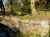
Nineveh was, however, destroyed in 612 BCE by the Medes, Babylonians and Susianians and remained unoccupied until the city of Mosul on the opposite bank of the river Tigris rose up again centuries later. In the early 19th century, the French consul at Mosul began to research the mounds on the opposite bank of the Tigris.
Later, in 1847 Sir Austen Henry Layard first excavated the ruins in the Kuyunjik mound and rediscovered the palace of Sennacherib across the Tigris River from Mosul, with its 71 rooms and colossal bas-reliefs and the famous library of Ashurbanipal with 22,000 inscribed clay tablets. Bas Relief stone slabs are now in many western museums, such as the British Museum, Pergamon Museum and the Metropolitan. The mound at Kuyunjik was excavated by British Museum archaeologists in the early 1900s who discovered the Temple of Nabu.
Note: “What we are proposing is that these demographic and climatic factors played an indirect but significant role in the demise of the Assyrian Empire,” See latest comment.
You may be viewing yesterday's version of this page. To see the most up to date information please register for a free account.
")
")
")
")
")
")
")
")
")
")
")
")
")
")
")
")
")
")
Do not use the above information on other web sites or publications without permission of the contributor.
Click here to see more info for this site
Nearby sites
Click here to view sites on an interactive map of the areaKey: Red: member's photo, Blue: 3rd party photo, Yellow: other image, Green: no photo - please go there and take one, Grey: site destroyed
Download sites to:
KML (Google Earth)
GPX (GPS waypoints)
CSV (Garmin/Navman)
CSV (Excel)
To unlock full downloads you need to sign up as a Contributory Member. Otherwise downloads are limited to 50 sites.
Turn off the page maps and other distractions
Nearby sites listing. In the following links * = Image available
17.2km NNE 22° Dur-Sharrukin* Ancient Village or Settlement
20.3km NNE 22° Tepe Gawra Ancient Village or Settlement
33.6km SSE 153° Nimrud* Ancient Village or Settlement
64.5km W 259° Taya Ancient Village or Settlement
75.3km W 267° Rima Ancient Village or Settlement
80.3km ESE 106° Arbil, Iraq* Ancient Village or Settlement
95.1km SSW 205° Hatra (Khvarvaran)* Ancient Temple
101.4km S 175° Assur (Iraq)* Ancient Village or Settlement
107.1km ENE 63° Shanidar Cave Cave or Rock Shelter
113.0km NW 323° Amarsava Ancient Village or Settlement
118.0km WNW 295° Tell Hamoukar Ancient Village or Settlement
132.3km SE 146° Tell al-Fakhar Ancient Palace
143.9km NNE 21° Tirsin Plateau Rock Art
148.7km ESE 111° Satu Qala (Idu)* Ancient Village or Settlement
154.3km SE 140° Nuzi Ancient Village or Settlement
160.0km WNW 289° Tell Qarassa* Ancient Village or Settlement
161.2km WNW 295° Shubat-Enlil Ancient Village or Settlement
173.8km NW 318° Cemka Hoyugu* Ancient Village or Settlement
174.8km NW 318° Boncuklu Tarla* Ancient Temple
176.0km NW 318° Zeviya Tivilki Ancient Village or Settlement
190.2km WNW 296° Girnavaz* Ancient Village or Settlement
190.4km W 281° Tell Brak* Ancient Village or Settlement
192.0km NW 322° Güzir Höyük Ancient Village or Settlement
207.2km WNW 292° Urkesh* Ancient Village or Settlement
209.3km W 273° Tell Tuneinir Ancient Village or Settlement
View more nearby sites and additional images


 We would like to know more about this location. Please feel free to add a brief description and any relevant information in your own language.
 Wir möchten mehr über diese Stätte erfahren. Bitte zögern Sie nicht, eine kurze Beschreibung und relevante Informationen in Deutsch hinzuzufügen.
 Nous aimerions en savoir encore un peu sur les lieux. S'il vous plaît n'hesitez pas à ajouter une courte description et tous les renseignements pertinents dans votre propre langue.
 Quisieramos informarnos un poco más de las lugares. No dude en añadir una breve descripción y otros datos relevantes en su propio idioma.