

<< Our Photo Pages >> Tiunovskoe sanctuary - Carving in Russia
Submitted by AlexAssa on Wednesday, 02 December 2015 Page Views: 1788
Multi-periodSite Name: Tiunovskoe sanctuary Alternative Name: Sacred carving stonesCountry: Russia
NOTE: This site is 117.528 km away from the location you searched for.
Type: Carving
Nearest Town: Vologda Nearest Village: Tiunovskaya
Latitude: 60.413745N Longitude: 43.694011E
Condition:
| 5 | Perfect |
| 4 | Almost Perfect |
| 3 | Reasonable but with some damage |
| 2 | Ruined but still recognisable as an ancient site |
| 1 | Pretty much destroyed, possibly visible as crop marks |
| 0 | No data. |
| -1 | Completely destroyed |
| 5 | Superb |
| 4 | Good |
| 3 | Ordinary |
| 2 | Not Good |
| 1 | Awful |
| 0 | No data. |
| 5 | Can be driven to, probably with disabled access |
| 4 | Short walk on a footpath |
| 3 | Requiring a bit more of a walk |
| 2 | A long walk |
| 1 | In the middle of nowhere, a nightmare to find |
| 0 | No data. |
| 5 | co-ordinates taken by GPS or official recorded co-ordinates |
| 4 | co-ordinates scaled from a detailed map |
| 3 | co-ordinates scaled from a bad map |
| 2 | co-ordinates of the nearest village |
| 1 | co-ordinates of the nearest town |
| 0 | no data |
Internal Links:
External Links:
")
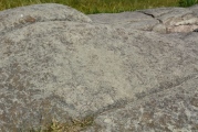
Tiunovskoe sanctuary
The object consists of two stone (in this area, nearby is another fairly large Boulder):
the first flat stone drowned in land and without visible images, while the second (about a metre to the West from the first) is larger and taller, named people cross.
This is an amazing stone. At the base it is something like a irregularly-shaped square and upwards gradually rounded. On smooth, bud-the surface cut various shapes, characters and objects. The images there are stairs leading up, and stairs, going under the ground-in shamanic cultures all over the world this means Trinity of lower world, and top, and a staircase as the path entrance.
The Boulder has a solar circle at the base and such is closer to his peak. Various geometric shapes: squares and triangles. Letters: Cyrillic and something Rune. You may want to consider the world tree, and, of course, a lot of crosses. For this reason, stone and call Crusades. The Orthodox tried to: literally baptized. Tried to tame it this way primitive power. And they partly succeeded (none of the natives could not understand the meaning of "Pagan" images on stone), but succeeded only temporarily: archaeologist Nikitinsky revived Tiunovskoe mythology.
Cross stone focuses on the West-East line (sunrises in the days of the equinoxes). The place itself-Tiunovskoe sanctuary, is located on the Hill, along the edges of the stones. Hill directed from South-West to North-East, it turns out vector stones sent there, where the sun rises in the days of the summer solstice. The Tiunovskoe stone cover all key points of the cycle Solstice. Understand-enough.
http://megalithica.ru/tiunovskoe-svyatilishhe.html
You may be viewing yesterday's version of this page. To see the most up to date information please register for a free account.
")
")
")
")
")
")
")
")
")
")
")
Do not use the above information on other web sites or publications without permission of the contributor.
Click here to see more info for this site
Nearby sites
Click here to view sites on an interactive map of the areaKey: Red: member's photo, Blue: 3rd party photo, Yellow: other image, Green: no photo - please go there and take one, Grey: site destroyed
Download sites to:
KML (Google Earth)
GPX (GPS waypoints)
CSV (Garmin/Navman)
CSV (Excel)
To unlock full downloads you need to sign up as a Contributory Member. Otherwise downloads are limited to 50 sites.
Turn off the page maps and other distractions
Nearby sites listing. In the following links * = Image available
324.7km W 280° Vytegorsky Boulder* Natural Stone / Erratic / Other Natural Feature
329.0km W 265° Belozersky Val* Ancient Village or Settlement
359.3km S 182° Seraphim Big Stone 4* Natural Stone / Erratic / Other Natural Feature
391.6km SW 217° Timerevsky complex stone sanctuary* Stone Circle
419.5km S 182° Gorodets Museum of Regional Studies* Museum
424.5km SW 227° Bear stone* Natural Stone / Erratic / Other Natural Feature
435.3km WNW 292° Lake Onega Rock Art* Rock Art
435.3km SW 216° Stone Dunilovo* Carving
439.6km S 179° Georgiev stone* Carving
447.5km SW 227° Petukhov Stone* Natural Stone / Erratic / Other Natural Feature
461.0km WSW 250° Complex Kurevaniha* Artificial Mound
477.4km SSW 207° Irmes* Ancient Village or Settlement
485.5km WNW 295° Olene-ostrovsky burial ground* Ancient Village or Settlement
485.8km WNW 295° Oleny Ostrov burial* Ancient Village or Settlement
492.4km SW 217° Hillfort Kleschin* Hillfort
506.5km SSW 203° Sungir Ancient Village or Settlement
524.0km WNW 292° Solomennoe Stone Circle (modern)* Modern Stone Circle etc
536.6km SE 144° Karman-Kuryk* Ancient Village or Settlement
571.2km ESE 112° Idnakar* Ancient Village or Settlement
592.6km SW 223° Shutov stone* Natural Stone / Erratic / Other Natural Feature
593.5km S 185° Thunder stone (Nizhny Novgorod)* Natural Stone / Erratic / Other Natural Feature
605.1km SW 235° Rudа́evskoe stone nest* Stone Circle
605.3km SSW 206° Serpentine stone* Natural Stone / Erratic / Other Natural Feature
623.4km WSW 238° Big boulder bridge Vasilevo* Ancient Mine, Quarry or other Industry
626.3km SW 233° Rock Garden - Morkino settlement* Natural Stone / Erratic / Other Natural Feature
View more nearby sites and additional images


 We would like to know more about this location. Please feel free to add a brief description and any relevant information in your own language.
 Wir möchten mehr über diese Stätte erfahren. Bitte zögern Sie nicht, eine kurze Beschreibung und relevante Informationen in Deutsch hinzuzufügen.
 Nous aimerions en savoir encore un peu sur les lieux. S'il vous plaît n'hesitez pas à ajouter une courte description et tous les renseignements pertinents dans votre propre langue.
 Quisieramos informarnos un poco más de las lugares. No dude en añadir una breve descripción y otros datos relevantes en su propio idioma.