


<< Text Pages >> Sungir - Ancient Village or Settlement in Russia
Submitted by davidmorgan on Friday, 23 August 2013 Page Views: 3148
Multi-periodSite Name: Sungir Alternative Name: SunghirCountry: Russia
NOTE: This site is 49.07 km away from the location you searched for.
Type: Ancient Village or Settlement
Nearest Town: Vladimir
Latitude: 56.175833N Longitude: 40.509167E
Condition:
| 5 | Perfect |
| 4 | Almost Perfect |
| 3 | Reasonable but with some damage |
| 2 | Ruined but still recognisable as an ancient site |
| 1 | Pretty much destroyed, possibly visible as crop marks |
| 0 | No data. |
| -1 | Completely destroyed |
| 5 | Superb |
| 4 | Good |
| 3 | Ordinary |
| 2 | Not Good |
| 1 | Awful |
| 0 | No data. |
| 5 | Can be driven to, probably with disabled access |
| 4 | Short walk on a footpath |
| 3 | Requiring a bit more of a walk |
| 2 | A long walk |
| 1 | In the middle of nowhere, a nightmare to find |
| 0 | No data. |
| 5 | co-ordinates taken by GPS or official recorded co-ordinates |
| 4 | co-ordinates scaled from a detailed map |
| 3 | co-ordinates scaled from a bad map |
| 2 | co-ordinates of the nearest village |
| 1 | co-ordinates of the nearest town |
| 0 | no data |
Be the first person to rate this site - see the 'Contribute!' box in the right hand menu.
Internal Links:
External Links:
Ancient Village or Settlement in Vladimir Oblast, Russia
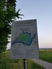
A Late Palaeolithic settlement dating from about 25,000 years ago, famous for its rich burials, the artefacts from which are now exhibited in the Moscow State Historical Museum.
More information at the Moscow State University Institute of Ecological Soil Science.
You may be viewing yesterday's version of this page. To see the most up to date information please register for a free account.
Do not use the above information on other web sites or publications without permission of the contributor.
Nearby Images from Flickr
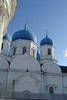
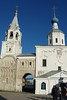
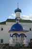
The above images may not be of the site on this page, but were taken nearby. They are loaded from Flickr so please click on them for image credits.
Click here to see more info for this site
Nearby sites
Click here to view sites on an interactive map of the areaKey: Red: member's photo, Blue: 3rd party photo, Yellow: other image, Green: no photo - please go there and take one, Grey: site destroyed
Download sites to:
KML (Google Earth)
GPX (GPS waypoints)
CSV (Garmin/Navman)
CSV (Excel)
To unlock full downloads you need to sign up as a Contributory Member. Otherwise downloads are limited to 50 sites.
Turn off the page maps and other distractions
Nearby sites listing. In the following links * = Image available
42.7km NNW 335° Irmes* Ancient Village or Settlement
104.2km SW 220° Serpentine stone* Natural Stone / Erratic / Other Natural Feature
122.3km NW 304° Hillfort Kleschin* Hillfort
130.5km NNW 330° Stone Dunilovo* Carving
158.7km NNW 343° Timerevsky complex stone sanctuary* Stone Circle
164.1km SW 224° Kolomna Hillfort-1* Hillfort
185.8km WSW 253° Polovetskaya Baba* Sculptured Stone
185.9km WSW 253° Borisov kamen* Early Christian Sculptured Stone
185.9km WSW 257° State Historical Museum (Moscow)* Museum
186.3km WSW 253° The Maiden Stone* Natural Stone / Erratic / Other Natural Feature
186.3km WSW 253° The Goose Stone* Natural Stone / Erratic / Other Natural Feature
186.9km WSW 256° The Pushkin State Museum of Fine Arts* Museum
187.0km WSW 252° Tsaritsyno-2* Barrow Cemetery
187.1km WSW 252° Tsaritsyno-1* Barrow Cemetery
189.3km ENE 73° Gorodets Museum of Regional Studies* Museum
193.8km WSW 252° Biryulevo-2* Barrow Cemetery
193.8km WSW 252° Biryulevo-1* Barrow Cemetery
193.8km WSW 253° Uzkoe-2* Barrow Cemetery
194.4km WSW 257° Fili-1* Barrow Cemetery
194.8km SE 127° Thunder stone (Nizhny Novgorod)* Natural Stone / Erratic / Other Natural Feature
196.6km WSW 253° Kon'kovo-3* Barrow Cemetery
196.7km WSW 253° Kon'kovo-4* Barrow Cemetery
197.6km S 182° Hillfort Old Rezan'* Hillfort
203.9km NW 318° Petukhov Stone* Natural Stone / Erratic / Other Natural Feature
204.7km E 80° Georgiev stone* Carving
View more nearby sites and additional images


 We would like to know more about this location. Please feel free to add a brief description and any relevant information in your own language.
 Wir möchten mehr über diese Stätte erfahren. Bitte zögern Sie nicht, eine kurze Beschreibung und relevante Informationen in Deutsch hinzuzufügen.
 Nous aimerions en savoir encore un peu sur les lieux. S'il vous plaît n'hesitez pas à ajouter une courte description et tous les renseignements pertinents dans votre propre langue.
 Quisieramos informarnos un poco más de las lugares. No dude en añadir una breve descripción y otros datos relevantes en su propio idioma.