<< Other Photo Pages >> Irmes - Ancient Village or Settlement in Russia
Submitted by AlexAssa on Sunday, 28 January 2018 Page Views: 1081
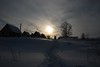
Multi-periodSite Name: Irmes Alternative Name: Мало-Давыдовско&Country: Russia
NOTE: This site is 18.275 km away from the location you searched for.
Type: Ancient Village or Settlement
Nearest Town: Vladimir Nearest Village: Small Davydovskoye
Latitude: 56.523334N Longitude: 40.216162E
Condition:
| 5 | Perfect |
| 4 | Almost Perfect |
| 3 | Reasonable but with some damage |
| 2 | Ruined but still recognisable as an ancient site |
| 1 | Pretty much destroyed, possibly visible as crop marks |
| 0 | No data. |
| -1 | Completely destroyed |
| 5 | Superb |
| 4 | Good |
| 3 | Ordinary |
| 2 | Not Good |
| 1 | Awful |
| 0 | No data. |
| 5 | Can be driven to, probably with disabled access |
| 4 | Short walk on a footpath |
| 3 | Requiring a bit more of a walk |
| 2 | A long walk |
| 1 | In the middle of nowhere, a nightmare to find |
| 0 | No data. |
| 5 | co-ordinates taken by GPS or official recorded co-ordinates |
| 4 | co-ordinates scaled from a detailed map |
| 3 | co-ordinates scaled from a bad map |
| 2 | co-ordinates of the nearest village |
| 1 | co-ordinates of the nearest town |
| 0 | no data |
Internal Links:
External Links:
")
Small Davydovo settlement - Irmes
More information at megalithica.ru.
You may be viewing yesterday's version of this page. To see the most up to date information please register for a free account.
")
Do not use the above information on other web sites or publications without permission of the contributor.
Nearby Images from Flickr
The above images may not be of the site on this page, but were taken nearby. They are loaded from Flickr so please click on them for image credits.
Click here to see more info for this site
Nearby sites
Click here to view sites on an interactive map of the areaKey: Red: member's photo, Blue: 3rd party photo, Yellow: other image, Green: no photo - please go there and take one, Grey: site destroyed
Download sites to:
KML (Google Earth)
GPX (GPS waypoints)
CSV (Garmin/Navman)
CSV (Excel)
To unlock full downloads you need to sign up as a Contributory Member. Otherwise downloads are limited to 50 sites.
Turn off the page maps and other distractions
Nearby sites listing. In the following links * = Image available
42.7km SSE 155° Sungir Ancient Village or Settlement
88.2km NNW 327° Stone Dunilovo* Carving
88.7km WNW 289° Hillfort Kleschin* Hillfort
116.6km NNW 346° Timerevsky complex stone sanctuary* Stone Circle
127.9km SSW 203° Serpentine stone* Natural Stone / Erratic / Other Natural Feature
163.5km NW 314° Petukhov Stone* Natural Stone / Erratic / Other Natural Feature
169.8km NW 322° Bear stone* Natural Stone / Erratic / Other Natural Feature
182.2km WSW 243° State Historical Museum (Moscow)* Museum
183.3km WSW 243° The Pushkin State Museum of Fine Arts* Museum
183.8km SSW 211° Kolomna Hillfort-1* Hillfort
184.5km WSW 240° Polovetskaya Baba* Sculptured Stone
184.5km WSW 240° Borisov kamen* Early Christian Sculptured Stone
185.0km WSW 240° The Maiden Stone* Natural Stone / Erratic / Other Natural Feature
185.0km WSW 240° The Goose Stone* Natural Stone / Erratic / Other Natural Feature
187.0km WSW 238° Tsaritsyno-2* Barrow Cemetery
187.1km WSW 238° Tsaritsyno-1* Barrow Cemetery
187.9km W 264° Shutov stone* Natural Stone / Erratic / Other Natural Feature
190.0km WSW 244° Fili-1* Barrow Cemetery
192.7km WSW 240° Uzkoe-2* Barrow Cemetery
193.3km WSW 239° Biryulevo-2* Barrow Cemetery
193.4km WSW 239° Biryulevo-1* Barrow Cemetery
195.0km WSW 241° Kon'kovo-3* Barrow Cemetery
195.1km WSW 241° Kon'kovo-4* Barrow Cemetery
199.6km E 85° Gorodets Museum of Regional Studies* Museum
206.5km WSW 248° Veles Stone* Holed Stone
View more nearby sites and additional images


 We would like to know more about this location. Please feel free to add a brief description and any relevant information in your own language.
 Wir möchten mehr über diese Stätte erfahren. Bitte zögern Sie nicht, eine kurze Beschreibung und relevante Informationen in Deutsch hinzuzufügen.
 Nous aimerions en savoir encore un peu sur les lieux. S'il vous plaît n'hesitez pas à ajouter une courte description et tous les renseignements pertinents dans votre propre langue.
 Quisieramos informarnos un poco más de las lugares. No dude en añadir una breve descripción y otros datos relevantes en su propio idioma.