<< Other Photo Pages >> Mariupol Museum of Local Lore - Museum in Ukraine
Submitted by XIII on Monday, 11 July 2022 Page Views: 1386
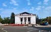
MuseumsSite Name: Mariupol Museum of Local Lore Alternative Name: Mairpol'skiy Krayeznavchyy MuzeyCountry: Ukraine
NOTE: This site is 8.816 km away from the location you searched for.
Type: Museum
Nearest Town: Mariopol
Latitude: 47.092778N Longitude: 37.557500E
Condition:
| 5 | Perfect |
| 4 | Almost Perfect |
| 3 | Reasonable but with some damage |
| 2 | Ruined but still recognisable as an ancient site |
| 1 | Pretty much destroyed, possibly visible as crop marks |
| 0 | No data. |
| -1 | Completely destroyed |
| 5 | Superb |
| 4 | Good |
| 3 | Ordinary |
| 2 | Not Good |
| 1 | Awful |
| 0 | No data. |
| 5 | Can be driven to, probably with disabled access |
| 4 | Short walk on a footpath |
| 3 | Requiring a bit more of a walk |
| 2 | A long walk |
| 1 | In the middle of nowhere, a nightmare to find |
| 0 | No data. |
| 5 | co-ordinates taken by GPS or official recorded co-ordinates |
| 4 | co-ordinates scaled from a detailed map |
| 3 | co-ordinates scaled from a bad map |
| 2 | co-ordinates of the nearest village |
| 1 | co-ordinates of the nearest town |
| 0 | no data |
Internal Links:
External Links:
")
The basis of the archaeological collection are materials from unique monuments - the Amvrosievskaya site, the Neolithic burial ground of Mariupol, tools, signs of power, jewellery, a collection of stone statues (“stone women”) of ancient and medieval nomads. This includes a bronze buckle in the form of an elk's head, an example of the "Scythian animal" style, bronze mirrors of oriental production from the Golden Horde burial ground.
Source: wikipedia
You may be viewing yesterday's version of this page. To see the most up to date information please register for a free account.
")
")
Do not use the above information on other web sites or publications without permission of the contributor.
Nearby Images from Flickr
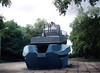
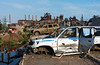
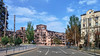
The above images may not be of the site on this page, but were taken nearby. They are loaded from Flickr so please click on them for image credits.
Click here to see more info for this site
Nearby sites
Click here to view sites on an interactive map of the areaKey: Red: member's photo, Blue: 3rd party photo, Yellow: other image, Green: no photo - please go there and take one, Grey: site destroyed
Download sites to:
KML (Google Earth)
GPX (GPS waypoints)
CSV (Garmin/Navman)
CSV (Excel)
To unlock full downloads you need to sign up as a Contributory Member. Otherwise downloads are limited to 50 sites.
Turn off the page maps and other distractions
Nearby sites listing. In the following links * = Image available
69.1km WSW 237° Stone Babas on Tsentralna Street* Carving
147.6km N 357° Popov Yar 2* Barrow Cemetery
159.0km W 265° Kamyana Mohyla Rock Cut Tomb
167.4km W 261° Melitopol Museum of Local History* Museum
174.2km E 84° Kobyakovo hillfort* Hillfort
174.2km E 84° Kobyakovo Settlement* Ancient Village or Settlement
178.8km NE 35° Merheleva Ridge Barrow Cemetery
195.7km WNW 295° Zaporizhzhya Regional Museum* Museum
200.5km WNW 294° Dolmens Scythian Camp* Burial Chamber or Dolmen
207.0km SSW 203° Tsarsky Kurgan* Chambered Cairn
212.3km SSW 204° Kul-Oba* Round Barrow(s)
212.8km SSW 204° Pantikapaion* Ancient Village or Settlement
232.9km N 355° Anthropomorphic Stelae near Mount Kremenets* Carving
235.6km NW 307° Sursʹkyy Kromlekh* Round Barrow(s)
238.1km W 265° Oguz Burial Mound Round Barrow(s)
239.2km W 267° Kozel Burial Mound Round Barrow(s)
240.2km NW 310° Dmytro Yavornytsky National Historical Museum of Dnipro* Museum
244.5km W 277° Znamenskoye Round Barrow(s)
245.0km S 185° Gorgippia* Ancient Village or Settlement
250.7km W 280° Mamay-Hora* Round Barrow(s)
254.8km WNW 287° Chertomlyk Kurgan Round Barrow(s)
260.5km S 178° Vasilyevka 1* Burial Chamber or Dolmen
260.7km S 178° Vasilyevka 2* Burial Chamber or Dolmen
265.0km S 171° Shapsugskiy mogil'nik* Barrow Cemetery
265.2km S 169° Erivanskaya Dolmen Burial Chamber or Dolmen
View more nearby sites and additional images


 We would like to know more about this location. Please feel free to add a brief description and any relevant information in your own language.
 Wir möchten mehr über diese Stätte erfahren. Bitte zögern Sie nicht, eine kurze Beschreibung und relevante Informationen in Deutsch hinzuzufügen.
 Nous aimerions en savoir encore un peu sur les lieux. S'il vous plaît n'hesitez pas à ajouter une courte description et tous les renseignements pertinents dans votre propre langue.
 Quisieramos informarnos un poco más de las lugares. No dude en añadir una breve descripción y otros datos relevantes en su propio idioma.