


<< Our Photo Pages >> Shuchye settlement - Ancient Village or Settlement in Russia
Submitted by AlexAssa on Wednesday, 14 February 2018 Page Views: 1365
Multi-periodSite Name: Shuchye settlement Alternative Name: Щучье городищеCountry: Russia
NOTE: This site is 83.433 km away from the location you searched for.
Type: Ancient Village or Settlement
Nearest Town: Tula Nearest Village: Shuchye
Latitude: 54.441118N Longitude: 38.387459E
Condition:
| 5 | Perfect |
| 4 | Almost Perfect |
| 3 | Reasonable but with some damage |
| 2 | Ruined but still recognisable as an ancient site |
| 1 | Pretty much destroyed, possibly visible as crop marks |
| 0 | No data. |
| -1 | Completely destroyed |
| 5 | Superb |
| 4 | Good |
| 3 | Ordinary |
| 2 | Not Good |
| 1 | Awful |
| 0 | No data. |
| 5 | Can be driven to, probably with disabled access |
| 4 | Short walk on a footpath |
| 3 | Requiring a bit more of a walk |
| 2 | A long walk |
| 1 | In the middle of nowhere, a nightmare to find |
| 0 | No data. |
| 5 | co-ordinates taken by GPS or official recorded co-ordinates |
| 4 | co-ordinates scaled from a detailed map |
| 3 | co-ordinates scaled from a bad map |
| 2 | co-ordinates of the nearest village |
| 1 | co-ordinates of the nearest town |
| 0 | no data |
Internal Links:
External Links:
")
You may be viewing yesterday's version of this page. To see the most up to date information please register for a free account.
")
")
Do not use the above information on other web sites or publications without permission of the contributor.
Nearby Images from Flickr
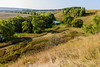
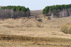
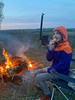
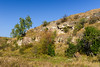
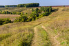
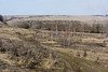
The above images may not be of the site on this page, but were taken nearby. They are loaded from Flickr so please click on them for image credits.
Click here to see more info for this site
Nearby sites
Click here to view sites on an interactive map of the areaKey: Red: member's photo, Blue: 3rd party photo, Yellow: other image, Green: no photo - please go there and take one, Grey: site destroyed
Download sites to:
KML (Google Earth)
GPX (GPS waypoints)
CSV (Garmin/Navman)
CSV (Excel)
To unlock full downloads you need to sign up as a Contributory Member. Otherwise downloads are limited to 50 sites.
Turn off the page maps and other distractions
Nearby sites listing. In the following links * = Image available
54.6km ESE 107° Zhokinskoe complex* Hillfort
76.3km NNE 16° Kolomna Hillfort-1* Hillfort
120.9km SSE 156° Kudeyar stone* Natural Stone / Erratic / Other Natural Feature
131.5km NNE 30° Serpentine stone* Natural Stone / Erratic / Other Natural Feature
132.1km E 91° Hillfort Old Rezan'* Hillfort
137.6km NNW 341° Tsaritsyno-2* Barrow Cemetery
137.7km NNW 341° Tsaritsyno-1* Barrow Cemetery
139.1km NNW 338° Biryulevo-2* Barrow Cemetery
139.1km NNW 338° Biryulevo-1* Barrow Cemetery
142.2km NNW 338° Uzkoe-2* Barrow Cemetery
143.5km NNW 342° The Maiden Stone* Natural Stone / Erratic / Other Natural Feature
143.5km NNW 342° The Goose Stone* Natural Stone / Erratic / Other Natural Feature
143.8km NNW 342° Polovetskaya Baba* Sculptured Stone
143.9km NNW 342° Borisov kamen* Early Christian Sculptured Stone
144.2km NNW 337° Kon'kovo-4* Barrow Cemetery
144.4km NNW 337° Kon'kovo-3* Barrow Cemetery
153.5km NNW 341° The Pushkin State Museum of Fine Arts* Museum
154.1km NNW 342° State Historical Museum (Moscow)* Museum
156.8km NNW 339° Fili-1* Barrow Cemetery
170.6km NNW 333° Veles Stone* Holed Stone
176.2km NW 318° Stone idol Moscow river* Sculptured Stone
195.8km SW 228° Hillfort Kruglitsa* Hillfort
221.8km NNW 340° Shutov stone* Natural Stone / Erratic / Other Natural Feature
235.0km NE 34° Sungir Ancient Village or Settlement
258.6km NNE 26° Irmes* Ancient Village or Settlement
View more nearby sites and additional images


 We would like to know more about this location. Please feel free to add a brief description and any relevant information in your own language.
 Wir möchten mehr über diese Stätte erfahren. Bitte zögern Sie nicht, eine kurze Beschreibung und relevante Informationen in Deutsch hinzuzufügen.
 Nous aimerions en savoir encore un peu sur les lieux. S'il vous plaît n'hesitez pas à ajouter une courte description et tous les renseignements pertinents dans votre propre langue.
 Quisieramos informarnos un poco más de las lugares. No dude en añadir una breve descripción y otros datos relevantes en su propio idioma.