

<< Image Pages >> Aksum - Ancient Village or Settlement in Ethiopia
Submitted by AlexHunger on Sunday, 23 July 2006 Page Views: 10109
Multi-periodSite Name: AksumCountry: Ethiopia
NOTE: This site is 163.616 km away from the location you searched for.
Type: Ancient Village or Settlement
Nearest Town: Adis Adaba
Latitude: 14.130190N Longitude: 38.718610E
Condition:
| 5 | Perfect |
| 4 | Almost Perfect |
| 3 | Reasonable but with some damage |
| 2 | Ruined but still recognisable as an ancient site |
| 1 | Pretty much destroyed, possibly visible as crop marks |
| 0 | No data. |
| -1 | Completely destroyed |
| 5 | Superb |
| 4 | Good |
| 3 | Ordinary |
| 2 | Not Good |
| 1 | Awful |
| 0 | No data. |
| 5 | Can be driven to, probably with disabled access |
| 4 | Short walk on a footpath |
| 3 | Requiring a bit more of a walk |
| 2 | A long walk |
| 1 | In the middle of nowhere, a nightmare to find |
| 0 | No data. |
| 5 | co-ordinates taken by GPS or official recorded co-ordinates |
| 4 | co-ordinates scaled from a detailed map |
| 3 | co-ordinates scaled from a bad map |
| 2 | co-ordinates of the nearest village |
| 1 | co-ordinates of the nearest town |
| 0 | no data |
Be the first person to rate this site - see the 'Contribute!' box in the right hand menu.
Internal Links:
External Links:
I have visited· I would like to visit
DrewParsons would like to visit
baz visited on 1st Oct 2017 - their rating: Cond: 4 Amb: 5 Access: 4
")
The ruins of the ancient city of Aksum mark the location of the heart of the ancient Kingdom of Ethiopia (Aksum). The massive ruins include monolithic obelisks, giant stelae, royal tombs and the ruins of ancient palaces.
You may be viewing yesterday's version of this page. To see the most up to date information please register for a free account.
")
")
")
Do not use the above information on other web sites or publications without permission of the contributor.
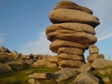
Nearby Images from Flickr
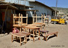
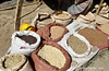
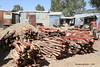

The above images may not be of the site on this page, but were taken nearby. They are loaded from Flickr so please click on them for image credits.
Click here to see more info for this site
Nearby sites
Click here to view sites on an interactive map of the areaKey: Red: member's photo, Blue: 3rd party photo, Yellow: other image, Green: no photo - please go there and take one, Grey: site destroyed
Download sites to:
KML (Google Earth)
GPX (GPS waypoints)
CSV (Garmin/Navman)
CSV (Excel)
To unlock full downloads you need to sign up as a Contributory Member. Otherwise downloads are limited to 50 sites.
Turn off the page maps and other distractions
Nearby sites listing. In the following links * = Image available
36.4km ENE 62° Yeha* Ancient Village or Settlement
260.8km SW 216° Gorgora Rock Shelter* Cave or Rock Shelter
472.7km E 89° al-Tihamah Standing Stones
473.7km E 90° Al Fazah standing stone Standing Stones
526.0km E 97° Al Muhandid stone rows Stone Row / Alignment
539.8km ENE 73° al-Mahwit tombs Rock Cut Tomb
602.2km E 91° Osaibah archaeological site Rock Cut Tomb
612.8km WNW 300° Abu Erteila Ancient Temple
617.2km WNW 301° Meroë Pyramids* Pyramid / Mastaba
620.6km WNW 301° Meroë* Ancient Village or Settlement
633.4km S 181° Tiya Stelae Standing Stones
634.0km WNW 297° El Kadada Neolithic Tomb Burial Chamber or Dolmen
666.7km E 99° Sabr Ancient Village or Settlement
673.7km NW 312° Statue of Taharqa Carving
687.3km WNW 285° Sudan National Museum Museum
713.4km ENE 78° Mahram Bilqis* Ancient Temple
715.6km ENE 78° Great Dam of Marib* Ancient Mine, Quarry or other Industry
718.8km ENE 78° Sabaean Temple of the Moon* Ancient Temple
764.5km NE 52° Bir Hima Petroglyphs* Rock Art
773.7km SE 130° Laas Gaal* Cave or Rock Shelter
863.5km NE 40° al-Maqar Ancient Village or Settlement
872.7km S 184° Tutu Fela* Sculptured Stone
877.3km NW 305° Nuri Pyramids* Pyramid / Mastaba
881.0km NW 304° Sanam Temple Ancient Temple
881.4km WNW 303° El-Kurru Tumuli Round Barrow(s)
View more nearby sites and additional images


 We would like to know more about this location. Please feel free to add a brief description and any relevant information in your own language.
 Wir möchten mehr über diese Stätte erfahren. Bitte zögern Sie nicht, eine kurze Beschreibung und relevante Informationen in Deutsch hinzuzufügen.
 Nous aimerions en savoir encore un peu sur les lieux. S'il vous plaît n'hesitez pas à ajouter une courte description et tous les renseignements pertinents dans votre propre langue.
 Quisieramos informarnos un poco más de las lugares. No dude en añadir una breve descripción y otros datos relevantes en su propio idioma.