<< Text Pages >> Antakya Museum - Museum in Turkey
Submitted by AlexHunger on Monday, 26 March 2007 Page Views: 4472
MuseumsSite Name: Antakya Museum Alternative Name: Antakya Arkeoloji MüzesiCountry: Turkey
NOTE: This site is 3.977 km away from the location you searched for.
Type: Museum
Nearest Town: Antakya Nearest Village: Antakya
Latitude: 36.220540N Longitude: 36.184100E
Condition:
| 5 | Perfect |
| 4 | Almost Perfect |
| 3 | Reasonable but with some damage |
| 2 | Ruined but still recognisable as an ancient site |
| 1 | Pretty much destroyed, possibly visible as crop marks |
| 0 | No data. |
| -1 | Completely destroyed |
| 5 | Superb |
| 4 | Good |
| 3 | Ordinary |
| 2 | Not Good |
| 1 | Awful |
| 0 | No data. |
| 5 | Can be driven to, probably with disabled access |
| 4 | Short walk on a footpath |
| 3 | Requiring a bit more of a walk |
| 2 | A long walk |
| 1 | In the middle of nowhere, a nightmare to find |
| 0 | No data. |
| 5 | co-ordinates taken by GPS or official recorded co-ordinates |
| 4 | co-ordinates scaled from a detailed map |
| 3 | co-ordinates scaled from a bad map |
| 2 | co-ordinates of the nearest village |
| 1 | co-ordinates of the nearest town |
| 0 | no data |
Internal Links:
External Links:
Museum in Hatay Province, Turkey
You may be viewing yesterday's version of this page. To see the most up to date information please register for a free account.
Do not use the above information on other web sites or publications without permission of the contributor.
Nearby Images from Flickr
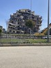
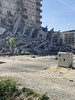
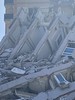


The above images may not be of the site on this page, but were taken nearby. They are loaded from Flickr so please click on them for image credits.
Click here to see more info for this site
Nearby sites
Click here to view sites on an interactive map of the areaKey: Red: member's photo, Blue: 3rd party photo, Yellow: other image, Green: no photo - please go there and take one, Grey: site destroyed
Download sites to:
KML (Google Earth)
GPX (GPS waypoints)
CSV (Garmin/Navman)
CSV (Excel)
To unlock full downloads you need to sign up as a Contributory Member. Otherwise downloads are limited to 50 sites.
Turn off the page maps and other distractions
Nearby sites listing. In the following links * = Image available
2.7km SSW 213° Antioch on the Orontes Ancient Village or Settlement
17.5km E 80° Tell Ta’yinat* Ancient Village or Settlement
17.9km E 83° Alalakh* Ancient Village or Settlement
25.7km SW 223° Al Mina Ancient Village or Settlement
25.9km WSW 245° Seleukeia Temple of Zeus Ancient Temple
37.1km SSE 147° Karkara Stone Fort or Dun
64.1km ENE 72° Bit-Agusi Ancient Village or Settlement
65.8km ESE 123° Neirab* Ancient Village or Settlement
69.7km ENE 63° Ain Dara* Ancient Temple
70.8km NNW 330° Aegeae Ancient Village or Settlement
72.5km SE 130° Ebla Palace* Ancient Palace
72.5km SE 130° Ebla.* Ancient Village or Settlement
72.5km SE 130° Ebla Temple of Ishtar* Ancient Temple
77.4km SSW 208° Ugarit Temples* Ancient Temple
77.7km SSW 208° Ugarit Palace* Ancient Palace
77.7km SSW 208° Ugarit* Ancient Village or Settlement
82.2km ESE 123° Ur-Schu Ancient Village or Settlement
83.1km WNW 296° Magarsus Ancient Village or Settlement
83.9km N 356° Issus (Cilicia) Ancient Village or Settlement
86.4km E 90° Tel al-Abar 3 Ancient Village or Settlement
86.6km E 91° Aleppo Museum* Museum
87.5km E 91° Djade al-Mughara Ancient Village or Settlement
87.8km E 91° Aleppo Tell* Ancient Village or Settlement
90.1km SSE 167° Apamea* Ancient Village or Settlement
91.1km NNE 33° Yesemek Ancient Mine, Quarry or other Industry
View more nearby sites and additional images


 We would like to know more about this location. Please feel free to add a brief description and any relevant information in your own language.
 Wir möchten mehr über diese Stätte erfahren. Bitte zögern Sie nicht, eine kurze Beschreibung und relevante Informationen in Deutsch hinzuzufügen.
 Nous aimerions en savoir encore un peu sur les lieux. S'il vous plaît n'hesitez pas à ajouter une courte description et tous les renseignements pertinents dans votre propre langue.
 Quisieramos informarnos un poco más de las lugares. No dude en añadir una breve descripción y otros datos relevantes en su propio idioma.