 with our Megalithic Portal iPhone app")


<< Image Pages >> Amrit Meghaziles - Chambered Cairn in Syria
Submitted by AlexHunger on Tuesday, 21 November 2006 Page Views: 4430
Neolithic and Bronze AgeSite Name: Amrit MeghazilesCountry: Syria
NOTE: This site is 4.687 km away from the location you searched for.
Type: Chambered Cairn
Nearest Town: Tartus Nearest Village: Marathos
Latitude: 34.896690N Longitude: 35.907442E
Condition:
| 5 | Perfect |
| 4 | Almost Perfect |
| 3 | Reasonable but with some damage |
| 2 | Ruined but still recognisable as an ancient site |
| 1 | Pretty much destroyed, possibly visible as crop marks |
| 0 | No data. |
| -1 | Completely destroyed |
| 5 | Superb |
| 4 | Good |
| 3 | Ordinary |
| 2 | Not Good |
| 1 | Awful |
| 0 | No data. |
| 5 | Can be driven to, probably with disabled access |
| 4 | Short walk on a footpath |
| 3 | Requiring a bit more of a walk |
| 2 | A long walk |
| 1 | In the middle of nowhere, a nightmare to find |
| 0 | No data. |
| 5 | co-ordinates taken by GPS or official recorded co-ordinates |
| 4 | co-ordinates scaled from a detailed map |
| 3 | co-ordinates scaled from a bad map |
| 2 | co-ordinates of the nearest village |
| 1 | co-ordinates of the nearest town |
| 0 | no data |
Be the first person to rate this site - see the 'Contribute!' box in the right hand menu.
Internal Links:
External Links:
")
Two 7 metre tall stone funeral monuments dating to 4th century BCE. City inhabited since 3rd millennium BCE.
You may be viewing yesterday's version of this page. To see the most up to date information please register for a free account.
")
Do not use the above information on other web sites or publications without permission of the contributor.
Nearby Images from Flickr


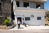

The above images may not be of the site on this page, but were taken nearby. They are loaded from Flickr so please click on them for image credits.
Click here to see more info for this site
Nearby sites
Click here to view sites on an interactive map of the areaKey: Red: member's photo, Blue: 3rd party photo, Yellow: other image, Green: no photo - please go there and take one, Grey: site destroyed
Download sites to:
KML (Google Earth)
GPX (GPS waypoints)
CSV (Garmin/Navman)
CSV (Excel)
To unlock full downloads you need to sign up as a Contributory Member. Otherwise downloads are limited to 50 sites.
Turn off the page maps and other distractions
Nearby sites listing. In the following links * = Image available
2.3km NW 311° Amrit Sacred Spring Holy Well or Sacred Spring
2.7km WSW 258° Tartus Museum Museum
6.3km SW 225° Arados* Ancient Village or Settlement
31.0km E 83° Baitokaike Temple of Zeus* Ancient Temple
45.6km N 2° Sukas Ancient Village or Settlement
48.2km SE 129° Beit Djallou Temple of Nemesis Ancient Temple
50.7km S 189° Tripoli (Lebanon)* Ancient Village or Settlement
56.8km SSE 166° Sfire Temples Ancient Temple
61.9km SE 138° Brissa Stele Sculptured Stone
67.0km S 188° Amioun Necropolis Rock Cut Tomb
67.5km SE 124° Kadesh Tell* Ancient Village or Settlement
67.8km S 185° Qasr Naous Temple Ancient Temple
67.8km S 185° Qasr Naous West Temple Ancient Temple
68.3km S 177° Monastery of Saint Anthony of Qozhaya Ancient Temple
70.1km S 186° Bziza Temple Ancient Temple
73.4km SE 136° Qamouat el-Hermel Marker Stone
74.2km SE 145° Deir Mar Maroun Ancient Village or Settlement
74.4km NE 37° Apamea* Ancient Village or Settlement
76.4km NE 39° Syrian tell* Ancient Village or Settlement
79.2km N 352° Ugarit Palace* Ancient Palace
79.3km N 352° Ugarit* Ancient Village or Settlement
79.3km N 352° Ugarit Temples* Ancient Temple
81.1km ENE 71° Hama National Museum Museum
81.2km ENE 71° Hama.* Ancient Village or Settlement
87.6km S 180° Aphaca* Holy Well or Sacred Spring
View more nearby sites and additional images


 We would like to know more about this location. Please feel free to add a brief description and any relevant information in your own language.
 Wir möchten mehr über diese Stätte erfahren. Bitte zögern Sie nicht, eine kurze Beschreibung und relevante Informationen in Deutsch hinzuzufügen.
 Nous aimerions en savoir encore un peu sur les lieux. S'il vous plaît n'hesitez pas à ajouter une courte description et tous les renseignements pertinents dans votre propre langue.
 Quisieramos informarnos un poco más de las lugares. No dude en añadir una breve descripción y otros datos relevantes en su propio idioma.