<< Our Photo Pages >> Hammat Tiberias - Ancient Village or Settlement in Israel
Submitted by motist on Wednesday, 11 October 2017 Page Views: 1488
Multi-periodSite Name: Hammat Tiberias Alternative Name: HammathCountry: Israel
NOTE: This site is 3.585 km away from the location you searched for.
Type: Ancient Village or Settlement
Nearest Town: Tiberias
Latitude: 32.766049N Longitude: 35.550759E
Condition:
| 5 | Perfect |
| 4 | Almost Perfect |
| 3 | Reasonable but with some damage |
| 2 | Ruined but still recognisable as an ancient site |
| 1 | Pretty much destroyed, possibly visible as crop marks |
| 0 | No data. |
| -1 | Completely destroyed |
| 5 | Superb |
| 4 | Good |
| 3 | Ordinary |
| 2 | Not Good |
| 1 | Awful |
| 0 | No data. |
| 5 | Can be driven to, probably with disabled access |
| 4 | Short walk on a footpath |
| 3 | Requiring a bit more of a walk |
| 2 | A long walk |
| 1 | In the middle of nowhere, a nightmare to find |
| 0 | No data. |
| 5 | co-ordinates taken by GPS or official recorded co-ordinates |
| 4 | co-ordinates scaled from a detailed map |
| 3 | co-ordinates scaled from a bad map |
| 2 | co-ordinates of the nearest village |
| 1 | co-ordinates of the nearest town |
| 0 | no data |
Internal Links:
External Links:
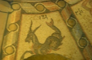
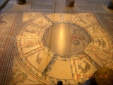
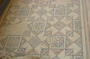
A number of synagogues were unearthed and reconstructed, including the 5th C Zodiac mosaic Joshua 19: 32, 35: The sixth lot came out for the children of Naphtali.... And their border was ... the fortified cities were Ziddim-zer, and Hammath, and Rakkath, and Chinnereth...
The city was a walled city during the Biblical times, and peaked during the Roman/Byzantine periods. It was known for its warm health springs (a total of 17 springs, at a temperature of about 60 C) and was a spa center for the great Roman city of Tiberias.
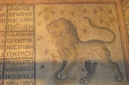
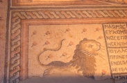
A number of synagogues were unearthed and reconstructed, including one of the most important mosaics - a zodiac with symbols, inscriptions and symbols, and two 7-branched menorahs.
The site is a national park and is open to the public during visiting times. It is located on the southern entrance to Tiberias, across the street to the modern baths (Hammei-Tveriah).
Bronze and Iron periods
The site was known for its healing waters even before the Israelites conquered the Holy Land. It may have been listed in the Anastasi Papyrus, written at the 13th C BC during the Ramses dynasty, when the author of the document tells about crossing Hammat.
It was one of the cities in the region of Naftali, and according to the Bible (Joshua 19, 32-25) it was a fortified Canaanite city. Its location, on the ancient trade route from Syria/Mesopotamia to Israel/Egypt, surrounded on two sides by the lake and the mountain, made it a prime strategic place.
Hellenistic period
The first structures were established in the Hellenistic period, and the site was known as Emmaus of the Galilee.
Roman/Byzantine period
The Romans installed a large set of baths in the site, whose waters were considered healing. At those times the number of sick people was extremely high, most of them without any cure, as implied in the new Testament and the miracles of Jesus. The healing power of the waters made the site popular in the Roman world.
Hammat Tiberias is the place, according to Josephus Flavius, where Vespesian pitched his camp in 67AD before launching the assault on Gamla.
A new major city, Tiberias, was established in 18 AD several hundred meters north to the site. After several hundred years, during the Byzantine period, the new city became so large that it incorporated the older city of Hammat. The Byzantine emperor Caesar Justinius (527-567) erected new walls and the city's southern gate was constructed on the south side of Hammat.
5 Synagogues
Tiberias became an important Jewish city, and several synagogues were built in Hammat. The oldest, in the 1st C AD, may have been a public house, with a court yard and several rooms. It was destroyed in the 2nd C, and replaced by a second synagogue at the 3rd C, which lasted until the 4th C and may have been destroyed in the 363 earthquake that damaged many Galilean sites. A third synagogue, the grandest of all, was built by Severus with an amazing Zodiac mosaic floor, but was destroyed in the 5th C. The 4th synagogue was built over its ruins in the 6th C and lasted until the 7th C. The 5th structure was built during the Arab conquest and was destroyed in the 8th C.
Arab periods
The site was in ruins since the 8th C.
During the 18th C a new Turkish bath was constructed at the site, and existed from 1780 until 1944.
You may be viewing yesterday's version of this page. To see the most up to date information please register for a free account.







These are just the first 25 photos of Hammat Tiberias. If you log in with a free user account you will be able to see our entire collection.
Do not use the above information on other web sites or publications without permission of the contributor.
Click here to see more info for this site
Nearby sites
Click here to view sites on an interactive map of the areaKey: Red: member's photo, Blue: 3rd party photo, Yellow: other image, Green: no photo - please go there and take one, Grey: site destroyed
Download sites to:
KML (Google Earth)
GPX (GPS waypoints)
CSV (Garmin/Navman)
CSV (Excel)
To unlock full downloads you need to sign up as a Contributory Member. Otherwise downloads are limited to 50 sites.
Turn off the page maps and other distractions
Nearby sites listing. In the following links * = Image available
5.8km SSE 152° Sea of Galilee Cairn* Cairn
5.9km SSE 161° Ohalo II* Ancient Village or Settlement
6.5km SSE 158° Tel Bet Yerah Artificial Mound
9.1km NNW 335° Dalmanutha* Ancient Village or Settlement
10.3km E 82° Sussita* Ancient Village or Settlement
10.4km SSE 153° Sha'ar HaGolan* Ancient Village or Settlement
10.7km E 79° NEG II Prehistoric Village* Ancient Village or Settlement
10.7km E 79° Wadi Ein Gev Ancient Village or Settlement
11.5km NE 54° Kursi National Park* Ancient Village or Settlement
14.8km NNW 334° Hukok* Ancient Temple
17.6km NNE 25° Bethsaida* Ancient Village or Settlement
22.5km NNW 329° Crescent-shaped monument near Shefer* Artificial Mound
24.0km WSW 251° Mary's Well (Nazareth)* Holy Well or Sacred Spring
24.0km NE 50° The ancient city of Gamla* Ancient Village or Settlement
24.2km NE 50° Gamla Dolmen field* Burial Chamber or Dolmen
25.3km W 266° Tzippori* Ancient Village or Settlement
26.3km W 262° 'Ain zippori* Ancient Village or Settlement
26.6km WNW 286° Tel Yodfat * Hillfort
26.7km N 352° Naburiya synagogue in Biriya Forest* Ancient Temple
27.0km WSW 255° Kfar HaHoresh Ancient Temple
27.1km ENE 60° Dolmen field near Natur on the Golan Heights* Barrow Cemetery
28.0km N 3° Tel Hatzor* Artificial Mound
28.2km NE 56° Rujm el-Hiri* Stone Circle
29.5km S 189° Tel Beth Shean* Ancient Village or Settlement
29.8km SSW 203° Beit Alpha Ancient Synagogue Mosaic Floor* Ancient Temple
View more nearby sites and additional images


 We would like to know more about this location. Please feel free to add a brief description and any relevant information in your own language.
 Wir möchten mehr über diese Stätte erfahren. Bitte zögern Sie nicht, eine kurze Beschreibung und relevante Informationen in Deutsch hinzuzufügen.
 Nous aimerions en savoir encore un peu sur les lieux. S'il vous plaît n'hesitez pas à ajouter une courte description et tous les renseignements pertinents dans votre propre langue.
 Quisieramos informarnos un poco más de las lugares. No dude en añadir una breve descripción y otros datos relevantes en su propio idioma.