<< Our Photo Pages >> Tel Yokneam - Artificial Mound in Israel
Submitted by motist on Friday, 06 January 2017 Page Views: 1697
Multi-periodSite Name: Tel YokneamCountry: Israel
NOTE: This site is 0.532 km away from the location you searched for.
Type: Artificial Mound
Nearest Town: Yokneam Nearest Village: Moshava Yokneam
Latitude: 32.664127N Longitude: 35.108839E
Condition:
| 5 | Perfect |
| 4 | Almost Perfect |
| 3 | Reasonable but with some damage |
| 2 | Ruined but still recognisable as an ancient site |
| 1 | Pretty much destroyed, possibly visible as crop marks |
| 0 | No data. |
| -1 | Completely destroyed |
| 5 | Superb |
| 4 | Good |
| 3 | Ordinary |
| 2 | Not Good |
| 1 | Awful |
| 0 | No data. |
| 5 | Can be driven to, probably with disabled access |
| 4 | Short walk on a footpath |
| 3 | Requiring a bit more of a walk |
| 2 | A long walk |
| 1 | In the middle of nowhere, a nightmare to find |
| 0 | No data. |
| 5 | co-ordinates taken by GPS or official recorded co-ordinates |
| 4 | co-ordinates scaled from a detailed map |
| 3 | co-ordinates scaled from a bad map |
| 2 | co-ordinates of the nearest village |
| 1 | co-ordinates of the nearest town |
| 0 | no data |
Internal Links:
External Links:
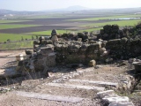
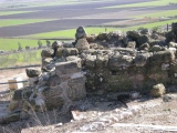
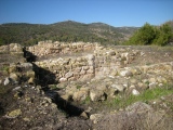
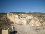
Tel Yokneam stands as a gate to the entrance of a pass through Mount Carmel towards the south. This steep hill was a mighty city in the biblical times, and due to its strategic location played an important role in ancient history of the region. The Bible told us that it was then one of Zebulon tribe cities and the city and the area around it was a Levite city.
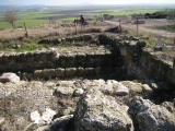
Today the Tel is in ruins, and the agriculture village of Yokneam (established 1935) is built east of the site. The modern city of Yokneam Illit (Upper), established in 1967, is built south of the site. An Advanced Technology park is located west of the site, across the highway.
Pre-history
According to the Archaeological survey, there were few pottery findings from the Chalcolithic period (4,500-3150BC). The city continued to be populated in the Early Bronze (3150-2200 BC), and especially in the middle Bronze (Canaanite) period (2200-1550BC).
Late Bronze (Canaanite)
In the late Bronze period (1550BC- 1200BC) the city expanded. Yokneam was an important city in this period. It was mentioned in list of cities that were conquered in 1468BC by Egyptian Pharaoh Thutmose III.
A plan of the Canaanite and Israelite city is seen in this model. The main city gate is located on the east side, protected by towers. The entry road ascends to the gate along the eastern slope of the hill. The city was defended by high walls with towers, and a glacis (artificial slope) before the walls. Inside the city are structures of storerooms, houses, and palace. On the north west side of the city is a staircase that leads down to an underground water reservoir. The area around the hill was an additional residential area - the "lower" city.
Israelites
The city of Yokneam also was one of the 31 Canaanite cities that assembled their forces to fight against Joshua and the Israelites, but were defeated (Joshua 12:1,22):
"Now these are the kings of the land, whom the children of Israel smote, and possessed their land... ...the king of Kedesh, one; the king of Jokneam in Carmel, one;".
It is interesting that the suffix "Jokneam in Carmel" was added, since there was another Yokneam in another region.
The city belonged to the Tribe of Zebulun (Zevulun). and was located on the south side of the area alloted to Zebulun (Joshua 19: 10-11):
"And the third lot came up for the children of Zebulun according to their families; and the border of their inheritance was unto Sarid. And their border went up westward, even to Maralah, and reached to Dabbesheth; and it reached to the brook that is before Jokneam".
The brook that the text refers to "before Jokneam" is probably the Kishon river, which is 0.5KM to the north.
Yokneam was a Levite city. This tribe settled among the other tribe regions and had religious and political duties. In this text Yokneam was listed as one of these cities, including the area around it (Joshua 21: 1-3,34):
"Then came near the heads of fathers' houses of the Levites unto Eleazar the priest, and unto Joshua the son of Nun, and unto the heads of fathers' houses of the tribes of the children of Israel; and they spoke unto them at Shiloh in the land of Canaan, saying: 'The HaShem commanded by the hand of Moses to give us cities to dwell in, with the open land thereabout for our cattle.' And the children of Israel gave unto the Levites out of their inheritance, according to the commandment of HaShem, these cities with the open land about them. ... And unto the families of the children of Merari, the rest of the Levites, out of the tribe of Zebulun, Jokneam with the open land about it, and Kartah with the open land about it".
You may be viewing yesterday's version of this page. To see the most up to date information please register for a free account.









These are just the first 25 photos of Tel Yokneam. If you log in with a free user account you will be able to see our entire collection.
Do not use the above information on other web sites or publications without permission of the contributor.
Click here to see more info for this site
Nearby sites
Click here to view sites on an interactive map of the areaKey: Red: member's photo, Blue: 3rd party photo, Yellow: other image, Green: no photo - please go there and take one, Grey: site destroyed
Download sites to:
KML (Google Earth)
GPX (GPS waypoints)
CSV (Garmin/Navman)
CSV (Excel)
To unlock full downloads you need to sign up as a Contributory Member. Otherwise downloads are limited to 50 sites.
Turn off the page maps and other distractions
Nearby sites listing. In the following links * = Image available
2.4km N 3° Tel Qashish Ancient Village or Settlement
3.9km SSE 151° Ein el-Jarba* Ancient Village or Settlement
4.7km NNE 24° Beit She'arim* Chambered Tomb
11.3km SE 141° Megiddo* Ancient Village or Settlement
13.5km W 273° Carmel Prehistoric Caves Cave or Rock Shelter
15.9km ENE 75° Kfar HaHoresh Ancient Temple
16.2km W 279° Atlit-Yam Ancient Village or Settlement
17.1km ENE 64° 'Ain zippori* Ancient Village or Settlement
18.8km WSW 254° Tel Dor* Ancient Village or Settlement
18.8km ENE 59° Tzippori* Ancient Village or Settlement
19.0km E 79° Mary's Well (Nazareth)* Holy Well or Sacred Spring
19.3km SSE 148° Tel Taanach* Ancient Village or Settlement
19.9km SW 234° Kebara Cave Cave or Rock Shelter
20.0km S 180° El-ahwat near kibuts Katsir-Harish* Ancient Village or Settlement
20.2km N 1° Tel Afek* Ancient Village or Settlement
21.1km SW 230° Horvat 'Aqev* Ancient Village or Settlement
21.9km SSW 203° Tel Esur Ancient Village or Settlement
23.8km ESE 120° Jezreel* Ancient Village or Settlement
24.5km NE 40° Tel Yodfat * Hillfort
26.0km SW 228° The Bird Mosaic, Caesarea, Israel* Ancient Palace
27.0km SW 229° Caesarea Maritima* Ancient Village or Settlement
28.1km N 11° Ahihud Ancient Settlement* Ancient Village or Settlement
29.0km N 353° Ancient Acre* Ancient Village or Settlement
30.2km NNE 30° Hilazon Tachtit* Cave or Rock Shelter
30.2km NNE 20° HaYonim cave* Cave or Rock Shelter
View more nearby sites and additional images




 We would like to know more about this location. Please feel free to add a brief description and any relevant information in your own language.
 Wir möchten mehr über diese Stätte erfahren. Bitte zögern Sie nicht, eine kurze Beschreibung und relevante Informationen in Deutsch hinzuzufügen.
 Nous aimerions en savoir encore un peu sur les lieux. S'il vous plaît n'hesitez pas à ajouter une courte description et tous les renseignements pertinents dans votre propre langue.
 Quisieramos informarnos un poco más de las lugares. No dude en añadir una breve descripción y otros datos relevantes en su propio idioma.