<< Text Pages >> Emmaus - Ancient Village or Settlement in Israel
Submitted by motist on Wednesday, 04 August 2010 Page Views: 4991
Multi-periodSite Name: Emmaus Alternative Name: Nicopolice,HammatCountry: Israel
NOTE: This site is 4.484 km away from the location you searched for.
Type: Ancient Village or Settlement
Nearest Town: Beit Shemesh Nearest Village: Nahshon
Latitude: 31.838392N Longitude: 34.990334E
Condition:
| 5 | Perfect |
| 4 | Almost Perfect |
| 3 | Reasonable but with some damage |
| 2 | Ruined but still recognisable as an ancient site |
| 1 | Pretty much destroyed, possibly visible as crop marks |
| 0 | No data. |
| -1 | Completely destroyed |
| 5 | Superb |
| 4 | Good |
| 3 | Ordinary |
| 2 | Not Good |
| 1 | Awful |
| 0 | No data. |
| 5 | Can be driven to, probably with disabled access |
| 4 | Short walk on a footpath |
| 3 | Requiring a bit more of a walk |
| 2 | A long walk |
| 1 | In the middle of nowhere, a nightmare to find |
| 0 | No data. |
| 5 | co-ordinates taken by GPS or official recorded co-ordinates |
| 4 | co-ordinates scaled from a detailed map |
| 3 | co-ordinates scaled from a bad map |
| 2 | co-ordinates of the nearest village |
| 1 | co-ordinates of the nearest town |
| 0 | no data |
Internal Links:
External Links:
Ancient Village or Settlement in Israel
Emmaus (Greek: Ἐμμαούς, Latin: Emmaus, Hebrew: חמת Hammat, meaning "warm spring", Arabic: عِمواس Imwas) was an ancient town located approximately 11 km northwest of present day Jerusalem. According to some Christian scriptures, Jesus appeared before two of his followers in Emmaus after his resurrection.
The first modern site identification of Emmaus was by the explorer Edward Robinson, who equated it with the Palestinian Arab village of Imwas. Before its destruction in 1967, the village of Imwas was located at the end of the Ayalon Valley, on the border of the hill country of Judah, at 153 stadia (18.6 miles) from Jerusalem via the Kiryat Yearim Ridge Route, 19.6 miles via the Beth-Horon Ridge Route and 490 meters lower by elevation.
Eusebius was probably the first to mention Nicopolis as biblical Emmaus in his Onomasticon. Jerome, who translated Eusebius’ book, implied in his letter 108 that there was a church in Nicopolis built in the house of Cleopas where Jesus broke bread on that late journey. From the 4th century CE on, the site was commonly identified as the biblical Emmaus.
More:
http://en.wikipedia.org/wiki/Emmaus
http://en.wikipedia.org/wiki/Emmaus_Nicopolis
http://www.biblewalks.com/Sites/emmaus.html
You may be viewing yesterday's version of this page. To see the most up to date information please register for a free account.
Do not use the above information on other web sites or publications without permission of the contributor.
Nearby Images from Flickr
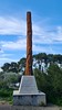

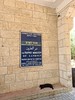

The above images may not be of the site on this page, but were taken nearby. They are loaded from Flickr so please click on them for image credits.
Click here to see more info for this site
Nearby sites
Click here to view sites on an interactive map of the areaKey: Red: member's photo, Blue: 3rd party photo, Yellow: other image, Green: no photo - please go there and take one, Grey: site destroyed
Download sites to:
KML (Google Earth)
GPX (GPS waypoints)
CSV (Garmin/Navman)
CSV (Excel)
To unlock full downloads you need to sign up as a Contributory Member. Otherwise downloads are limited to 50 sites.
Turn off the page maps and other distractions
Nearby sites listing. In the following links * = Image available
7.2km WNW 289° Tel Gezer* Ancient Village or Settlement
10.5km S 177° Tel Beth-Shemesh* Artificial Mound
14.7km WSW 243° Tel 'Ekron Ancient Village or Settlement
15.3km ESE 107° Motza Neolithic City* Ancient Village or Settlement
15.3km NNW 328° Lod Mosaic Ancient Palace
15.9km S 179° Ramat Beit Shemesh ritual baths* Ancient Village or Settlement
16.1km S 191° Khirbet Qeiyafa* Ancient Village or Settlement
16.3km SSW 198° Tel Azeqa Ancient Village or Settlement
16.8km S 177° 2,000-year-old ‘Emperor’s Road’ near Beit Shemesh* Ancient Trackway
17.8km ESE 108° Tel Motza* Ancient Village or Settlement
17.9km NNW 347° Mosaic and Stone structure near Shoham Ancient Village or Settlement
20.4km SW 221° Tel Gath Ancient Village or Settlement
21.1km S 185° Khirbat Ethri* Ancient Village or Settlement
22.7km S 185° Tel Burgin* Ancient Village or Settlement
23.5km ESE 115° Talpiot Tomb Rock Cut Tomb
23.8km SSW 197° Tel Goded Ancient Village or Settlement
23.9km E 98° Shuafat road Chalcolithic period site* Ancient Village or Settlement
24.0km ESE 123° Rachel's Tomb Ancient Temple
24.0km ESE 104° 2000 year old stone fragment in Jerusalem* Marker Stone
24.1km ESE 106° Temple Mount* Ancient Temple
24.3km ESE 107° City of David* Ancient Village or Settlement
24.3km ESE 108° Hezekiah's Tunnel* Ancient Mine, Quarry or other Industry
25.7km SSW 206° Tel Burna* Ancient Village or Settlement
25.7km SSW 206° Tel Burna* Ancient Village or Settlement
27.7km SSW 199° Bet Guvrin-Maresha National Park* Ancient Village or Settlement
View more nearby sites and additional images


 We would like to know more about this location. Please feel free to add a brief description and any relevant information in your own language.
 Wir möchten mehr über diese Stätte erfahren. Bitte zögern Sie nicht, eine kurze Beschreibung und relevante Informationen in Deutsch hinzuzufügen.
 Nous aimerions en savoir encore un peu sur les lieux. S'il vous plaît n'hesitez pas à ajouter une courte description et tous les renseignements pertinents dans votre propre langue.
 Quisieramos informarnos un poco más de las lugares. No dude en añadir una breve descripción y otros datos relevantes en su propio idioma.