<< Text Pages >> Mosaic and Stone structure near Shoham - Ancient Village or Settlement in Israel
Submitted by Andy B on Monday, 15 October 2018 Page Views: 863
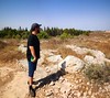
Multi-periodSite Name: Mosaic and Stone structure near ShohamCountry: Israel Type: Ancient Village or Settlement
Nearest Village: Shoham
Latitude: 31.995758N Longitude: 34.948841E
Condition:
| 5 | Perfect |
| 4 | Almost Perfect |
| 3 | Reasonable but with some damage |
| 2 | Ruined but still recognisable as an ancient site |
| 1 | Pretty much destroyed, possibly visible as crop marks |
| 0 | No data. |
| -1 | Completely destroyed |
| 5 | Superb |
| 4 | Good |
| 3 | Ordinary |
| 2 | Not Good |
| 1 | Awful |
| 0 | No data. |
| 5 | Can be driven to, probably with disabled access |
| 4 | Short walk on a footpath |
| 3 | Requiring a bit more of a walk |
| 2 | A long walk |
| 1 | In the middle of nowhere, a nightmare to find |
| 0 | No data. |
| 5 | co-ordinates taken by GPS or official recorded co-ordinates |
| 4 | co-ordinates scaled from a detailed map |
| 3 | co-ordinates scaled from a bad map |
| 2 | co-ordinates of the nearest village |
| 1 | co-ordinates of the nearest town |
| 0 | no data |
Be the first person to rate this site - see the 'Contribute!' box in the right hand menu.
Internal Links:
External Links:
Ancient Village or Settlement in Israel
James Riggs: About 1 km north of me in shoham,israel stands a sort of 'mini stonehenge' and a mosaic from the byzantine times. The mini stonehenge is about 2/3 north from the south entrance.
You may be viewing yesterday's version of this page. To see the most up to date information please register for a free account.
Do not use the above information on other web sites or publications without permission of the contributor.
Nearby Images from Flickr

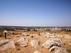
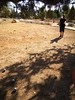
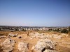
The above images may not be of the site on this page, but were taken nearby. They are loaded from Flickr so please click on them for image credits.
Click here to see more info for this site
Nearby sites
Click here to view sites on an interactive map of the areaKey: Red: member's photo, Blue: 3rd party photo, Yellow: other image, Green: no photo - please go there and take one, Grey: site destroyed
Download sites to:
KML (Google Earth)
GPX (GPS waypoints)
CSV (Garmin/Navman)
CSV (Excel)
To unlock full downloads you need to sign up as a Contributory Member. Otherwise downloads are limited to 50 sites.
Turn off the page maps and other distractions
Nearby sites listing. In the following links * = Image available
6.2km SW 223° Lod Mosaic Ancient Palace
12.0km NNE 18° Ancient Farm near Rosh Ha'ayin * Ancient Village or Settlement
12.3km N 352° Antipatris* Ancient Village or Settlement
13.0km NNE 13° Qesem Cave* Cave or Rock Shelter
15.5km S 191° Tel Gezer* Ancient Village or Settlement
17.8km N 1° The Gilgal associated violently with Joshua Stone Circle
17.9km SSE 167° Emmaus Ancient Village or Settlement
18.7km NW 309° Tel Qasile* Artificial Mound
20.1km NW 307° Tel Qudadi Ancient Village or Settlement
25.4km WSW 252° Yavne Yam Ancient Village or Settlement
25.8km E 82° The Gilgal associated with Elijah and Elisha Stone Circle
25.9km NNW 329° Apollonia (Israel)* Ancient Village or Settlement
25.9km SSW 201° Tel 'Ekron Ancient Village or Settlement
28.3km S 171° Tel Beth-Shemesh* Artificial Mound
28.8km SE 140° Motza Neolithic City* Ancient Village or Settlement
31.0km SE 138° Tel Motza* Ancient Village or Settlement
32.8km ENE 78° Tel Shiloh Ancient Village or Settlement
32.9km S 182° Tel Azeqa Ancient Village or Settlement
33.3km S 179° Khirbet Qeiyafa* Ancient Village or Settlement
33.6km S 173° Ramat Beit Shemesh ritual baths* Ancient Village or Settlement
34.2km SSW 196° Tel Gath Ancient Village or Settlement
34.5km SE 127° Shuafat road Chalcolithic period site* Ancient Village or Settlement
34.7km S 172° 2,000-year-old ‘Emperor’s Road’ near Beit Shemesh* Ancient Trackway
35.9km SE 131° 2000 year old stone fragment in Jerusalem* Marker Stone
36.3km SE 132° Temple Mount* Ancient Temple
View more nearby sites and additional images


 We would like to know more about this location. Please feel free to add a brief description and any relevant information in your own language.
 Wir möchten mehr über diese Stätte erfahren. Bitte zögern Sie nicht, eine kurze Beschreibung und relevante Informationen in Deutsch hinzuzufügen.
 Nous aimerions en savoir encore un peu sur les lieux. S'il vous plaît n'hesitez pas à ajouter une courte description et tous les renseignements pertinents dans votre propre langue.
 Quisieramos informarnos un poco más de las lugares. No dude en añadir una breve descripción y otros datos relevantes en su propio idioma.