
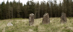

<< Our Photo Pages >> Bet Guvrin-Maresha National Park - Ancient Village or Settlement in Israel
Submitted by motist on Wednesday, 14 July 2010 Page Views: 6738
Multi-periodSite Name: Bet Guvrin-Maresha National Park Alternative Name: Eleutheropolis, Beit GuvrinCountry: Israel
NOTE: This site is 1.339 km away from the location you searched for.
Type: Ancient Village or Settlement
Nearest Town: Kiryat Gat Nearest Village: Kibuts Bait Guvrin
Latitude: 31.602542N Longitude: 34.897155E
Condition:
| 5 | Perfect |
| 4 | Almost Perfect |
| 3 | Reasonable but with some damage |
| 2 | Ruined but still recognisable as an ancient site |
| 1 | Pretty much destroyed, possibly visible as crop marks |
| 0 | No data. |
| -1 | Completely destroyed |
| 5 | Superb |
| 4 | Good |
| 3 | Ordinary |
| 2 | Not Good |
| 1 | Awful |
| 0 | No data. |
| 5 | Can be driven to, probably with disabled access |
| 4 | Short walk on a footpath |
| 3 | Requiring a bit more of a walk |
| 2 | A long walk |
| 1 | In the middle of nowhere, a nightmare to find |
| 0 | No data. |
| 5 | co-ordinates taken by GPS or official recorded co-ordinates |
| 4 | co-ordinates scaled from a detailed map |
| 3 | co-ordinates scaled from a bad map |
| 2 | co-ordinates of the nearest village |
| 1 | co-ordinates of the nearest town |
| 0 | no data |
Internal Links:
External Links:
")
They dug small openings into the nari, normally no more than two meters thick, and expanded the caves into the softer chalk beneath. Hundreds of such caves were dug at Bet Guvrin and its surroundings, creating subterranean networks of unparalleled complexity.
A prominent city in the period of the Second Temple, located in the southern Shephelah. Ancient Bet Guvrin rose to importance after the destruction of Maresha (Marissa) by the Parthians in 40 BCE. Betabris, mentioned by Josephus (Wars, 4:447) as one of two villages taken by the Romans in 68 CE. "right in the heart of Idumea," may possibly refer to Bet Guvrin. The city began expanding following the Bar Kokhba revolt, during the second half of the second century CE, with the construction of public and administrative buildings. In 199/200 CE, Septimus Severus conferred on it the privileges of a Roman city and called it Eleutheropolis (the city of freemen). The city of that period covered an area of about 160 acres, and topographically it extended mainly over a hill located south of the present-day highway between Bet Shemesh and Ashkelon, with the northern extension of the city built on a low plain. Two aqueducts and an underground tunnel supplied water to the city. The Midrash (Gen. R. 41:10) interprets Mt. Seir of the "Horites" (Gen. 14:6) as Eleutheropolis – an interpretation based on a play of words, since Hori means both "freeman" and "cave dweller" and the Bet Guvrin region abounds in large caves. Severus also granted the new city a large area encompassing the districts of Bethletepha, western Edom, and Hebron as far as En-Gedi, which made it the largest single region in Roman times, with over a hundred villages. Bet Guvrin also had its own system of dating and coinage. The wealth of its inhabitants is attested to by a mosaic pavement of a Roman house from the 4th century CE which depicts a hunting expedition, with representations of animals and the personifications of the four seasons. Public buildings have been uncovered in recent excavations, including a bath house with double arches and a system of vaults made of ashlars with Severan-type stone dressing, and an amphitheater which was built on flat ground on the northwest edge of the city
See below for links and more photos.
You may be viewing yesterday's version of this page. To see the most up to date information please register for a free account.
")
")
")
")
")
")
")
")
")
")
")
")
")
")
")
")
")
")
")
")
")
")
")
")
These are just the first 25 photos of Bet Guvrin-Maresha National Park. If you log in with a free user account you will be able to see our entire collection.
Do not use the above information on other web sites or publications without permission of the contributor.
Click here to see more info for this site
Nearby sites
Click here to view sites on an interactive map of the areaKey: Red: member's photo, Blue: 3rd party photo, Yellow: other image, Green: no photo - please go there and take one, Grey: site destroyed
Download sites to:
KML (Google Earth)
GPX (GPS waypoints)
CSV (Garmin/Navman)
CSV (Excel)
To unlock full downloads you need to sign up as a Contributory Member. Otherwise downloads are limited to 50 sites.
Turn off the page maps and other distractions
Nearby sites listing. In the following links * = Image available
3.8km NW 323° Tel Burna* Ancient Village or Settlement
3.8km NW 324° Tel Burna* Ancient Village or Settlement
3.9km NNE 28° Tel Goded Ancient Village or Settlement
6.2km SW 227° Tel Lachish* Artificial Mound
7.4km W 260° Ziklag* Ancient Village or Settlement
7.8km ENE 62° Tel Burgin* Ancient Village or Settlement
8.0km SSE 165° Amatzia* Ancient Mine, Quarry or other Industry
8.8km NE 54° Khirbat Ethri* Ancient Village or Settlement
11.4km NNE 19° Tel Azeqa Ancient Village or Settlement
11.9km NNE 29° Khirbet Qeiyafa* Ancient Village or Settlement
11.9km NNW 337° Tel Gath Ancient Village or Settlement
13.6km NE 46° 2,000-year-old ‘Emperor’s Road’ near Beit Shemesh* Ancient Trackway
13.7km NE 41° Ramat Beit Shemesh ritual baths* Ancient Village or Settlement
16.9km WSW 249° Tel El-Hesi Ancient Village or Settlement
18.3km NNE 31° Tel Beth-Shemesh* Artificial Mound
19.9km NNW 348° Tel 'Ekron Ancient Village or Settlement
21.1km S 188° Khirbat Za'aq* Ancient Village or Settlement
22.0km ESE 113° Cave of the Patriarchs Rock Cut Tomb
25.3km SSW 193° Khirbet Abu Hof (chaf)* Ancient Village or Settlement
27.7km NNE 19° Emmaus Ancient Village or Settlement
28.3km NW 307° Tel Ashdod Ancient Village or Settlement
28.6km N 4° Tel Gezer* Ancient Village or Settlement
29.2km SE 138° Khirbat Susya* Ancient Village or Settlement
29.6km NW 308° Hill of Jonah* Hillfort
31.7km ENE 66° Rachel's Tomb Ancient Temple
View more nearby sites and additional images


 We would like to know more about this location. Please feel free to add a brief description and any relevant information in your own language.
 Wir möchten mehr über diese Stätte erfahren. Bitte zögern Sie nicht, eine kurze Beschreibung und relevante Informationen in Deutsch hinzuzufügen.
 Nous aimerions en savoir encore un peu sur les lieux. S'il vous plaît n'hesitez pas à ajouter une courte description et tous les renseignements pertinents dans votre propre langue.
 Quisieramos informarnos un poco más de las lugares. No dude en añadir una breve descripción y otros datos relevantes en su propio idioma.