 with our Megalithic Portal iPhone app")

<< Our Photo Pages >> Tel Qasile - Artificial Mound in Israel
Submitted by motist on Thursday, 15 July 2010 Page Views: 5282
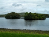
DigsSite Name: Tel QasileCountry: Israel
NOTE: This site is 3.526 km away from the location you searched for.
Type: Artificial Mound
Nearest Town: Tel Aviv
Latitude: 32.101417N Longitude: 34.794367E
Condition:
| 5 | Perfect |
| 4 | Almost Perfect |
| 3 | Reasonable but with some damage |
| 2 | Ruined but still recognisable as an ancient site |
| 1 | Pretty much destroyed, possibly visible as crop marks |
| 0 | No data. |
| -1 | Completely destroyed |
| 5 | Superb |
| 4 | Good |
| 3 | Ordinary |
| 2 | Not Good |
| 1 | Awful |
| 0 | No data. |
| 5 | Can be driven to, probably with disabled access |
| 4 | Short walk on a footpath |
| 3 | Requiring a bit more of a walk |
| 2 | A long walk |
| 1 | In the middle of nowhere, a nightmare to find |
| 0 | No data. |
| 5 | co-ordinates taken by GPS or official recorded co-ordinates |
| 4 | co-ordinates scaled from a detailed map |
| 3 | co-ordinates scaled from a bad map |
| 2 | co-ordinates of the nearest village |
| 1 | co-ordinates of the nearest town |
| 0 | no data |
Internal Links:
External Links:
")
The first excavations at Tel Qasile were conducted from 1948 to 1950. Excavations were renewed between 1971 and 1974. The most significant remains include a Philistine residential quarter with a sacred area, dated to the beginning of the Iron Age (12th - 10th century BCE). The excavations provided evidence of continued settlement through the 10th century, when the area came under the control of the kings of Israel. Remains of settlement from the end of the Iron Age to the Early Arab period were also found.
You may be viewing yesterday's version of this page. To see the most up to date information please register for a free account.
")
")
")
")
")
")
")
")
")
")
")
")
Do not use the above information on other web sites or publications without permission of the contributor.
Click here to see more info for this site
Nearby sites
Click here to view sites on an interactive map of the areaKey: Red: member's photo, Blue: 3rd party photo, Yellow: other image, Green: no photo - please go there and take one, Grey: site destroyed
Download sites to:
KML (Google Earth)
GPX (GPS waypoints)
CSV (Garmin/Navman)
CSV (Excel)
To unlock full downloads you need to sign up as a Contributory Member. Otherwise downloads are limited to 50 sites.
Turn off the page maps and other distractions
Nearby sites listing. In the following links * = Image available
1.7km W 278° Tel Qudadi Ancient Village or Settlement
10.5km N 6° Apollonia (Israel)* Ancient Village or Settlement
12.8km E 88° Antipatris* Ancient Village or Settlement
16.1km ENE 68° The Gilgal associated violently with Joshua Stone Circle
17.5km E 87° Qesem Cave* Cave or Rock Shelter
18.2km E 91° Ancient Farm near Rosh Ha'ayin * Ancient Village or Settlement
18.7km SE 129° Mosaic and Stone structure near Shoham Ancient Village or Settlement
19.3km SSE 147° Lod Mosaic Ancient Palace
22.0km SSW 206° Yavne Yam Ancient Village or Settlement
29.4km SSE 157° Tel Gezer* Ancient Village or Settlement
34.6km SSE 148° Emmaus Ancient Village or Settlement
36.4km S 171° Tel 'Ekron Ancient Village or Settlement
39.4km SSW 200° Hill of Jonah* Hillfort
40.4km SSW 198° Tel Ashdod Ancient Village or Settlement
40.9km ESE 101° The Gilgal associated with Elijah and Elisha Stone Circle
44.1km SSE 154° Tel Beth-Shemesh* Artificial Mound
44.8km S 174° Tel Gath Ancient Village or Settlement
45.7km NNE 12° Caesarea Maritima* Ancient Village or Settlement
46.2km NNE 13° The Bird Mosaic, Caesarea, Israel* Ancient Palace
46.6km SSE 163° Tel Azeqa Ancient Village or Settlement
46.9km E 96° Tel Shiloh Ancient Village or Settlement
47.1km ENE 75° Jacob's Well (Bir Ya'Qub)* Holy Well or Sacred Spring
47.3km SE 136° Motza Neolithic City* Ancient Village or Settlement
47.3km NNE 26° Tel Esur Ancient Village or Settlement
47.6km SSE 161° Khirbet Qeiyafa* Ancient Village or Settlement
View more nearby sites and additional images


 We would like to know more about this location. Please feel free to add a brief description and any relevant information in your own language.
 Wir möchten mehr über diese Stätte erfahren. Bitte zögern Sie nicht, eine kurze Beschreibung und relevante Informationen in Deutsch hinzuzufügen.
 Nous aimerions en savoir encore un peu sur les lieux. S'il vous plaît n'hesitez pas à ajouter une courte description et tous les renseignements pertinents dans votre propre langue.
 Quisieramos informarnos un poco más de las lugares. No dude en añadir una breve descripción y otros datos relevantes en su propio idioma.