


Yavne Yam - Ancient Village or Settlement in Israel
Submitted by motist on Monday, 02 August 2010 Page Views: 3426
Site Name: Yavne YamCountry: Israel Type: Ancient Village or Settlement
Nearest Town: Yavne Nearest Village: Palmahim
Latitude: 31.922907N Longitude: 34.693176E
Condition:
| 5 | Perfect |
| 4 | Almost Perfect |
| 3 | Reasonable but with some damage |
| 2 | Ruined but still recognisable as an ancient site |
| 1 | Pretty much destroyed, possibly visible as crop marks |
| 0 | No data. |
| -1 | Completely destroyed |
| 5 | Superb |
| 4 | Good |
| 3 | Ordinary |
| 2 | Not Good |
| 1 | Awful |
| 0 | No data. |
| 5 | Can be driven to, probably with disabled access |
| 4 | Short walk on a footpath |
| 3 | Requiring a bit more of a walk |
| 2 | A long walk |
| 1 | In the middle of nowhere, a nightmare to find |
| 0 | No data. |
| 5 | co-ordinates taken by GPS or official recorded co-ordinates |
| 4 | co-ordinates scaled from a detailed map |
| 3 | co-ordinates scaled from a bad map |
| 2 | co-ordinates of the nearest village |
| 1 | co-ordinates of the nearest town |
| 0 | no data |
Internal Links:
External Links:
Ancient Village or Settlement in Israel
Yavne, located on the Mediterranean coast 20 kilometers south of Jaffa and the same distance to the north of Ashdod, was known mainly as the center of learning of Jewish rabbis after the destruction of the Temple of Jerusalem by the Romans in 70 CE. There is also a tradition which claims that Yavneh was the burial place of the Biblical Reuven. Yavneh Yam, although little known, is important for understanding shipping practices in the ancient world. Last but not least, it is the location of the find of an important inscription which demonstrates the relations of the citizens with the Seleucid King Antiochus V.
Like some other coastal towns, Yavneh had an inland settlement and a counterpart on the sea about 8 kilometers to the northwest, which was Yavneh Yam. As the modern town of Yavneh covers the same place as historical Yavneh, archeological research has concentrated on the ancient coastal tel. The digs are fairly recent and are by no means finished, therefore the site has not yet been turned into a national park.
More:
http://www.jewishmag.com/98mag/yavnehyam/yavnehyam.htm
http://en.wikipedia.org/wiki/Yavneh-Yam
http://en.wikipedia.org/wiki/Mesad_Hashavyahu
You may be viewing yesterday's version of this page. To see the most up to date information please register for a free account.
Do not use the above information on other web sites or publications without permission of the contributor.
Nearby Images from Flickr

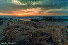

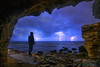


The above images may not be of the site on this page, but were taken nearby. They are loaded from Flickr so please click on them for image credits.
Click here to see more info for this site
Nearby sites
Click here to view sites on an interactive map of the areaKey: Red: member's photo, Blue: 3rd party photo, Yellow: other image, Green: no photo - please go there and take one, Grey: site destroyed
Download sites to:
KML (Google Earth)
GPX (GPS waypoints)
CSV (Garmin/Navman)
CSV (Excel)
To unlock full downloads you need to sign up as a Contributory Member. Otherwise downloads are limited to 50 sites.

 We would like to know more about this location. Please feel free to add a brief description and any relevant information in your own language.
 Wir möchten mehr über diese Stätte erfahren. Bitte zögern Sie nicht, eine kurze Beschreibung und relevante Informationen in Deutsch hinzuzufügen.
 Nous aimerions en savoir encore un peu sur les lieux. S'il vous plaît n'hesitez pas à ajouter une courte description et tous les renseignements pertinents dans votre propre langue.
 Quisieramos informarnos un poco más de las lugares. No dude en añadir una breve descripción y otros datos relevantes en su propio idioma.