<< Our Photo Pages >> Kissonerga-Skalia - Ancient Village or Settlement in Cyprus
Submitted by DrewParsons on Thursday, 15 March 2018 Page Views: 9800
DigsSite Name: Kissonerga-SkaliaCountry: Cyprus
NOTE: This site is 20.552 km away from the location you searched for.
Type: Ancient Village or Settlement
Nearest Town: Paphos Nearest Village: Kissonerga
Latitude: 34.822682N Longitude: 32.396610E
Condition:
| 5 | Perfect |
| 4 | Almost Perfect |
| 3 | Reasonable but with some damage |
| 2 | Ruined but still recognisable as an ancient site |
| 1 | Pretty much destroyed, possibly visible as crop marks |
| 0 | No data. |
| -1 | Completely destroyed |
| 5 | Superb |
| 4 | Good |
| 3 | Ordinary |
| 2 | Not Good |
| 1 | Awful |
| 0 | No data. |
| 5 | Can be driven to, probably with disabled access |
| 4 | Short walk on a footpath |
| 3 | Requiring a bit more of a walk |
| 2 | A long walk |
| 1 | In the middle of nowhere, a nightmare to find |
| 0 | No data. |
| 5 | co-ordinates taken by GPS or official recorded co-ordinates |
| 4 | co-ordinates scaled from a detailed map |
| 3 | co-ordinates scaled from a bad map |
| 2 | co-ordinates of the nearest village |
| 1 | co-ordinates of the nearest town |
| 0 | no data |
Internal Links:
External Links:
I have visited· I would like to visit
smallblueplanet would like to visit
Catrinm visited on 7th Mar 2018 - their rating: Cond: 2 Amb: 3 Access: 5 Free access follow brown signs. No charge. Signage does not
cover some of the remarkable finds at kissonerga which are in the Cyprus museum.
Coloured painted bowls with dozens of female figures in and around them. See pics
")
Kissonerga-Skalia is the site of an ancient settlement dating back to the Early Middle Cypriot Bronze Age (EM-MC ca 2400-1650 BC) located to the north of Paphos near the village of Kissonerga. Recent excavations by a Manchester University/Manchester Museum team have focused on this Kissongera-Skalia site.
Kissonerga-Skalia is considered somewhat unique as it is located within 300 metres of the coast and by copper sources whereas most similar dated sites are found inland and have an agricultural basis. This 12 hectare site has produced finds of large quantities of pot sherds, some including a style known as "Drab Polished Ware" found in small quantities at other sites and thought to originate in the south west of the country. These finds will assist archeaologists to further understand Drab Polished Ware's origins. Other finds have produced beads, pendants, copper fragments, evidence of textile production (spindle whorls and a loom weight), querns, gaming stones, ground stone tools, and evidence of deer, sheep/goat, pig, crab, shellfish, grape and lentil use, as well as large quantities of pottery sherds dating through the EC-MC, Chalcolithic, Late Roman and Byzantine eras. They have also found stone footings for approximately thirty EC-MC era dwellings and 17 metres of a curved wall which may have been a perimeter wall or fortification dated to ca. 1750 BC.
More at: http://www.arts.manchester.ac.uk/archaeology/research/kissonerga/
Note: More on our page - one of the key finds from Kissonerga - a birthing figure - one of 50 plus anthropomorphic female figures found in and around large brightly painted bowls, estimated date 3000 BC (with thanks to Catrinm for the new photos from Cyprus museum)
You may be viewing yesterday's version of this page. To see the most up to date information please register for a free account.
")
")
")
")
Do not use the above information on other web sites or publications without permission of the contributor.
Nearby Images from Flickr
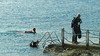
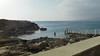

The above images may not be of the site on this page, but were taken nearby. They are loaded from Flickr so please click on them for image credits.
Click here to see more info for this site
Nearby sites
Click here to view sites on an interactive map of the areaKey: Red: member's photo, Blue: 3rd party photo, Yellow: other image, Green: no photo - please go there and take one, Grey: site destroyed
Download sites to:
KML (Google Earth)
GPX (GPS waypoints)
CSV (Garmin/Navman)
CSV (Excel)
To unlock full downloads you need to sign up as a Contributory Member. Otherwise downloads are limited to 50 sites.
Turn off the page maps and other distractions
Nearby sites listing. In the following links * = Image available
1.5km SE 144° Lempa* Ancient Village or Settlement
4.6km NW 317° Maa-Palaeokastro Ancient Village or Settlement
5.4km S 171° Tombs of the Kings* Rock Cut Tomb
26.4km N 350° Baths of Aphrodite Holy Well or Sacred Spring
27.5km SE 130° Petra Tou Romiou* Natural Stone / Erratic / Other Natural Feature
30.8km NNW 344° Fontana Amorosa (Akamis Peninsula) Holy Well or Sacred Spring
48.0km ESE 111° Kurion* Ancient Village or Settlement
67.7km E 100° Amathus* Ancient Village or Settlement
72.6km E 98° Pyrgos-Mavrorachi Ancient Village or Settlement
80.0km ENE 77° Tamassos Ancient Village or Settlement
84.7km ENE 78° Kataliondas Kourvellos* Ancient Village or Settlement
86.5km E 92° Choirokoitia* Ancient Village or Settlement
88.2km ENE 72° Tseri-Angali Ancient Village or Settlement
92.0km E 79° Ayia Varvara Asprokremnos Ancient Village or Settlement
95.7km NE 55° Karmi.* Chambered Tomb
96.0km ENE 77° Idalion Ancient Village or Settlement
109.2km ENE 58° Vrysi* Ancient Village or Settlement
110.4km E 86° Dromolaxia Vizatzia Ancient Village or Settlement
113.1km E 84° Temple of Paphian Aphrodite* Ancient Temple
113.1km E 84° Kition* Ancient Village or Settlement
120.2km ENE 79° Pyla (Cyprus)* Ancient Temple
121.6km E 81° Pyla-Kokkinokremos Ancient Village or Settlement
138.5km NNE 15° Anemurium* Ancient Village or Settlement
143.1km ENE 73° Salamis* Ancient Village or Settlement
148.2km N 1° Antiochia ad Cragum Ancient Village or Settlement
View more nearby sites and additional images


 We would like to know more about this location. Please feel free to add a brief description and any relevant information in your own language.
 Wir möchten mehr über diese Stätte erfahren. Bitte zögern Sie nicht, eine kurze Beschreibung und relevante Informationen in Deutsch hinzuzufügen.
 Nous aimerions en savoir encore un peu sur les lieux. S'il vous plaît n'hesitez pas à ajouter une courte description et tous les renseignements pertinents dans votre propre langue.
 Quisieramos informarnos un poco más de las lugares. No dude en añadir una breve descripción y otros datos relevantes en su propio idioma.