<< Text Pages >> Mont des Tombes - Hillfort in France in Nord:Nord (59)
Submitted by thecaptain on Monday, 27 April 2009 Page Views: 4812
Iron Age and Later PrehistorySite Name: Mont des TombesCountry: France
NOTE: This site is 14.165 km away from the location you searched for.
Département: Nord:Nord (59) Type: Hillfort
Nearest Town: Lille Nearest Village: Sainghin-en-Melantoi
Latitude: 50.595600N Longitude: 3.177800E
Condition:
| 5 | Perfect |
| 4 | Almost Perfect |
| 3 | Reasonable but with some damage |
| 2 | Ruined but still recognisable as an ancient site |
| 1 | Pretty much destroyed, possibly visible as crop marks |
| 0 | No data. |
| -1 | Completely destroyed |
| 5 | Superb |
| 4 | Good |
| 3 | Ordinary |
| 2 | Not Good |
| 1 | Awful |
| 0 | No data. |
| 5 | Can be driven to, probably with disabled access |
| 4 | Short walk on a footpath |
| 3 | Requiring a bit more of a walk |
| 2 | A long walk |
| 1 | In the middle of nowhere, a nightmare to find |
| 0 | No data. |
| 5 | co-ordinates taken by GPS or official recorded co-ordinates |
| 4 | co-ordinates scaled from a detailed map |
| 3 | co-ordinates scaled from a bad map |
| 2 | co-ordinates of the nearest village |
| 1 | co-ordinates of the nearest town |
| 0 | no data |
Be the first person to rate this site - see the 'Contribute!' box in the right hand menu.
Internal Links:
External Links:
Hillfort to the north of the village of Sainghin-en-Melantois, a few kilometers to the east of Lille.
You may be viewing yesterday's version of this page. To see the most up to date information please register for a free account.
Do not use the above information on other web sites or publications without permission of the contributor.
Nearby Images from Flickr
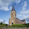
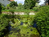
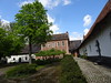
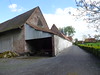
The above images may not be of the site on this page, but were taken nearby. They are loaded from Flickr so please click on them for image credits.
Click here to see more info for this site
Nearby sites
Click here to view sites on an interactive map of the areaKey: Red: member's photo, Blue: 3rd party photo, Yellow: other image, Green: no photo - please go there and take one, Grey: site destroyed
Download sites to:
KML (Google Earth)
GPX (GPS waypoints)
CSV (Garmin/Navman)
CSV (Excel)
To unlock full downloads you need to sign up as a Contributory Member. Otherwise downloads are limited to 50 sites.
Turn off the page maps and other distractions
Nearby sites listing. In the following links * = Image available
14.6km E 84° Musée archéologique de Tournai* Museum
18.5km ESE 115° Brunehault* Standing Stone (Menhir)
20.2km E 98° Tumulus du Trou de Billemont* Artificial Mound
21.0km S 189° Douai Musée d'Archéologie* Museum
25.3km SW 235° Tombe de Pont-a-Vendin Burial Chamber or Dolmen
28.8km NE 50° Peetje en Meetje * Burial Chamber or Dolmen
29.5km NE 52° Kluisberg* Natural Stone / Erratic / Other Natural Feature
31.2km NNW 336° Porch am Tir Nan Myfyr* Stone Circle
31.7km S 181° Menhir dit la Borne-Grand-Père* Marker Stone
35.1km E 94° Archéosite* Museum
35.5km ENE 58° Menhir van Jolybos* Modern Stone Circle etc
35.5km ESE 111° Bernissart, Jardin Géologique* Museum
35.7km SSW 194° Dolmen dit les Pierres Chavattes* Burial Chamber or Dolmen
35.7km ENE 58° Dolmen van Jolybos* Modern Stone Circle etc
35.9km WNW 297° La Pierre-qui-Tourne de Bailleul Standing Stone (Menhir)
36.6km S 184° La-Pierre-qui-Pousse (Aubigny-au-Bac)* Standing Stone (Menhir)
36.8km S 176° Féchain Polissoir* Polissoir
36.9km S 189° Palluel Menhir Statue* Standing Stone (Menhir)
37.8km WNW 303° Petit Janne de Yourcenar* Standing Stone (Menhir)
37.8km SSW 197° La Pierre du Diable (Lécluse)* Standing Stone (Menhir)
38.2km SSW 202° Cromlech dit Les-Sept-Bonnettes* Stone Circle
38.5km S 189° Le Gros Caillou (Oisy-le-Verger)* Standing Stone (Menhir)
39.8km NNW 328° Boezinge* Modern Stone Circle etc
43.3km SSE 147° Menhir dit le Gros Caillou* Standing Stone (Menhir)
44.9km SW 232° Les Pierres Jumelles (Mont-Saint-Éloi)* Standing Stones
View more nearby sites and additional images


 We would like to know more about this location. Please feel free to add a brief description and any relevant information in your own language.
 Wir möchten mehr über diese Stätte erfahren. Bitte zögern Sie nicht, eine kurze Beschreibung und relevante Informationen in Deutsch hinzuzufügen.
 Nous aimerions en savoir encore un peu sur les lieux. S'il vous plaît n'hesitez pas à ajouter une courte description et tous les renseignements pertinents dans votre propre langue.
 Quisieramos informarnos un poco más de las lugares. No dude en añadir una breve descripción y otros datos relevantes en su propio idioma.