<< Our Photo Pages >> World's View Matobo National Park - Natural Stone / Erratic / Other Natural Feature in Zimbabwe
Submitted by ladrin on Thursday, 19 November 2015 Page Views: 2212
Natural PlacesSite Name: World's View Matobo National Park Alternative Name: Malindidzimu HillCountry: Zimbabwe Type: Natural Stone / Erratic / Other Natural Feature
Nearest Town: Bulawayo
Latitude: 20.49383S Longitude: 28.514162E
Condition:
| 5 | Perfect |
| 4 | Almost Perfect |
| 3 | Reasonable but with some damage |
| 2 | Ruined but still recognisable as an ancient site |
| 1 | Pretty much destroyed, possibly visible as crop marks |
| 0 | No data. |
| -1 | Completely destroyed |
| 5 | Superb |
| 4 | Good |
| 3 | Ordinary |
| 2 | Not Good |
| 1 | Awful |
| 0 | No data. |
| 5 | Can be driven to, probably with disabled access |
| 4 | Short walk on a footpath |
| 3 | Requiring a bit more of a walk |
| 2 | A long walk |
| 1 | In the middle of nowhere, a nightmare to find |
| 0 | No data. |
| 5 | co-ordinates taken by GPS or official recorded co-ordinates |
| 4 | co-ordinates scaled from a detailed map |
| 3 | co-ordinates scaled from a bad map |
| 2 | co-ordinates of the nearest village |
| 1 | co-ordinates of the nearest town |
| 0 | no data |
Internal Links:
External Links:
I have visited· I would like to visit
NiciJD2004: would like to visit I'd also love to visit the Great House in Zimbabwe.
")
Spectacular hills in Matobo National Park are another UNESCO World Heritage Site in Zimbabwe. Among these peaks the most breathtaking is so called the World's View on the top of Malindidzimu Hill. This is a spiritual and sacred place to the Ndebele people. The grave of Cecil Rhodes is there as well, which fact brings is a bit of controversy. Giant granite sphere-like boulders are dominant to the place.
You may be viewing yesterday's version of this page. To see the most up to date information please register for a free account.
")
")
Do not use the above information on other web sites or publications without permission of the contributor.
Nearby Images from Flickr

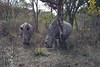
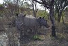
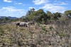

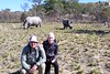
The above images may not be of the site on this page, but were taken nearby. They are loaded from Flickr so please click on them for image credits.
Click here to see more info for this site
Nearby sites
Click here to view sites on an interactive map of the areaKey: Red: member's photo, Blue: 3rd party photo, Yellow: other image, Green: no photo - please go there and take one, Grey: site destroyed
Download sites to:
KML (Google Earth)
GPX (GPS waypoints)
CSV (Garmin/Navman)
CSV (Excel)
To unlock full downloads you need to sign up as a Contributory Member. Otherwise downloads are limited to 50 sites.
Turn off the page maps and other distractions
Nearby sites listing. In the following links * = Image available
6.3km S 186° Inanke Cave Cave or Rock Shelter
11.3km W 265° Bambata Cave* Cave or Rock Shelter
211.2km SSE 158° Machete I Rock Art
253.5km E 85° Great Zimbabwe* Ancient Village or Settlement
349.3km W 268° Makgadikgadi* Ancient Village or Settlement
369.7km S 184° Palala River Bluffs San Rock Paintings* Rock Art
484.3km NNW 331° Sikaunda petroglyphs Rock Art
496.0km SSW 210° Matsieng Footprints Rock Art
585.7km S 183° African Window* Museum
602.9km S 186° Malapa* Cave or Rock Shelter
615.8km SSE 159° Bantu stone circles* Standing Stones
619.2km S 187° Sterkfontein* Cave or Rock Shelter
683.7km SSE 158° Lion Cavern Ngwenya Ancient Mine, Quarry or other Industry
734.9km WNW 284° Tsodilo Hills* Rock Art
789.1km SSW 199° Wolmaransstad Rock Art Rock Art
807.1km SSE 155° Border Cave* Cave or Rock Shelter
890.2km SSW 202° Stowlands Rock art Rock Art
921.3km NE 42° Chongoni Rock Art Rock Art
959.6km SSW 211° Wonderwerk Cave* Cave or Rock Shelter
974.2km SSW 214° Kathu Pan* Ancient Mine, Quarry or other Industry
983.9km SSW 203° Nooitgedacht Rock art Rock Art
989.1km SSW 202° Wildebeestkuil* Rock Art
992.4km SSW 202° McGregor Museum Museum
995.8km S 174° Kamberg rock art Rock Art
1009.7km NNW 339° Nyambwezu Rock Shelter Rock Art
View more nearby sites and additional images


 We would like to know more about this location. Please feel free to add a brief description and any relevant information in your own language.
 Wir möchten mehr über diese Stätte erfahren. Bitte zögern Sie nicht, eine kurze Beschreibung und relevante Informationen in Deutsch hinzuzufügen.
 Nous aimerions en savoir encore un peu sur les lieux. S'il vous plaît n'hesitez pas à ajouter une courte description et tous les renseignements pertinents dans votre propre langue.
 Quisieramos informarnos un poco más de las lugares. No dude en añadir una breve descripción y otros datos relevantes en su propio idioma.