


<< Our Photo Pages >> Ūdrīši Akmeņi - Modern Stone Circle etc in Latvia
Submitted by Alta-Falisa on Sunday, 08 March 2015 Page Views: 2038
Modern SitesSite Name: Ūdrīši AkmeņiCountry: Latvia
NOTE: This site is 14.488 km away from the location you searched for.
Type: Modern Stone Circle etc
Nearest Town: Krāslava
Latitude: 55.906200N Longitude: 27.103800E
Condition:
| 5 | Perfect |
| 4 | Almost Perfect |
| 3 | Reasonable but with some damage |
| 2 | Ruined but still recognisable as an ancient site |
| 1 | Pretty much destroyed, possibly visible as crop marks |
| 0 | No data. |
| -1 | Completely destroyed |
| 5 | Superb |
| 4 | Good |
| 3 | Ordinary |
| 2 | Not Good |
| 1 | Awful |
| 0 | No data. |
| 5 | Can be driven to, probably with disabled access |
| 4 | Short walk on a footpath |
| 3 | Requiring a bit more of a walk |
| 2 | A long walk |
| 1 | In the middle of nowhere, a nightmare to find |
| 0 | No data. |
| 5 | co-ordinates taken by GPS or official recorded co-ordinates |
| 4 | co-ordinates scaled from a detailed map |
| 3 | co-ordinates scaled from a bad map |
| 2 | co-ordinates of the nearest village |
| 1 | co-ordinates of the nearest town |
| 0 | no data |
Internal Links:
External Links:
")
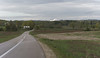
Along A6, between Krāslava and Daugavpils.
You may be viewing yesterday's version of this page. To see the most up to date information please register for a free account.
")
Do not use the above information on other web sites or publications without permission of the contributor.
Nearby Images from Flickr
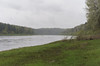
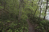
The above images may not be of the site on this page, but were taken nearby. They are loaded from Flickr so please click on them for image credits.
Click here to see more info for this site
Nearby sites
Click here to view sites on an interactive map of the areaKey: Red: member's photo, Blue: 3rd party photo, Yellow: other image, Green: no photo - please go there and take one, Grey: site destroyed
Download sites to:
KML (Google Earth)
GPX (GPS waypoints)
CSV (Garmin/Navman)
CSV (Excel)
To unlock full downloads you need to sign up as a Contributory Member. Otherwise downloads are limited to 50 sites.
Turn off the page maps and other distractions
Nearby sites listing. In the following links * = Image available
48.4km NW 305° Nīcgales Lielais Akmens* Natural Stone / Erratic / Other Natural Feature
71.6km SW 230° Vardžiukiemio akmuo* Natural Stone / Erratic / Other Natural Feature
84.0km WSW 250° Lūžų akmuo su dubeniu* Holed Stone
85.9km NW 313° Vaiķu Laukakmens* Natural Stone / Erratic / Other Natural Feature
96.6km SW 217° Bajorų akmuo* Natural Stone / Erratic / Other Natural Feature
98.7km SW 216° Šventos akmuo* Natural Stone / Erratic / Other Natural Feature
117.4km WSW 247° Zarasų akmuo su dubeniu* Holed Stone
117.4km WSW 247° Kilėviškių akmuo su dubeniu* Holed Stone
117.6km NW 312° Stukmaņu Pētera akmens* Natural Stone / Erratic / Other Natural Feature
120.4km ESE 117° Yanovo lake* Henge
125.5km N 2° Medņu dižakmens* Natural Stone / Erratic / Other Natural Feature
129.6km NW 309° Pastmuižas Velnakmens* Natural Stone / Erratic / Other Natural Feature
136.4km WSW 251° Puntuko akmuo* Natural Stone / Erratic / Other Natural Feature
136.4km N 4° Lāča Darzs* Modern Stone Circle etc
144.2km NW 306° Meļķitāru Muldas akmens* Natural Stone / Erratic / Other Natural Feature
146.3km NW 304° Kraukļu akmens* Natural Stone / Erratic / Other Natural Feature
149.5km N 359° Jaunannas Akmen* Marker Stone
150.0km SW 222° Nemenčinės Bilith* Modern Stone Circle etc
163.9km WSW 245° Ukmergės piliakalnis* Artificial Mound
168.6km NE 40° Maramohinskiy stone* Natural Stone / Erratic / Other Natural Feature
174.0km NW 323° Ūdri (Pūķi) cross stone* Ancient Cross
179.6km WSW 243° Juozapavos akmuo* Natural Stone / Erratic / Other Natural Feature
188.2km SW 235° Zasliai Footprint Stone* Rock Art
188.6km SW 235° Laukagalio akmuo su dubenėliais* Rock Art
190.0km SW 217° Marijampolio akmuo* Natural Stone / Erratic / Other Natural Feature
View more nearby sites and additional images


 We would like to know more about this location. Please feel free to add a brief description and any relevant information in your own language.
 Wir möchten mehr über diese Stätte erfahren. Bitte zögern Sie nicht, eine kurze Beschreibung und relevante Informationen in Deutsch hinzuzufügen.
 Nous aimerions en savoir encore un peu sur les lieux. S'il vous plaît n'hesitez pas à ajouter une courte description et tous les renseignements pertinents dans votre propre langue.
 Quisieramos informarnos un poco más de las lugares. No dude en añadir una breve descripción y otros datos relevantes en su propio idioma.