<< Our Photo Pages >> Spileo Stalaktiton - Cave or Rock Shelter in Greece in Greek Islands
Submitted by Bjorn on Tuesday, 12 June 2007 Page Views: 5396
Natural PlacesSite Name: Spileo Stalaktiton Alternative Name: Antiparos' CaveCountry: Greece
NOTE: This site is 6.035 km away from the location you searched for.
Region: Greek Islands Type: Cave or Rock Shelter
Nearest Town: Paros Nearest Village: Antiparos Port
Latitude: 36.990750N Longitude: 25.059763E
Condition:
| 5 | Perfect |
| 4 | Almost Perfect |
| 3 | Reasonable but with some damage |
| 2 | Ruined but still recognisable as an ancient site |
| 1 | Pretty much destroyed, possibly visible as crop marks |
| 0 | No data. |
| -1 | Completely destroyed |
| 5 | Superb |
| 4 | Good |
| 3 | Ordinary |
| 2 | Not Good |
| 1 | Awful |
| 0 | No data. |
| 5 | Can be driven to, probably with disabled access |
| 4 | Short walk on a footpath |
| 3 | Requiring a bit more of a walk |
| 2 | A long walk |
| 1 | In the middle of nowhere, a nightmare to find |
| 0 | No data. |
| 5 | co-ordinates taken by GPS or official recorded co-ordinates |
| 4 | co-ordinates scaled from a detailed map |
| 3 | co-ordinates scaled from a bad map |
| 2 | co-ordinates of the nearest village |
| 1 | co-ordinates of the nearest town |
| 0 | no data |
Internal Links:
External Links:
I have visited· I would like to visit
Bjorn davidmorgan have visited here
")
A car ferry takes you across from the coast south of Paros town, at a place called Pounta. The crossing takes 10 - 15 minutes. Here is some additional info on the cave from Antiparos' own web site. And here's a Norwegian web site in English.
You may be viewing yesterday's version of this page. To see the most up to date information please register for a free account.
")
")
")
")
Do not use the above information on other web sites or publications without permission of the contributor.
Nearby Images from Flickr
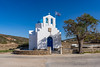


The above images may not be of the site on this page, but were taken nearby. They are loaded from Flickr so please click on them for image credits.
Click here to see more info for this site
Nearby sites
Click here to view sites on an interactive map of the areaKey: Red: member's photo, Blue: 3rd party photo, Yellow: other image, Green: no photo - please go there and take one, Grey: site destroyed
Download sites to:
KML (Google Earth)
GPX (GPS waypoints)
CSV (Garmin/Navman)
CSV (Excel)
To unlock full downloads you need to sign up as a Contributory Member. Otherwise downloads are limited to 50 sites.
Turn off the page maps and other distractions
Nearby sites listing. In the following links * = Image available
30.1km ENE 71° Yria Temple* Ancient Temple
30.8km ENE 64° Portara* Ancient Temple
33.3km E 83° Dimitras Temple* Ancient Temple
35.8km S 175° Episkopi (Sikinos)* Ancient Temple
36.3km ENE 73° Flerio Kouros* Carving
36.4km ENE 74° Potami Kouros* Carving
36.5km ENE 76° Menhir of Naxos* Standing Stone (Menhir)
38.0km ESE 114° Irakleia Spiral shaped petroglyph 2* Rock Art
38.4km ESE 114° Irakleia - Cyclades Petroglyph 1* Rock Art
38.4km ESE 114° Irakleia spiral shaped Petroglyph 4* Rock Art
38.4km ESE 114° Iracleia Calculation Grid* Carving
38.7km ESE 116° Irakleia Spiral shaped petroglyphs 3 * Rock Art
39.3km E 83° Zeus' Cave* Cave or Rock Shelter
42.1km ENE 77° Archaeological Museum of Apiranthos* Museum
48.1km ENE 64° Apollonas Kouros* Carving
49.2km NNE 22° Delos (Greece)* Ancient Temple
49.3km NNE 22° Delos Archaeological Museum* Museum
53.4km ESE 102° Keros* Sculptured Stone
53.9km NNE 27° Platys Gialos Trilithon* Ancient Village or Settlement
54.4km NNE 27° Leno Tower* Stone Fort or Dun
55.9km WSW 242° Phylakopi Ancient Village or Settlement
56.4km NNE 25° Mykonos Archaeological Museum Museum
59.3km NNE 29° Paleokastro* Hillfort
62.9km WSW 244° Milos Archaeological Museum Museum
72.0km SSE 152° Museum of Prehistoric Thera* Museum
View more nearby sites and additional images


 We would like to know more about this location. Please feel free to add a brief description and any relevant information in your own language.
 Wir möchten mehr über diese Stätte erfahren. Bitte zögern Sie nicht, eine kurze Beschreibung und relevante Informationen in Deutsch hinzuzufügen.
 Nous aimerions en savoir encore un peu sur les lieux. S'il vous plaît n'hesitez pas à ajouter une courte description et tous les renseignements pertinents dans votre propre langue.
 Quisieramos informarnos un poco más de las lugares. No dude en añadir una breve descripción y otros datos relevantes en su propio idioma.