<< Text Pages >> Gheorgheni Museum - Museum in Romania
Submitted by mfrincu on Wednesday, 23 September 2015 Page Views: 1308
MuseumsSite Name: Gheorgheni MuseumCountry: Romania
NOTE: This site is 83.97 km away from the location you searched for.
Type: Museum
Nearest Town: Gheorgheni
Latitude: 46.723550N Longitude: 25.607790E
Condition:
| 5 | Perfect |
| 4 | Almost Perfect |
| 3 | Reasonable but with some damage |
| 2 | Ruined but still recognisable as an ancient site |
| 1 | Pretty much destroyed, possibly visible as crop marks |
| 0 | No data. |
| -1 | Completely destroyed |
| 5 | Superb |
| 4 | Good |
| 3 | Ordinary |
| 2 | Not Good |
| 1 | Awful |
| 0 | No data. |
| 5 | Can be driven to, probably with disabled access |
| 4 | Short walk on a footpath |
| 3 | Requiring a bit more of a walk |
| 2 | A long walk |
| 1 | In the middle of nowhere, a nightmare to find |
| 0 | No data. |
| 5 | co-ordinates taken by GPS or official recorded co-ordinates |
| 4 | co-ordinates scaled from a detailed map |
| 3 | co-ordinates scaled from a bad map |
| 2 | co-ordinates of the nearest village |
| 1 | co-ordinates of the nearest town |
| 0 | no data |
Internal Links:
External Links:
Museum in Romania
Small museum containing a few stones with rock art on them.
You may be viewing yesterday's version of this page. To see the most up to date information please register for a free account.
Do not use the above information on other web sites or publications without permission of the contributor.
Nearby Images from Flickr
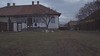
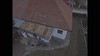
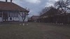
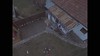


The above images may not be of the site on this page, but were taken nearby. They are loaded from Flickr so please click on them for image credits.
Click here to see more info for this site
Nearby sites
Click here to view sites on an interactive map of the areaKey: Red: member's photo, Blue: 3rd party photo, Yellow: other image, Green: no photo - please go there and take one, Grey: site destroyed
Download sites to:
KML (Google Earth)
GPX (GPS waypoints)
CSV (Garmin/Navman)
CSV (Excel)
To unlock full downloads you need to sign up as a Contributory Member. Otherwise downloads are limited to 50 sites.
Turn off the page maps and other distractions
Nearby sites listing. In the following links * = Image available
22.9km NNW 341° Teasc Mountain* Rock Art
58.7km NNW 333° Gura Haitii Petroglyphs* Rock Art
77.7km NE 52° Grumăzești - Deleni Ancient Village or Settlement
120.9km WNW 282° Ethnoarchaeological Park from Taga Ancient Village or Settlement
139.3km WNW 290° Valea Somesului Rock Art* Rock Art
139.9km WNW 296° Ciceu-Mihaiesti Menhir* Standing Stone (Menhir)
154.1km W 273° Cluj-Napoca Romanian National History Museum* Museum
157.9km SSE 155° Turtudui menhir* Standing Stone (Menhir)
158.1km W 272° Polus Tumuli* Barrow Cemetery
158.2km SSE 156° Fundul Pesterii Cave* Rock Art
158.2km SSE 156° Menhir near Fundul Pesterii* Standing Stone (Menhir)
175.3km WSW 237° Capâlna Dacian citadel Hillfort
176.7km NE 47° Buteşti, Moldova* Cave or Rock Shelter
179.2km WNW 292° Cuciulat Cave Rock Art
189.9km WSW 244° Tartaria Tablets* Rock Art
200.0km W 264° Coliboaia Cave Rock Art
203.6km E 98° Upper Trajan's Wall Misc. Earthwork
215.1km SW 236° Sarmizegetusa Regia Sanctuary* Ancient Temple
215.1km SW 236° Sarmizegetusa Regia Circle* Stone Circle
215.1km SW 236° Sarmizegetusa Regia Sacred Well* Holy Well or Sacred Spring
215.3km SW 236° Sarmizegetusa Regia citadel* Hillfort
219.1km WSW 245° Magura Uroiului* Ancient Village or Settlement
219.3km WSW 245° Simeria mound* Artificial Mound
221.6km WSW 239° Costesti-Cetatuie Dacian citadel* Hillfort
221.8km WSW 239° Costesti-Blidaru Dacian citadel* Hillfort
View more nearby sites and additional images


 We would like to know more about this location. Please feel free to add a brief description and any relevant information in your own language.
 Wir möchten mehr über diese Stätte erfahren. Bitte zögern Sie nicht, eine kurze Beschreibung und relevante Informationen in Deutsch hinzuzufügen.
 Nous aimerions en savoir encore un peu sur les lieux. S'il vous plaît n'hesitez pas à ajouter une courte description et tous les renseignements pertinents dans votre propre langue.
 Quisieramos informarnos un poco más de las lugares. No dude en añadir una breve descripción y otros datos relevantes en su propio idioma.