<< Our Photo Pages >> Karalgirio akmuo - Natural Stone / Erratic / Other Natural Feature in Lithuania
Submitted by Alta-Falisa on Sunday, 06 March 2016 Page Views: 1437
Natural PlacesSite Name: Karalgirio akmuoCountry: Lithuania
NOTE: This site is 8.352 km away from the location you searched for.
Type: Natural Stone / Erratic / Other Natural Feature
Nearest Town: Kaunas
Latitude: 55.136500N Longitude: 23.688200E
Condition:
| 5 | Perfect |
| 4 | Almost Perfect |
| 3 | Reasonable but with some damage |
| 2 | Ruined but still recognisable as an ancient site |
| 1 | Pretty much destroyed, possibly visible as crop marks |
| 0 | No data. |
| -1 | Completely destroyed |
| 5 | Superb |
| 4 | Good |
| 3 | Ordinary |
| 2 | Not Good |
| 1 | Awful |
| 0 | No data. |
| 5 | Can be driven to, probably with disabled access |
| 4 | Short walk on a footpath |
| 3 | Requiring a bit more of a walk |
| 2 | A long walk |
| 1 | In the middle of nowhere, a nightmare to find |
| 0 | No data. |
| 5 | co-ordinates taken by GPS or official recorded co-ordinates |
| 4 | co-ordinates scaled from a detailed map |
| 3 | co-ordinates scaled from a bad map |
| 2 | co-ordinates of the nearest village |
| 1 | co-ordinates of the nearest town |
| 0 | no data |
Internal Links:
External Links:
")
Random boulder on the southern edge of road 1925.
Anciently used as a landmark along a path which became a track then a road, it is now surrounded by a crescent of trees.
Karalgiris is the name of the spot about 500 m to the West.
About 1500 m to the East (along the same road towards the highway A1 ; signposted at (55.1373, 23.7111)), you will find a memorial to the
Uprising of 1863.
You may be viewing yesterday's version of this page. To see the most up to date information please register for a free account.
")
")
")
")
Do not use the above information on other web sites or publications without permission of the contributor.
Nearby Images from Flickr
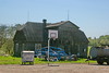
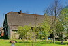
The above images may not be of the site on this page, but were taken nearby. They are loaded from Flickr so please click on them for image credits.
Click here to see more info for this site
Nearby sites
Click here to view sites on an interactive map of the areaKey: Red: member's photo, Blue: 3rd party photo, Yellow: other image, Green: no photo - please go there and take one, Grey: site destroyed
Download sites to:
KML (Google Earth)
GPX (GPS waypoints)
CSV (Garmin/Navman)
CSV (Excel)
To unlock full downloads you need to sign up as a Contributory Member. Otherwise downloads are limited to 50 sites.
Turn off the page maps and other distractions
Nearby sites listing. In the following links * = Image available
28.4km NNE 27° Dotnuvo akmuo* Modern Stone Circle etc
29.1km SSE 155° Santakos parkas* Modern Stone Circle etc
57.5km E 89° Juozapavos akmuo* Natural Stone / Erratic / Other Natural Feature
64.8km S 180° Šakališkių piliakalnis* Artificial Mound
66.8km SW 232° Lithuanian Millenium Stone* Modern Stone Circle etc
67.7km S 180° Gudelių akmuo* Natural Stone / Erratic / Other Natural Feature
68.5km ESE 111° Laukagalio akmuo su dubenėliais* Rock Art
69.0km SE 127° Girelių akmuo* Natural Stone / Erratic / Other Natural Feature
69.7km E 79° Ukmergės piliakalnis* Artificial Mound
69.9km ESE 112° Zasliai Footprint Stone* Rock Art
71.5km SSW 193° Padovinio piliakalnis* Artificial Mound
71.8km SW 220° Vilkaviškio krašto akmuo* Marker Stone
72.6km S 188° Varnupių piliakalnis* Artificial Mound
72.8km S 188° Varnupių akmuo* Natural Stone / Erratic / Other Natural Feature
73.3km S 180° Riečių piliakalnis* Artificial Mound
74.7km NW 308° Kriaučiaus akmuo* Natural Stone / Erratic / Other Natural Feature
79.0km S 184° Bambininkų piliakalnis* Artificial Mound
90.3km W 279° Tauragė's 500th Anniversary Stone* Modern Stone Circle etc
95.0km ENE 65° Puntuko akmuo* Natural Stone / Erratic / Other Natural Feature
97.3km SW 221° Vištyčio akmuo* Natural Stone / Erratic / Other Natural Feature
98.4km SSE 167° Didysis Dzūkijos akmuo* Natural Stone / Erratic / Other Natural Feature
101.6km WNW 303° Didžiųjų Vankių akmuo* Natural Stone / Erratic / Other Natural Feature
102.9km WNW 302° Požerė akmuo* Natural Stone / Erratic / Other Natural Feature
106.2km W 268° Rambyno kalno akmuo* Marker Stone
112.3km SSE 155° Perlojos akmuo* Marker Stone
View more nearby sites and additional images


 We would like to know more about this location. Please feel free to add a brief description and any relevant information in your own language.
 Wir möchten mehr über diese Stätte erfahren. Bitte zögern Sie nicht, eine kurze Beschreibung und relevante Informationen in Deutsch hinzuzufügen.
 Nous aimerions en savoir encore un peu sur les lieux. S'il vous plaît n'hesitez pas à ajouter une courte description et tous les renseignements pertinents dans votre propre langue.
 Quisieramos informarnos un poco más de las lugares. No dude en añadir una breve descripción y otros datos relevantes en su propio idioma.