


<< Text Pages >> Orchomenos (Arcadia) - Ancient Village or Settlement in Greece in Peloponnese Peninsula
Submitted by davidmorgan on Friday, 04 June 2021 Page Views: 359
Roman, Greek and ClassicalSite Name: Orchomenos (Arcadia)Country: Greece Region: Peloponnese Peninsula Type: Ancient Village or Settlement
Nearest Town: Levidi
Latitude: 37.724000N Longitude: 22.315000E
Condition:
| 5 | Perfect |
| 4 | Almost Perfect |
| 3 | Reasonable but with some damage |
| 2 | Ruined but still recognisable as an ancient site |
| 1 | Pretty much destroyed, possibly visible as crop marks |
| 0 | No data. |
| -1 | Completely destroyed |
| 5 | Superb |
| 4 | Good |
| 3 | Ordinary |
| 2 | Not Good |
| 1 | Awful |
| 0 | No data. |
| 5 | Can be driven to, probably with disabled access |
| 4 | Short walk on a footpath |
| 3 | Requiring a bit more of a walk |
| 2 | A long walk |
| 1 | In the middle of nowhere, a nightmare to find |
| 0 | No data. |
| 5 | co-ordinates taken by GPS or official recorded co-ordinates |
| 4 | co-ordinates scaled from a detailed map |
| 3 | co-ordinates scaled from a bad map |
| 2 | co-ordinates of the nearest village |
| 1 | co-ordinates of the nearest town |
| 0 | no data |
Internal Links:
External Links:
Ancient Settlement in Peloponnese Peninsula
An Arcadian Greek city from the 7th century BCE.
You may be viewing yesterday's version of this page. To see the most up to date information please register for a free account.
Do not use the above information on other web sites or publications without permission of the contributor.
Nearby Images from Flickr
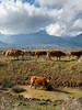
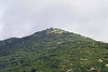
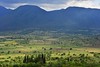


The above images may not be of the site on this page, but were taken nearby. They are loaded from Flickr so please click on them for image credits.
Click here to see more info for this site
Nearby sites
Click here to view sites on an interactive map of the areaKey: Red: member's photo, Blue: 3rd party photo, Yellow: other image, Green: no photo - please go there and take one, Grey: site destroyed
Download sites to:
KML (Google Earth)
GPX (GPS waypoints)
CSV (Garmin/Navman)
CSV (Excel)
To unlock full downloads you need to sign up as a Contributory Member. Otherwise downloads are limited to 50 sites.
Turn off the page maps and other distractions
Nearby sites listing. In the following links * = Image available
18.0km SSE 149° Mantinea Ancient Village or Settlement
26.9km ENE 61° Aidonia* Rock Cut Tomb
31.3km SSE 163° Tegea Ancient Village or Settlement
31.4km SW 229° Gortyna Ancient Temple
31.4km SSE 163° Tegea Museum* Museum
32.3km ENE 65° Phlius* Ancient Village or Settlement
34.1km S 190° Asea Ancient Temple
34.8km S 180° Peraitheis Ancient Temple
34.9km ESE 116° Hellenikon Pyramid* Pyramid / Mastaba
36.0km ENE 75° Nemea* Ancient Village or Settlement
36.2km ENE 75° Nemea stadium* Ancient Temple
37.1km ESE 106° Argos Agora* Ancient Village or Settlement
38.2km ESE 105° Argos Museum* Museum
38.2km E 89° Cyclopean Tomb* Cairn
38.2km E 89° Tomb of the Genii Cairn
38.2km SSW 206° Ancient Megalopoli* Ancient Temple
38.2km E 89° Kato Fournos Tomb* Cairn
38.2km E 89° Mycene tomb (9) of the Cyclops* Chambered Tomb
38.4km E 89° Pano Fournos Tomb* Cairn
38.4km E 89° Panagitsa Tomb* Cairn
38.6km E 89° Treasury of Atreus* Chambered Cairn
38.6km SSW 205° Ancient theater of Megalopolis* Ancient Village or Settlement
38.7km E 89° Tholos Of Clytaemnestra* Chambered Cairn
38.7km E 89° Tholos Of the Lions* Chambered Cairn
38.7km E 89° Tholos Of Aegistus* Chambered Cairn
View more nearby sites and additional images


 We would like to know more about this location. Please feel free to add a brief description and any relevant information in your own language.
 Wir möchten mehr über diese Stätte erfahren. Bitte zögern Sie nicht, eine kurze Beschreibung und relevante Informationen in Deutsch hinzuzufügen.
 Nous aimerions en savoir encore un peu sur les lieux. S'il vous plaît n'hesitez pas à ajouter une courte description et tous les renseignements pertinents dans votre propre langue.
 Quisieramos informarnos un poco más de las lugares. No dude en añadir una breve descripción y otros datos relevantes en su propio idioma.