<< Text Pages >> Bylazora - Ancient Village or Settlement in North Macedonia
Submitted by coldrum on Friday, 02 October 2009 Page Views: 7515
DigsSite Name: BylazoraCountry: North Macedonia
NOTE: This site is 31.756 km away from the location you searched for.
Type: Ancient Village or Settlement
Nearest Town: Sveti Nikole Nearest Village: Knezje
Latitude: 41.847278N Longitude: 21.912531E
Condition:
| 5 | Perfect |
| 4 | Almost Perfect |
| 3 | Reasonable but with some damage |
| 2 | Ruined but still recognisable as an ancient site |
| 1 | Pretty much destroyed, possibly visible as crop marks |
| 0 | No data. |
| -1 | Completely destroyed |
| 5 | Superb |
| 4 | Good |
| 3 | Ordinary |
| 2 | Not Good |
| 1 | Awful |
| 0 | No data. |
| 5 | Can be driven to, probably with disabled access |
| 4 | Short walk on a footpath |
| 3 | Requiring a bit more of a walk |
| 2 | A long walk |
| 1 | In the middle of nowhere, a nightmare to find |
| 0 | No data. |
| 5 | co-ordinates taken by GPS or official recorded co-ordinates |
| 4 | co-ordinates scaled from a detailed map |
| 3 | co-ordinates scaled from a bad map |
| 2 | co-ordinates of the nearest village |
| 1 | co-ordinates of the nearest town |
| 0 | no data |
Internal Links:
External Links:
Ancient Village or Settlement in Macedonia (FYROM).
Ancient city going back to the seventh century BC in Macedonia and is currently under excavation.
Texas Foundation for Archaeological & Historical Research (TFAHR)
You may be viewing yesterday's version of this page. To see the most up to date information please register for a free account.
Do not use the above information on other web sites or publications without permission of the contributor.
Nearby Images from Flickr
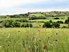

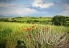


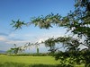
The above images may not be of the site on this page, but were taken nearby. They are loaded from Flickr so please click on them for image credits.
Click here to see more info for this site
Nearby sites
Click here to view sites on an interactive map of the areaKey: Red: member's photo, Blue: 3rd party photo, Yellow: other image, Green: no photo - please go there and take one, Grey: site destroyed
Download sites to:
KML (Google Earth)
GPX (GPS waypoints)
CSV (Garmin/Navman)
CSV (Excel)
To unlock full downloads you need to sign up as a Contributory Member. Otherwise downloads are limited to 50 sites.
Turn off the page maps and other distractions
Nearby sites listing. In the following links * = Image available
27.3km NW 310° The Sacred Stone of Tekia Standing Stone (Menhir)
33.1km S 171° Stobi* Ancient Village or Settlement
46.2km N 354° Kokino* Rock Outcrop
46.5km N 4° Cocev Kamen* Cave or Rock Shelter
63.8km SSW 204° The Great Goddess with three faces* Natural Stone / Erratic / Other Natural Feature
75.3km SE 128° Tsarevi Kuli Ancient Village or Settlement
76.2km SSW 201° Pavla chuka Burial Chamber or Dolmen
79.4km ENE 73° Piyanets Museum Museum
79.6km N 2° Maniste Necropolis* Barrow Cemetery
104.4km SSW 207° Heraclea* Ancient Village or Settlement
117.5km S 174° Edessa* Ancient Village or Settlement
123.8km SW 229° Ohrid Ancient Village or Settlement
124.1km SW 229° Saint Pantelejmon Church - Plaosnik Monastery Ohrid* Ancient Temple
125.6km NNW 348° Caričin Grad* Ancient Village or Settlement
126.8km SSE 158° Giannitsa Archontikon* Ancient Village or Settlement
128.4km NE 36° Sacred Nuraghe Well (Garlo)* Holy Well or Sacred Spring
131.5km SSE 157° Pella (Greece)* Ancient Village or Settlement
132.1km NE 46° Krivi Kamik* Hillfort
132.8km SW 225° Ohrid Bay of Bones Museum* Ancient Village or Settlement
134.0km S 172° Fleurons Macedonian Tomb* Chambered Tomb
134.0km S 172° Krisis Macedonian Tomb* Chambered Tomb
134.1km S 172° Lyson and Kallicleus Macedonian Tomb* Chambered Tomb
134.1km S 172° Kinch's Macedonian Tomb* Chambered Tomb
136.0km S 173° Mieza* Ancient Village or Settlement
136.2km S 173° School of Aristotle* NOT SET
View more nearby sites and additional images


 We would like to know more about this location. Please feel free to add a brief description and any relevant information in your own language.
 Wir möchten mehr über diese Stätte erfahren. Bitte zögern Sie nicht, eine kurze Beschreibung und relevante Informationen in Deutsch hinzuzufügen.
 Nous aimerions en savoir encore un peu sur les lieux. S'il vous plaît n'hesitez pas à ajouter une courte description et tous les renseignements pertinents dans votre propre langue.
 Quisieramos informarnos un poco más de las lugares. No dude en añadir una breve descripción y otros datos relevantes en su propio idioma.