

<< Our Photo Pages >> Slottsbergkjerringa - Natural Stone / Erratic / Other Natural Feature in Norway
Submitted by kenntha88 on Wednesday, 21 November 2007 Page Views: 2604
Natural PlacesSite Name: Slottsbergkjerringa Alternative Name: Slottsberget sacrificial siteCountry: Norway Type: Natural Stone / Erratic / Other Natural Feature
Nearest Town: Alta
Latitude: 70.121512N Longitude: 23.370066E
Condition:
| 5 | Perfect |
| 4 | Almost Perfect |
| 3 | Reasonable but with some damage |
| 2 | Ruined but still recognisable as an ancient site |
| 1 | Pretty much destroyed, possibly visible as crop marks |
| 0 | No data. |
| -1 | Completely destroyed |
| 5 | Superb |
| 4 | Good |
| 3 | Ordinary |
| 2 | Not Good |
| 1 | Awful |
| 0 | No data. |
| 5 | Can be driven to, probably with disabled access |
| 4 | Short walk on a footpath |
| 3 | Requiring a bit more of a walk |
| 2 | A long walk |
| 1 | In the middle of nowhere, a nightmare to find |
| 0 | No data. |
| 5 | co-ordinates taken by GPS or official recorded co-ordinates |
| 4 | co-ordinates scaled from a detailed map |
| 3 | co-ordinates scaled from a bad map |
| 2 | co-ordinates of the nearest village |
| 1 | co-ordinates of the nearest town |
| 0 | no data |
Internal Links:
External Links:
")
It looks very similar with the site "Skarmunken", but this is not a rock laying on itself, this is more like a part of the mountainside.
It is more like sacrificial sites not far away from this site, and it has been a site important for the old sami population, and not far from the rock carvings at Alta. Maybe it has been in use in older times?
The climate here can be rough with strong winds and cold, and climbing the loose rocks up to this site was a hazardous trip!
The name can be best translated to something like: "The castle-cliff woman".
Note: Finnmark county
You may be viewing yesterday's version of this page. To see the most up to date information please register for a free account.
")
")
Do not use the above information on other web sites or publications without permission of the contributor.
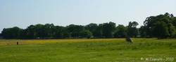
Nearby Images from Flickr
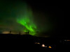

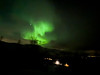
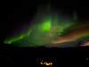

The above images may not be of the site on this page, but were taken nearby. They are loaded from Flickr so please click on them for image credits.
Click here to see more info for this site
Nearby sites
Click here to view sites on an interactive map of the areaKey: Red: member's photo, Blue: 3rd party photo, Yellow: other image, Green: no photo - please go there and take one, Grey: site destroyed
Download sites to:
KML (Google Earth)
GPX (GPS waypoints)
CSV (Garmin/Navman)
CSV (Excel)
To unlock full downloads you need to sign up as a Contributory Member. Otherwise downloads are limited to 50 sites.
Turn off the page maps and other distractions
Nearby sites listing. In the following links * = Image available
934m S 174° Kviby sacrificial site* Natural Stone / Erratic / Other Natural Feature
9.3km SW 224° Djupvika sacrificial site* Natural Stone / Erratic / Other Natural Feature
15.2km SSW 192° Amtmannsnes* Carving
15.2km SSW 194° Komsa sacrificial site* Natural Stone / Erratic / Other Natural Feature
15.3km SSE 162° Transfardalen* Cave or Rock Shelter
20.5km SSW 200° Alta (Norway)* Rock Art
20.6km SSW 200° Hjemmeluft stone age settlement* Ancient Village or Settlement
47.0km NNE 23° Stallogargo sacrificial site* Natural Stone / Erratic / Other Natural Feature
151.2km WSW 250° Skarmunken* Natural Stone / Erratic / Other Natural Feature
177.3km WSW 237° Nordkjosbotn sacrificial site* Natural Stone / Erratic / Other Natural Feature
178.9km WSW 254° University Museum, Tromso* Museum
179.6km WSW 242° Balsfjord rock carvings* Carving
183.0km WSW 256° Håkøya* Ancient Village or Settlement
187.8km WSW 253° Skavberget* Rock Art
199.8km WSW 242° Mårfjellskardet sacrificial site* Natural Stone / Erratic / Other Natural Feature
201.3km SE 129° Ukonkivi Round Cairn
208.8km WSW 254° Greipstad* Ancient Village or Settlement
210.0km WSW 257° Sandvik* Ancient Village or Settlement
210.9km WSW 255° Buvika* Barrow Cemetery
211.1km WSW 257° Brensholmen stone age settlement* Ancient Village or Settlement
211.4km WSW 258° Sommarøy* Ancient Village or Settlement
212.3km WSW 257° Brensholmen iron age settlement* Ancient Village or Settlement
260.2km WSW 240° Andasteinen* Natural Stone / Erratic / Other Natural Feature
260.7km SW 235° Lapphaugen sacrificial site* Natural Stone / Erratic / Other Natural Feature
260.8km WSW 253° Grunnfarnes Neolithic Settlement* Ancient Village or Settlement
View more nearby sites and additional images


 We would like to know more about this location. Please feel free to add a brief description and any relevant information in your own language.
 Wir möchten mehr über diese Stätte erfahren. Bitte zögern Sie nicht, eine kurze Beschreibung und relevante Informationen in Deutsch hinzuzufügen.
 Nous aimerions en savoir encore un peu sur les lieux. S'il vous plaît n'hesitez pas à ajouter une courte description et tous les renseignements pertinents dans votre propre langue.
 Quisieramos informarnos un poco más de las lugares. No dude en añadir una breve descripción y otros datos relevantes en su propio idioma.