<< Our Photo Pages >> Edessa - Ancient Village or Settlement in Greece in Northern Greece
Submitted by Armand on Tuesday, 01 January 2019 Page Views: 1102
Multi-periodSite Name: EdessaCountry: Greece Region: Northern Greece Type: Ancient Village or Settlement
Nearest Town: Edessa
Latitude: 40.796500N Longitude: 22.057300E
Condition:
| 5 | Perfect |
| 4 | Almost Perfect |
| 3 | Reasonable but with some damage |
| 2 | Ruined but still recognisable as an ancient site |
| 1 | Pretty much destroyed, possibly visible as crop marks |
| 0 | No data. |
| -1 | Completely destroyed |
| 5 | Superb |
| 4 | Good |
| 3 | Ordinary |
| 2 | Not Good |
| 1 | Awful |
| 0 | No data. |
| 5 | Can be driven to, probably with disabled access |
| 4 | Short walk on a footpath |
| 3 | Requiring a bit more of a walk |
| 2 | A long walk |
| 1 | In the middle of nowhere, a nightmare to find |
| 0 | No data. |
| 5 | co-ordinates taken by GPS or official recorded co-ordinates |
| 4 | co-ordinates scaled from a detailed map |
| 3 | co-ordinates scaled from a bad map |
| 2 | co-ordinates of the nearest village |
| 1 | co-ordinates of the nearest town |
| 0 | no data |
Internal Links:
External Links:
")
According to some ancient writers, Caranus, the legendary founder of the Argead Dynasty (whose most famous member was Alexander the Great), established the city of Edessa and made it the first capital of ancient Macedon, and later Argead rulers moved Macedon's capital to Aegae and eventually Pella. Archaeological remains have been discovered on the site of ancient Edessa, just below the modern city. The walls and many buildings have been unearthed so far. A colonnade with inscription in Greek dates from Roman times. The city achieved certain prominence in the first centuries AD, being located on the Via Egnatia. From 27 BC to 268 AD it had its own mint.
For more information click here.
You may be viewing yesterday's version of this page. To see the most up to date information please register for a free account.
")
")
")
")
Do not use the above information on other web sites or publications without permission of the contributor.
Nearby Images from Flickr

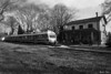


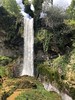
The above images may not be of the site on this page, but were taken nearby. They are loaded from Flickr so please click on them for image credits.
Click here to see more info for this site
Nearby sites
Click here to view sites on an interactive map of the areaKey: Red: member's photo, Blue: 3rd party photo, Yellow: other image, Green: no photo - please go there and take one, Grey: site destroyed
Download sites to:
KML (Google Earth)
GPX (GPS waypoints)
CSV (Garmin/Navman)
CSV (Excel)
To unlock full downloads you need to sign up as a Contributory Member. Otherwise downloads are limited to 50 sites.
Turn off the page maps and other distractions
Nearby sites listing. In the following links * = Image available
17.1km SSE 160° Lyson and Kallicleus Macedonian Tomb* Chambered Tomb
17.2km SSE 157° Krisis Macedonian Tomb* Chambered Tomb
17.2km SSE 159° Kinch's Macedonian Tomb* Chambered Tomb
17.2km SSE 156° Fleurons Macedonian Tomb* Chambered Tomb
18.6km S 169° Mieza* Ancient Village or Settlement
18.8km S 169° School of Aristotle* NOT SET
34.5km E 92° Giannitsa Archontikon* Ancient Village or Settlement
39.1km E 97° Pella (Greece)* Ancient Village or Settlement
40.9km SSE 147° Tomb of Philip II* Chambered Cairn
41.8km SSE 148° Vergina* Ancient Village or Settlement
60.2km NW 319° Pavla chuka Burial Chamber or Dolmen
64.7km WNW 292° Heraclea* Ancient Village or Settlement
66.5km SE 134° Pydna* Ancient Village or Settlement
69.8km NNW 327° The Great Goddess with three faces* Natural Stone / Erratic / Other Natural Feature
78.1km ESE 107° Karabournaki* Ancient Village or Settlement
78.1km SSE 152° Dio.* Ancient Village or Settlement
84.5km N 355° Stobi* Ancient Village or Settlement
85.4km NE 34° Tsarevi Kuli Ancient Village or Settlement
108.1km WNW 282° Ohrid Bay of Bones Museum* Ancient Village or Settlement
111.9km WNW 289° Ohrid Ancient Village or Settlement
111.9km W 264° Vashtëmi* Ancient Village or Settlement
112.0km WNW 289° Saint Pantelejmon Church - Plaosnik Monastery Ohrid* Ancient Temple
115.7km WSW 256° Kamenicë Tumulus Round Barrow(s)
117.5km N 354° Bylazora Ancient Village or Settlement
125.5km SSW 197° Metéora* Natural Stone / Erratic / Other Natural Feature
View more nearby sites and additional images


 We would like to know more about this location. Please feel free to add a brief description and any relevant information in your own language.
 Wir möchten mehr über diese Stätte erfahren. Bitte zögern Sie nicht, eine kurze Beschreibung und relevante Informationen in Deutsch hinzuzufügen.
 Nous aimerions en savoir encore un peu sur les lieux. S'il vous plaît n'hesitez pas à ajouter une courte description et tous les renseignements pertinents dans votre propre langue.
 Quisieramos informarnos un poco más de las lugares. No dude en añadir una breve descripción y otros datos relevantes en su propio idioma.