<< Text Pages >> Kurhany Huzele - Barrow Cemetery in Poland in Podkarpackie
Submitted by SolarMegalith on Thursday, 12 May 2011 Page Views: 3222
Neolithic and Bronze AgeSite Name: Kurhany Huzele Alternative Name: Huzele Barrow CemeteryCountry: Poland
NOTE: This site is 12.975 km away from the location you searched for.
Voivodeship: Podkarpackie Type: Barrow Cemetery
Nearest Town: Lesko Nearest Village: Huzele
Latitude: 49.464515N Longitude: 22.304893E
Condition:
| 5 | Perfect |
| 4 | Almost Perfect |
| 3 | Reasonable but with some damage |
| 2 | Ruined but still recognisable as an ancient site |
| 1 | Pretty much destroyed, possibly visible as crop marks |
| 0 | No data. |
| -1 | Completely destroyed |
| 5 | Superb |
| 4 | Good |
| 3 | Ordinary |
| 2 | Not Good |
| 1 | Awful |
| 0 | No data. |
| 5 | Can be driven to, probably with disabled access |
| 4 | Short walk on a footpath |
| 3 | Requiring a bit more of a walk |
| 2 | A long walk |
| 1 | In the middle of nowhere, a nightmare to find |
| 0 | No data. |
| 5 | co-ordinates taken by GPS or official recorded co-ordinates |
| 4 | co-ordinates scaled from a detailed map |
| 3 | co-ordinates scaled from a bad map |
| 2 | co-ordinates of the nearest village |
| 1 | co-ordinates of the nearest town |
| 0 | no data |
Internal Links:
External Links:
Barrow Cemetery in Podkarpackie
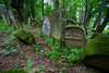
A large early medieval barrow cemetery is located west of the village of Huzele, in a forest called Gruszka, not far from the 2nd WW execution sites. The cemetery includes some 30-40 round barrows of 0.5-0.8m height.
You may be viewing yesterday's version of this page. To see the most up to date information please register for a free account.
Do not use the above information on other web sites or publications without permission of the contributor.
Nearby Images from Flickr
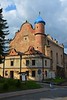
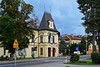
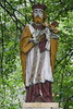

The above images may not be of the site on this page, but were taken nearby. They are loaded from Flickr so please click on them for image credits.
Click here to see more info for this site
Nearby sites
Click here to view sites on an interactive map of the areaKey: Red: member's photo, Blue: 3rd party photo, Yellow: other image, Green: no photo - please go there and take one, Grey: site destroyed
Download sites to:
KML (Google Earth)
GPX (GPS waypoints)
CSV (Garmin/Navman)
CSV (Excel)
To unlock full downloads you need to sign up as a Contributory Member. Otherwise downloads are limited to 50 sites.
Turn off the page maps and other distractions
Nearby sites listing. In the following links * = Image available
4.7km SSE 156° Grodzisko Hoczew* Hillfort
7.1km E 84° Kurhan Uherce Mineralne Round Barrow(s)
23.1km SSE 153° Studenne Earthwork Misc. Earthwork
33.4km NE 45° Grodzisko Kopyśno Hillfort
36.9km NE 51° Grodzisko Aksmanice Hillfort
45.1km NNE 22° Kurhan Średnia 5* Round Barrow(s)
45.4km NNE 23° Kurhan Średnia 4* Round Barrow(s)
45.5km NNE 23° Kurhan Średnia 3* Round Barrow(s)
45.5km NNE 24° Kurhan Średnia 2* Round Barrow(s)
45.6km NNE 24° Kurhan Średnia 1* Round Barrow(s)
45.9km WNW 291° Grodzisko Wietrzno* Promontory Fort / Cliff Castle
49.0km NNE 25° Grodzisko Tuligłowy* Hillfort
49.2km NW 311° Kurhany Czarnorzeki Barrow Cemetery
61.4km W 281° Grodzisko Walik - Brzezowa* Hillfort
64.4km NW 304° Kurhany Bierówka* Barrow Cemetery
67.1km NNW 341° Muzeum Okręgowe w Rzeszowie* Museum
68.9km NE 44° Kopiec Gaje Round Barrow(s)
69.5km WNW 296° Trzcinica - Ekspozycja Archeologiczna* Museum
69.7km WNW 296° Grodzisko Trzcinica* Hillfort
80.9km NW 324° Kurhan Witkowice Round Barrow(s)
81.9km NNW 340° Grodzisko Budy Głogowskie* Hillfort
84.8km NW 306° Grodzisko Przeczyca* Hillfort
110.0km WNW 302° Grodzisko Zawada (Tarnów)* Hillfort
116.2km WNW 294° Grodzisko Roztoka* Promontory Fort / Cliff Castle
118.0km WNW 293° Grodzisko Zawada Lanckorońska* Hillfort
View more nearby sites and additional images


 We would like to know more about this location. Please feel free to add a brief description and any relevant information in your own language.
 Wir möchten mehr über diese Stätte erfahren. Bitte zögern Sie nicht, eine kurze Beschreibung und relevante Informationen in Deutsch hinzuzufügen.
 Nous aimerions en savoir encore un peu sur les lieux. S'il vous plaît n'hesitez pas à ajouter une courte description et tous les renseignements pertinents dans votre propre langue.
 Quisieramos informarnos un poco más de las lugares. No dude en añadir una breve descripción y otros datos relevantes en su propio idioma.