<< Text Pages >> Kurhany Czarnorzeki - Barrow Cemetery in Poland in Podkarpackie
Submitted by SolarMegalith on Sunday, 01 May 2011 Page Views: 2734
Neolithic and Bronze AgeSite Name: Kurhany Czarnorzeki Alternative Name: Czarnorzeki Barrow CemeteryCountry: Poland Voivodeship: Podkarpackie Type: Barrow Cemetery
Nearest Village: Odrzykoń
Latitude: 49.756100N Longitude: 21.791810E
Condition:
| 5 | Perfect |
| 4 | Almost Perfect |
| 3 | Reasonable but with some damage |
| 2 | Ruined but still recognisable as an ancient site |
| 1 | Pretty much destroyed, possibly visible as crop marks |
| 0 | No data. |
| -1 | Completely destroyed |
| 5 | Superb |
| 4 | Good |
| 3 | Ordinary |
| 2 | Not Good |
| 1 | Awful |
| 0 | No data. |
| 5 | Can be driven to, probably with disabled access |
| 4 | Short walk on a footpath |
| 3 | Requiring a bit more of a walk |
| 2 | A long walk |
| 1 | In the middle of nowhere, a nightmare to find |
| 0 | No data. |
| 5 | co-ordinates taken by GPS or official recorded co-ordinates |
| 4 | co-ordinates scaled from a detailed map |
| 3 | co-ordinates scaled from a bad map |
| 2 | co-ordinates of the nearest village |
| 1 | co-ordinates of the nearest town |
| 0 | no data |
Internal Links:
External Links:
Barrow Cemetery in Podkarpackie
The large barrow cemetery consisting of 100 small mounds is located 1km north of the ruins of the Kamieniec castle. The site is dated for the early medieval period, the excavated barrows contained cremation burials.
You may be viewing yesterday's version of this page. To see the most up to date information please register for a free account.
Do not use the above information on other web sites or publications without permission of the contributor.
Nearby Images from Flickr
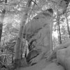
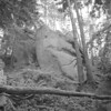
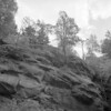
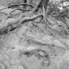
The above images may not be of the site on this page, but were taken nearby. They are loaded from Flickr so please click on them for image credits.
Click here to see more info for this site
Nearby sites
Click here to view sites on an interactive map of the areaKey: Red: member's photo, Blue: 3rd party photo, Yellow: other image, Green: no photo - please go there and take one, Grey: site destroyed
Download sites to:
KML (Google Earth)
GPX (GPS waypoints)
CSV (Garmin/Navman)
CSV (Excel)
To unlock full downloads you need to sign up as a Contributory Member. Otherwise downloads are limited to 50 sites.
Turn off the page maps and other distractions
Nearby sites listing. In the following links * = Image available
16.9km WNW 281° Kurhany Bierówka* Barrow Cemetery
17.1km SSW 200° Grodzisko Wietrzno* Promontory Fort / Cliff Castle
25.9km W 264° Trzcinica - Ekspozycja Archeologiczna* Museum
26.1km W 264° Grodzisko Trzcinica* Hillfort
31.2km SW 228° Grodzisko Walik - Brzezowa* Hillfort
34.5km NNE 26° Muzeum Okręgowe w Rzeszowie* Museum
34.8km NNW 343° Kurhan Witkowice Round Barrow(s)
36.2km WNW 297° Grodzisko Przeczyca* Hillfort
45.0km N 10° Grodzisko Budy Głogowskie* Hillfort
49.2km SE 131° Kurhany Huzele Barrow Cemetery
53.5km SE 133° Grodzisko Hoczew* Hillfort
54.2km SE 126° Kurhan Uherce Mineralne Round Barrow(s)
54.9km E 80° Kurhan Średnia 5* Round Barrow(s)
55.3km E 80° Kurhan Średnia 4* Round Barrow(s)
55.7km E 80° Kurhan Średnia 3* Round Barrow(s)
55.8km E 80° Kurhan Średnia 2* Round Barrow(s)
56.0km E 80° Kurhan Średnia 1* Round Barrow(s)
59.0km ENE 78° Grodzisko Tuligłowy* Hillfort
61.0km E 98° Grodzisko Kopyśno Hillfort
62.0km WNW 295° Grodzisko Zawada (Tarnów)* Hillfort
66.3km E 98° Grodzisko Aksmanice Hillfort
70.9km WNW 281° Grodzisko Roztoka* Promontory Fort / Cliff Castle
71.1km SE 138° Studenne Earthwork Misc. Earthwork
73.0km W 281° Grodzisko Zawada Lanckorońska* Hillfort
76.7km W 270° Grodzisko Małpia Wyspa* Hillfort
View more nearby sites and additional images


 We would like to know more about this location. Please feel free to add a brief description and any relevant information in your own language.
 Wir möchten mehr über diese Stätte erfahren. Bitte zögern Sie nicht, eine kurze Beschreibung und relevante Informationen in Deutsch hinzuzufügen.
 Nous aimerions en savoir encore un peu sur les lieux. S'il vous plaît n'hesitez pas à ajouter une courte description et tous les renseignements pertinents dans votre propre langue.
 Quisieramos informarnos un poco más de las lugares. No dude en añadir una breve descripción y otros datos relevantes en su propio idioma.