<< Other Photo Pages >> Thermos - Ancient Village or Settlement in Greece in Central Greece
Submitted by AlexHunger on Sunday, 29 October 2006 Page Views: 8066
Multi-periodSite Name: Thermos Alternative Name: Thermon Sanctuary of ApolloCountry: Greece
NOTE: This site is 26.876 km away from the location you searched for.
Region: Central Greece Type: Ancient Village or Settlement
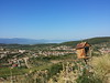
Nearest Town: Lamia Nearest Village: Thérmon
Latitude: 38.558783N Longitude: 21.667571E
Condition:
| 5 | Perfect |
| 4 | Almost Perfect |
| 3 | Reasonable but with some damage |
| 2 | Ruined but still recognisable as an ancient site |
| 1 | Pretty much destroyed, possibly visible as crop marks |
| 0 | No data. |
| -1 | Completely destroyed |
| 5 | Superb |
| 4 | Good |
| 3 | Ordinary |
| 2 | Not Good |
| 1 | Awful |
| 0 | No data. |
| 5 | Can be driven to, probably with disabled access |
| 4 | Short walk on a footpath |
| 3 | Requiring a bit more of a walk |
| 2 | A long walk |
| 1 | In the middle of nowhere, a nightmare to find |
| 0 | No data. |
| 5 | co-ordinates taken by GPS or official recorded co-ordinates |
| 4 | co-ordinates scaled from a detailed map |
| 3 | co-ordinates scaled from a bad map |
| 2 | co-ordinates of the nearest village |
| 1 | co-ordinates of the nearest town |
| 0 | no data |
Internal Links:
External Links:
")
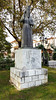
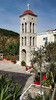
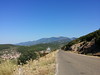
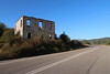
Ancient Settlement with 3rd century BCE temple of Apollo, Stoa and habitations.
You may be viewing yesterday's version of this page. To see the most up to date information please register for a free account.
Do not use the above information on other web sites or publications without permission of the contributor.
davidmorgan has found this location on Google Street View:
Nearby Images from Flickr
The above images may not be of the site on this page, but were taken nearby. They are loaded from Flickr so please click on them for image credits.
Click here to see more info for this site
Nearby sites
Click here to view sites on an interactive map of the areaKey: Red: member's photo, Blue: 3rd party photo, Yellow: other image, Green: no photo - please go there and take one, Grey: site destroyed
Download sites to:
KML (Google Earth)
GPX (GPS waypoints)
CSV (Garmin/Navman)
CSV (Excel)
To unlock full downloads you need to sign up as a Contributory Member. Otherwise downloads are limited to 50 sites.
Turn off the page maps and other distractions
Nearby sites listing. In the following links * = Image available
20.6km SSE 160° Velvina Temple Ancient Temple
23.8km SSW 210° Calydon* Ancient Village or Settlement
24.0km SSW 210° Laphrion Sanctuary of Artemis Laphria and Apollo Laphrios Ancient Temple
25.0km SW 220° Alikyrna* Ancient Village or Settlement
27.9km SW 234° Pleuron* Ancient Village or Settlement
32.3km WNW 293° Stratos necropolis* Ancient Village or Settlement
32.7km WNW 293° Stratos theatre* Ancient Village or Settlement
33.4km WNW 292° Stratos Temple of Zeus* Ancient Temple
51.2km SSE 168° Chalandritsa Ancient Village or Settlement
55.1km SE 133° Helike Ancient Village or Settlement
58.4km WNW 283° Alyzia Kastri* Hillfort
63.7km NE 36° Nikopolis stadium Ancient Village or Settlement
64.3km SE 132° Tholos of Gaion* Ancient Temple
65.3km SE 134° Fourni* Chambered Tomb
65.6km SE 131° Pounta Diakopto* Standing Stone (Menhir)
65.6km SE 131° Pounta Diakopto Stones* Natural Stone / Erratic / Other Natural Feature
66.2km SE 133° Lombozino* Not Known (by us)
66.4km SE 134° Katholiko* Standing Stones
67.1km SE 136° Lofos Kernitsas* Natural Stone / Erratic / Other Natural Feature
73.0km E 96° Delphi Temple* Ancient Temple
79.5km WNW 293° Palairos* Ancient Village or Settlement
81.0km WNW 290° Sterna Kastro Hillfort
84.5km WSW 252° Cave of Eumaeus Cave or Rock Shelter
84.6km WSW 252° Arethousa Well Holy Well or Sacred Spring
85.3km W 281° Nidri Bronze Age Tumuli* Barrow Cemetery
View more nearby sites and additional images


 We would like to know more about this location. Please feel free to add a brief description and any relevant information in your own language.
 Wir möchten mehr über diese Stätte erfahren. Bitte zögern Sie nicht, eine kurze Beschreibung und relevante Informationen in Deutsch hinzuzufügen.
 Nous aimerions en savoir encore un peu sur les lieux. S'il vous plaît n'hesitez pas à ajouter une courte description et tous les renseignements pertinents dans votre propre langue.
 Quisieramos informarnos un poco más de las lugares. No dude en añadir una breve descripción y otros datos relevantes en su propio idioma.