<< Our Photo Pages >> Pielgrzym Sculpture - Sculptured Stone in Poland in Swietokrzyskie
Submitted by SolarMegalith on Wednesday, 20 April 2011 Page Views: 3121
Multi-periodSite Name: Pielgrzym SculptureCountry: Poland
NOTE: This site is 11.928 km away from the location you searched for.
Voivodeship: Swietokrzyskie Type: Sculptured Stone
Nearest Village: Nowa Słupia
Latitude: 50.862200N Longitude: 21.079330E
Condition:
| 5 | Perfect |
| 4 | Almost Perfect |
| 3 | Reasonable but with some damage |
| 2 | Ruined but still recognisable as an ancient site |
| 1 | Pretty much destroyed, possibly visible as crop marks |
| 0 | No data. |
| -1 | Completely destroyed |
| 5 | Superb |
| 4 | Good |
| 3 | Ordinary |
| 2 | Not Good |
| 1 | Awful |
| 0 | No data. |
| 5 | Can be driven to, probably with disabled access |
| 4 | Short walk on a footpath |
| 3 | Requiring a bit more of a walk |
| 2 | A long walk |
| 1 | In the middle of nowhere, a nightmare to find |
| 0 | No data. |
| 5 | co-ordinates taken by GPS or official recorded co-ordinates |
| 4 | co-ordinates scaled from a detailed map |
| 3 | co-ordinates scaled from a bad map |
| 2 | co-ordinates of the nearest village |
| 1 | co-ordinates of the nearest town |
| 0 | no data |
Internal Links:
External Links:
")
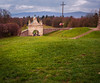
Near the track leading to the top of Łysa Góra, there is a mysterous sculpture called Pielgrzym (“The Pilgrim”). It’s age is unknown – it was linked with early medieval and later medieval period, but it might be much older. The legend says, that Pielgrzym moves for distance of 1 sand pebble every year – when he will reach the top of Łysa Góra, it will mean the end of the world.
You may be viewing yesterday's version of this page. To see the most up to date information please register for a free account.
Do not use the above information on other web sites or publications without permission of the contributor.
Nearby Images from Flickr
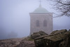
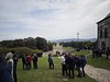
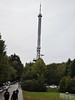


The above images may not be of the site on this page, but were taken nearby. They are loaded from Flickr so please click on them for image credits.
Click here to see more info for this site
Nearby sites
Click here to view sites on an interactive map of the areaKey: Red: member's photo, Blue: 3rd party photo, Yellow: other image, Green: no photo - please go there and take one, Grey: site destroyed
Download sites to:
KML (Google Earth)
GPX (GPS waypoints)
CSV (Garmin/Navman)
CSV (Excel)
To unlock full downloads you need to sign up as a Contributory Member. Otherwise downloads are limited to 50 sites.
Turn off the page maps and other distractions
Nearby sites listing. In the following links * = Image available
1.5km W 260° Łysa Góra Sacred Mountain* Misc. Earthwork
30.7km ENE 70° Krzemionki Opatowskie Flint Mine* Ancient Mine, Quarry or other Industry
32.4km ESE 114° Kurhan Leszczków Round Barrow(s)
32.8km ESE 109° Malice Kościelne Megalithic Tomb Long Barrow
37.2km ESE 102° Kurhan Łopata Round Barrow(s)
37.6km WNW 289° Tumlin Earthwork* Misc. Earthwork
48.4km SSW 205° Kurhan Żerniki Górne Round Barrow(s)
50.6km SSW 203° Grodzisko Szczaworyż* Hillfort
53.3km WNW 285° Dobrzeszowska Góra* Misc. Earthwork
64.1km SSW 206° Grodzisko Wiślica* Hillfort
67.4km SSW 209° Kurhany Kolosy* Round Barrow(s)
68.0km SSW 203° Czarkowy - Kopiec Kościuszki Round Barrow(s)
75.0km SSW 206° Kurhan Królewice* Round Barrow(s)
77.5km SW 223° Kurhan Szczotkowice Round Barrow(s)
78.2km N 356° Grodzisko Kiełbów Stary Ancient Village or Settlement
80.8km NNW 338° Grodzisko Klwów Hillfort
82.4km SW 221° Kurhan Pałecznica Round Barrow(s)
96.0km WNW 284° Grodzisko Chełmo Hillfort
97.7km S 183° Grodzisko Zawada (Tarnów)* Hillfort
97.9km SE 143° Grodzisko Budy Głogowskie* Hillfort
98.4km SSE 156° Kurhan Witkowice Round Barrow(s)
103.4km ENE 74° Grodzisko Osmolice Hillfort
103.5km WSW 244° Grodzisko Udórz Hillfort
105.7km N 6° Grodzisko Stara Warka Promontory Fort / Cliff Castle
106.6km SSW 197° Grodzisko Jadowniki Podgórne* Hillfort
View more nearby sites and additional images


 We would like to know more about this location. Please feel free to add a brief description and any relevant information in your own language.
 Wir möchten mehr über diese Stätte erfahren. Bitte zögern Sie nicht, eine kurze Beschreibung und relevante Informationen in Deutsch hinzuzufügen.
 Nous aimerions en savoir encore un peu sur les lieux. S'il vous plaît n'hesitez pas à ajouter une courte description et tous les renseignements pertinents dans votre propre langue.
 Quisieramos informarnos un poco más de las lugares. No dude en añadir una breve descripción y otros datos relevantes en su propio idioma.