<< Our Photo Pages >> Tumlin Earthwork - Misc. Earthwork in Poland in Swietokrzyskie
Submitted by SolarMegalith on Sunday, 12 July 2009 Page Views: 4187
Multi-periodSite Name: Tumlin Earthwork Alternative Name: Góra GrodowaCountry: Poland
NOTE: This site is 17.327 km away from the location you searched for.
Voivodeship: Swietokrzyskie Type: Misc. Earthwork
Nearest Town: Kielce Nearest Village: Tumlin
Latitude: 50.970890N Longitude: 20.570800E
Condition:
| 5 | Perfect |
| 4 | Almost Perfect |
| 3 | Reasonable but with some damage |
| 2 | Ruined but still recognisable as an ancient site |
| 1 | Pretty much destroyed, possibly visible as crop marks |
| 0 | No data. |
| -1 | Completely destroyed |
| 5 | Superb |
| 4 | Good |
| 3 | Ordinary |
| 2 | Not Good |
| 1 | Awful |
| 0 | No data. |
| 5 | Can be driven to, probably with disabled access |
| 4 | Short walk on a footpath |
| 3 | Requiring a bit more of a walk |
| 2 | A long walk |
| 1 | In the middle of nowhere, a nightmare to find |
| 0 | No data. |
| 5 | co-ordinates taken by GPS or official recorded co-ordinates |
| 4 | co-ordinates scaled from a detailed map |
| 3 | co-ordinates scaled from a bad map |
| 2 | co-ordinates of the nearest village |
| 1 | co-ordinates of the nearest town |
| 0 | no data |
Internal Links:
External Links:
I have visited· I would like to visit
SolarMegalith has visited here
")
The top of the Góra Grodowa hill near Tumlin was a sacred place for the local Slavic tribes. The remains of the earthwork which surrounded this place are still visible.
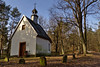
If you go from the direction of Miedziana Góra, you have to turn left behind the main part of the village. The path leads towards the small chapel, the earthwork is hidden in the forest around it.
You may be viewing yesterday's version of this page. To see the most up to date information please register for a free account.
")
Do not use the above information on other web sites or publications without permission of the contributor.
Nearby Images from Flickr
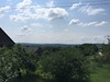
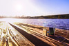

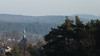
The above images may not be of the site on this page, but were taken nearby. They are loaded from Flickr so please click on them for image credits.
Click here to see more info for this site
Nearby sites
Click here to view sites on an interactive map of the areaKey: Red: member's photo, Blue: 3rd party photo, Yellow: other image, Green: no photo - please go there and take one, Grey: site destroyed
Download sites to:
KML (Google Earth)
GPX (GPS waypoints)
CSV (Garmin/Navman)
CSV (Excel)
To unlock full downloads you need to sign up as a Contributory Member. Otherwise downloads are limited to 50 sites.
Turn off the page maps and other distractions
Nearby sites listing. In the following links * = Image available
15.9km W 276° Dobrzeszowska Góra* Misc. Earthwork
36.4km ESE 110° Łysa Góra Sacred Mountain* Misc. Earthwork
37.6km ESE 109° Pielgrzym Sculpture* Sculptured Stone
58.1km SSE 165° Kurhan Żerniki Górne Round Barrow(s)
58.6km W 280° Grodzisko Chełmo Hillfort
61.0km SSE 164° Grodzisko Szczaworyż* Hillfort
62.7km N 4° Grodzisko Klwów Hillfort
64.5km E 91° Krzemionki Opatowskie Flint Mine* Ancient Mine, Quarry or other Industry
70.0km ESE 111° Kurhan Leszczków Round Barrow(s)
70.0km S 174° Grodzisko Wiślica* Hillfort
70.4km ESE 109° Malice Kościelne Megalithic Tomb Long Barrow
71.0km SSW 194° Kurhan Szczotkowice Round Barrow(s)
71.5km S 177° Kurhany Kolosy* Round Barrow(s)
72.6km NNE 25° Grodzisko Kiełbów Stary Ancient Village or Settlement
74.8km ESE 105° Kurhan Łopata Round Barrow(s)
75.6km S 172° Czarkowy - Kopiec Kościuszki Round Barrow(s)
76.6km SSW 194° Kurhan Pałecznica Round Barrow(s)
79.9km S 177° Kurhan Królewice* Round Barrow(s)
81.4km SW 224° Grodzisko Udórz Hillfort
82.0km WSW 239° Grodzisko Góra Słupsko* Hillfort
86.5km SW 227° Smoleń - Zamek Pilcza* Ancient Village or Settlement
86.6km WSW 249° Grodzisko Wały - Potok Złoty* Hillfort
87.1km WSW 238° Jaskinia w Dziadowej Skale Cave or Rock Shelter
87.9km SW 227° Jaskinia Na Biśniku Cave or Rock Shelter
93.2km WSW 254° Jaskinia Komarowa Cave or Rock Shelter
View more nearby sites and additional images


 We would like to know more about this location. Please feel free to add a brief description and any relevant information in your own language.
 Wir möchten mehr über diese Stätte erfahren. Bitte zögern Sie nicht, eine kurze Beschreibung und relevante Informationen in Deutsch hinzuzufügen.
 Nous aimerions en savoir encore un peu sur les lieux. S'il vous plaît n'hesitez pas à ajouter une courte description et tous les renseignements pertinents dans votre propre langue.
 Quisieramos informarnos un poco más de las lugares. No dude en añadir una breve descripción y otros datos relevantes en su propio idioma.