


<< Text Pages >> Grodzisko Łapczyca - Hillfort in Poland in Malopolskie
Submitted by SolarMegalith on Sunday, 01 January 2012 Page Views: 2378
Iron Age and Later PrehistorySite Name: Grodzisko ŁapczycaCountry: Poland
NOTE: This site is 11.731 km away from the location you searched for.
Voivodeship: Malopolskie Type: Hillfort
Latitude: 49.971981N Longitude: 20.370798E
Condition:
| 5 | Perfect |
| 4 | Almost Perfect |
| 3 | Reasonable but with some damage |
| 2 | Ruined but still recognisable as an ancient site |
| 1 | Pretty much destroyed, possibly visible as crop marks |
| 0 | No data. |
| -1 | Completely destroyed |
| 5 | Superb |
| 4 | Good |
| 3 | Ordinary |
| 2 | Not Good |
| 1 | Awful |
| 0 | No data. |
| 5 | Can be driven to, probably with disabled access |
| 4 | Short walk on a footpath |
| 3 | Requiring a bit more of a walk |
| 2 | A long walk |
| 1 | In the middle of nowhere, a nightmare to find |
| 0 | No data. |
| 5 | co-ordinates taken by GPS or official recorded co-ordinates |
| 4 | co-ordinates scaled from a detailed map |
| 3 | co-ordinates scaled from a bad map |
| 2 | co-ordinates of the nearest village |
| 1 | co-ordinates of the nearest town |
| 0 | no data |
Internal Links:
External Links:
Hillfort in Malopolskie
An early medieval hillfort in Łapczyca is located NW of the village of Łapczyca. The rampart is up to 3-3.5m high and encloses the area of 1ha.
You may be viewing yesterday's version of this page. To see the most up to date information please register for a free account.
Do not use the above information on other web sites or publications without permission of the contributor.
Nearby Images from Flickr
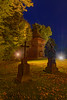

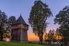


The above images may not be of the site on this page, but were taken nearby. They are loaded from Flickr so please click on them for image credits.
Click here to see more info for this site
Nearby sites
Click here to view sites on an interactive map of the areaKey: Red: member's photo, Blue: 3rd party photo, Yellow: other image, Green: no photo - please go there and take one, Grey: site destroyed
Download sites to:
KML (Google Earth)
GPX (GPS waypoints)
CSV (Garmin/Navman)
CSV (Excel)
To unlock full downloads you need to sign up as a Contributory Member. Otherwise downloads are limited to 50 sites.
Turn off the page maps and other distractions
Nearby sites listing. In the following links * = Image available
8.7km W 267° Kurhan Krakuszowice Round Barrow(s)
13.6km W 260° Kurhany Jawczyce Barrow Cemetery
20.0km E 99° Grodzisko Jadowniki Podgórne* Hillfort
23.2km SW 221° Grodzisko Klasztorzysko* Hillfort
23.6km SW 223° Grodzisko Poznachowice Górne* Hillfort
24.2km WNW 297° Kopiec Wandy* Artificial Mound
30.4km WNW 284° Kopiec Krakusa* Artificial Mound
32.0km ESE 110° Grodzisko Zawada Lanckorońska* Hillfort
32.5km WNW 286° Kraków - Wawel* Ancient Village or Settlement
32.5km WNW 287° Archaeological Museum of Kraków* Museum
34.0km ESE 108° Grodzisko Roztoka* Promontory Fort / Cliff Castle
35.5km SE 134° Grodzisko Małpia Wyspa* Hillfort
36.1km NNE 30° Kurhan Królewice* Round Barrow(s)
36.8km N 354° Kurhan Pałecznica Round Barrow(s)
39.8km SSE 147° Grodzisko Marcinkowice* Hillfort
42.2km N 357° Kurhan Szczotkowice Round Barrow(s)
42.3km SSE 150° Grodzisko Chełmiec* Hillfort
43.6km NE 34° Czarkowy - Kopiec Kościuszki Round Barrow(s)
43.7km NNE 25° Kurhany Kolosy* Round Barrow(s)
45.2km E 88° Grodzisko Zawada (Tarnów)* Hillfort
46.0km WNW 299° Jaskinia Mamutowa* Cave or Rock Shelter
46.1km SSE 162° Grodzisko Grobla - Podegrodzie* Hillfort
46.1km WNW 299° Jaskinia Wierzchowska Górna* Cave or Rock Shelter
46.9km W 273° Wołowice Flint Mine Ancient Mine, Quarry or other Industry
46.9km NNE 28° Grodzisko Wiślica* Hillfort
View more nearby sites and additional images


 We would like to know more about this location. Please feel free to add a brief description and any relevant information in your own language.
 Wir möchten mehr über diese Stätte erfahren. Bitte zögern Sie nicht, eine kurze Beschreibung und relevante Informationen in Deutsch hinzuzufügen.
 Nous aimerions en savoir encore un peu sur les lieux. S'il vous plaît n'hesitez pas à ajouter une courte description et tous les renseignements pertinents dans votre propre langue.
 Quisieramos informarnos un poco más de las lugares. No dude en añadir una breve descripción y otros datos relevantes en su propio idioma.