

<< Text Pages >> Grodzisko Klwów - Hillfort in Poland in Mazowieckie
Submitted by SolarMegalith on Wednesday, 29 July 2009 Page Views: 3171
Iron Age and Later PrehistorySite Name: Grodzisko KlwówCountry: Poland
NOTE: This site is 32.842 km away from the location you searched for.
Voivodeship: Mazowieckie Type: Hillfort
Nearest Town: Opoczno Nearest Village: Klwów
Latitude: 51.533330N Longitude: 20.633330E
Condition:
| 5 | Perfect |
| 4 | Almost Perfect |
| 3 | Reasonable but with some damage |
| 2 | Ruined but still recognisable as an ancient site |
| 1 | Pretty much destroyed, possibly visible as crop marks |
| 0 | No data. |
| -1 | Completely destroyed |
| 5 | Superb |
| 4 | Good |
| 3 | Ordinary |
| 2 | Not Good |
| 1 | Awful |
| 0 | No data. |
| 5 | Can be driven to, probably with disabled access |
| 4 | Short walk on a footpath |
| 3 | Requiring a bit more of a walk |
| 2 | A long walk |
| 1 | In the middle of nowhere, a nightmare to find |
| 0 | No data. |
| 5 | co-ordinates taken by GPS or official recorded co-ordinates |
| 4 | co-ordinates scaled from a detailed map |
| 3 | co-ordinates scaled from a bad map |
| 2 | co-ordinates of the nearest village |
| 1 | co-ordinates of the nearest town |
| 0 | no data |
Internal Links:
External Links:
Hillfort in Mazowieckie
Remains of an early medieval fort together with ruins of a palace built on top are in 60% destroyed. The site lies near the river.
You may be viewing yesterday's version of this page. To see the most up to date information please register for a free account.
Do not use the above information on other web sites or publications without permission of the contributor.
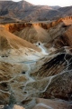
Nearby Images from Flickr

The above images may not be of the site on this page, but were taken nearby. They are loaded from Flickr so please click on them for image credits.
Click here to see more info for this site
Nearby sites
Click here to view sites on an interactive map of the areaKey: Red: member's photo, Blue: 3rd party photo, Yellow: other image, Green: no photo - please go there and take one, Grey: site destroyed
Download sites to:
KML (Google Earth)
GPX (GPS waypoints)
CSV (Garmin/Navman)
CSV (Excel)
To unlock full downloads you need to sign up as a Contributory Member. Otherwise downloads are limited to 50 sites.
Turn off the page maps and other distractions
Nearby sites listing. In the following links * = Image available
26.1km E 82° Grodzisko Kiełbów Stary Ancient Village or Settlement
51.9km NE 54° Grodzisko Stara Warka Promontory Fort / Cliff Castle
62.7km S 184° Tumlin Earthwork* Misc. Earthwork
64.0km SSW 198° Dobrzeszowska Góra* Misc. Earthwork
80.5km SSE 158° Łysa Góra Sacred Mountain* Misc. Earthwork
80.8km SSE 157° Pielgrzym Sculpture* Sculptured Stone
81.1km SW 230° Grodzisko Chełmo Hillfort
82.9km NNW 346° Kurhan Strzyżew Round Barrow(s)
85.6km WNW 289° Muzeum Archeologiczne i Etnograficzne w Łodzi* Museum
87.7km SE 137° Krzemionki Opatowskie Flint Mine* Ancient Mine, Quarry or other Industry
105.5km SE 144° Malice Kościelne Megalithic Tomb Long Barrow
106.4km SE 140° Kurhan Łopata Round Barrow(s)
106.8km SE 145° Kurhan Leszczków Round Barrow(s)
107.9km NNW 343° Grodzisko Orszymowo Hillfort
108.8km NNW 342° Grodzisko Wilkanowo Hillfort
110.5km NW 307° Kurhan Ględzianówek Round Barrow(s)
112.7km WNW 301° Grodzisko Tum* Hillfort
115.0km NW 316° Mnich Stone Circle* Stone Circle
116.2km NNW 336° Grodzisko Miszewo Murowane Hillfort
119.0km S 175° Kurhan Żerniki Górne Round Barrow(s)
121.9km S 174° Grodzisko Szczaworyż* Hillfort
124.7km W 268° Grodzisko Witów Hillfort
125.1km SW 232° Grodzisko Gąszczyk* Hillfort
126.2km SW 223° Grodzisko Wały - Potok Złoty* Hillfort
127.1km SW 233° Wyczerpy Górne Bronze Age Settlement Ancient Village or Settlement
View more nearby sites and additional images


 We would like to know more about this location. Please feel free to add a brief description and any relevant information in your own language.
 Wir möchten mehr über diese Stätte erfahren. Bitte zögern Sie nicht, eine kurze Beschreibung und relevante Informationen in Deutsch hinzuzufügen.
 Nous aimerions en savoir encore un peu sur les lieux. S'il vous plaît n'hesitez pas à ajouter une courte description et tous les renseignements pertinents dans votre propre langue.
 Quisieramos informarnos un poco más de las lugares. No dude en añadir una breve descripción y otros datos relevantes en su propio idioma.