<< Our Photo Pages >> Le Roc Rôti - Early Christian Sculptured Stone in France in Auvergne:Cantal (15)
Submitted by alchemille on Saturday, 11 January 2014 Page Views: 1866
Early Medieval (Dark Age)Site Name: Le Roc RôtiCountry: France
NOTE: This site is 9.967 km away from the location you searched for.
Département: Auvergne:Cantal (15) Type: Early Christian Sculptured Stone
Nearest Town: Aurillac Nearest Village: Saint Saury, Le Rouget
Latitude: 44.515140N Longitude: 2.993000E
Condition:
| 5 | Perfect |
| 4 | Almost Perfect |
| 3 | Reasonable but with some damage |
| 2 | Ruined but still recognisable as an ancient site |
| 1 | Pretty much destroyed, possibly visible as crop marks |
| 0 | No data. |
| -1 | Completely destroyed |
| 5 | Superb |
| 4 | Good |
| 3 | Ordinary |
| 2 | Not Good |
| 1 | Awful |
| 0 | No data. |
| 5 | Can be driven to, probably with disabled access |
| 4 | Short walk on a footpath |
| 3 | Requiring a bit more of a walk |
| 2 | A long walk |
| 1 | In the middle of nowhere, a nightmare to find |
| 0 | No data. |
| 5 | co-ordinates taken by GPS or official recorded co-ordinates |
| 4 | co-ordinates scaled from a detailed map |
| 3 | co-ordinates scaled from a bad map |
| 2 | co-ordinates of the nearest village |
| 1 | co-ordinates of the nearest town |
| 0 | no data |
Internal Links:
External Links:
I have visited· I would like to visit
alchemille has visited here
")
Le roc Rôti is situated between Aurillac and Saint Saury, passed the village of Roumégoux, today there is a parking by the side of national road D20. A sign has been place there by the council reading: "Rocher du Roc Rôti, monument mégalithe de la Préhistoire, TYPE MENHIR."
A postcard was printed in 1907 with the title "Le Roc Rôti avec les restes d'enceinte druidique près St Saury Cantal". From the parking we can observe on the other side of the national road groups of stones and a spring.
St Saury coordinates 44.5205N, 2.0823E.
You may be viewing yesterday's version of this page. To see the most up to date information please register for a free account.
")
Do not use the above information on other web sites or publications without permission of the contributor.
Nearby Images from Flickr
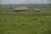
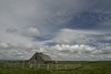


The above images may not be of the site on this page, but were taken nearby. They are loaded from Flickr so please click on them for image credits.
Click here to see more info for this site
Nearby sites
Click here to view sites on an interactive map of the areaKey: Red: member's photo, Blue: 3rd party photo, Yellow: other image, Green: no photo - please go there and take one, Grey: site destroyed
Download sites to:
KML (Google Earth)
GPX (GPS waypoints)
CSV (Garmin/Navman)
CSV (Excel)
To unlock full downloads you need to sign up as a Contributory Member. Otherwise downloads are limited to 50 sites.
Turn off the page maps and other distractions
Nearby sites listing. In the following links * = Image available
10.9km SSW 202° Dolmen des Trois-Communes Burial Chamber or Dolmen
11.4km SSE 151° Dolmen d'Aiguevive Burial Chamber or Dolmen
11.9km SSE 167° Dolmen de Lestang 1 Burial Chamber or Dolmen
11.9km S 182° Dolmen de Rans Burial Chamber or Dolmen
12.5km SSE 167° Dolmen de Lestang 2 Burial Chamber or Dolmen
12.6km SSE 151° Dolmen du Viala (Campagnac) Burial Chamber or Dolmen
12.9km S 190° Dolmen d'Agues Burial Chamber or Dolmen
13.3km SSE 147° Dolmen de Campagnac Burial Chamber or Dolmen
15.3km S 182° Galitorte Dolmen* Burial Chamber or Dolmen
15.9km S 191° Menhir La Pierre Plantée (Buzeins)* Modern Stone Circle etc
16.1km S 177° Buzareingues dolmen 2* Burial Chamber or Dolmen
16.1km S 172° Puech de las Fadès* Hillfort
16.1km S 178° Buzareingues Dolmen 1* Burial Chamber or Dolmen
16.5km SSW 193° Dolmen de Surguières 4* Burial Chamber or Dolmen
16.7km SSW 197° Dolmen de Surguières 1* Burial Chamber or Dolmen
16.9km SSW 192° Dolmen de Saplous 2* Burial Chamber or Dolmen
16.9km SSW 195° Dolmen de Surguières 3* Burial Chamber or Dolmen
16.9km SW 234° Dolmen des Champs de la Draye 1 Burial Chamber or Dolmen
16.9km SSW 196° Dolmen de Surguières 2* Burial Chamber or Dolmen
17.0km SW 230° Dolmen de Lou Luc Burial Chamber or Dolmen
17.1km SW 233° Dolmen des Champs de la Draye 2 Burial Chamber or Dolmen
17.2km SSW 192° Dolmen de Saplous 1* Burial Chamber or Dolmen
17.4km S 184° Dolmen de Sirandels* Burial Chamber or Dolmen
17.5km SW 236° Dolmen de Bourines 2* Burial Chamber or Dolmen
17.6km SSW 192° Dolmen de Saplous 4* Burial Chamber or Dolmen
View more nearby sites and additional images


 We would like to know more about this location. Please feel free to add a brief description and any relevant information in your own language.
 Wir möchten mehr über diese Stätte erfahren. Bitte zögern Sie nicht, eine kurze Beschreibung und relevante Informationen in Deutsch hinzuzufügen.
 Nous aimerions en savoir encore un peu sur les lieux. S'il vous plaît n'hesitez pas à ajouter une courte description et tous les renseignements pertinents dans votre propre langue.
 Quisieramos informarnos un poco más de las lugares. No dude en añadir una breve descripción y otros datos relevantes en su propio idioma.